The Inca Trail, a master road communication network that extended to six countries in South America, was declared a World Heritage Site by Unesco on Saturday, a distinction that recognizes the ingenuity of a pre-Hispanic system that surprised the world. The trails, which served the Inca to control its empire (Tahuantisuyo), extend from Argentina to Chile, Bolivia, Peru, Ecuador and Colombia, and were linked by a network of roads that constituted the Qhapaq Ñan (in Quechua Inca Trail).
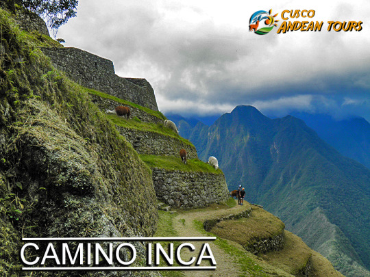
"This extraordinary system of roads extends through one of the geographical areas of the world with the greatest contrasts," among the Andres, the rainforest, the Pacific coasts and deserts, the Unesco statement said. "The denomination means for the six countries the recognition of one of the most important monuments of the Andean world," said Luis Lumbreras Flores, archaeologist of the Inca Trail Project of the Peruvian Ministry of Culture. The Qhapaq Ñan, the oldest road network in America, ran along the entire Tahuantinsuyo along the Andes Mountains, from western Argentina to southern Colombia. The main road has about 6000 km from south to north. This mountain road parallel to the Pacific Ocean was linked by cross sections that even reached the jungles and the Gran Chaco in Argentina and Bolivia. "There are other sections where the population still travels. It has cobbled areas, with flagstone or land fill, and in some places you can see retaining walls on both sides of the road," said Peruvian archaeologist Cristian Viscount. The distinction will allow to obtain financing from international organizations for the conservation and restoration of the paths and sanctuaries that were built around the road, archaeologists say optimistic. The entire network in coast, mountains and jungle, totaled an extension of 30,000 km, which interconnected the four of them, or cardinal points of the empire, with the mythical capital, Cusco (in Quechua, "navel" or "center").
Peru gathers most of the discovered routes of the old routes. The most famous stretch, and where millions of tourists from all over the world arrive, leave from Cusco to the citadel of Machu Picchu. They are 43 kilometers between forests, with ancient stone steps. The road reaches the Puerta del Sol where it offers majestic views of the Machu Picchu ruins.
INFORMATION OF INCA TRAIL
The Qhapaq Ñan, is the word that defines the road system of the Inca Civilization and is definitely the best material test, which can give us an idea of the magnitude of this empire, becoming one of the greatest achievements in indigenous America. An estimated 23 thousand km is calculated, although other studies say that up to 40 thousand km could be registered, from an extensive network of roads, built on one of the most rugged territories in the world, which communicates the cities and settlements of the state most important in America, before the Spanish invasion.
This network of roads crossed the Empire of the Incas, along roads drawn from north to south (from end to end) along the coast, mountains and jungle; through the Cordillera de los Andes, with small sections, which communicated from the east of its territory to the Pacific coast. Designed in harmony with the topography of the place, wide in some areas, very narrow in others, with completely cobbled sections and others simply of land.
Like all the important cities of the Empire, the city of Machu Picchu, connected to Cusco (capital of the Empire), through the Inca Trail that we have traveled so far, at least two important accesses to the Sacred City (Inca Trail and Camino Salkantay), although there may be two others; one that descended through the Urubamba valley from Ollantaytambo, and another that crossed the high part of the Andes. And together with these, a complex network of secondary roads, to communicate the existing settlements throughout the region.
The world-famous Inca Trail to Machu Picchu, is only part of this complex network of roads, which goes up the Urubamba river basin to the Inca City, named for being the most suitable name. At present it is considered by many, the most beautiful of all, for the complement present between its landscapes and its history, you can visit it in three or four days, on a perfectly planned tour.
This Inca Trail to Machu Picchu, allowed to join production sites, with storage and administration centers. It is located in the middle of the jungle, which provides adequate environmental conditions for the production of specific foods. It is very likely that the entire Empire was supplied from this area. Therefore, this road articulated Machu Picchu with the capital and this with the rest of the cities.
The gigantic network of roads of the Inca Empire (Qhapaq Ñan) was built with the main purpose of keeping a huge territory communicated, this allowed to mobilize armies very quickly for the time. But it had other very important uses, as it served as trade routes, acting as an economic articulator, in a civilization with a tendency to redistribution and exchange, in the same way that Machu Picchu's corn or coca reached Huánuco, In Huánuco, surplus production (potatoes and others) was redistributed in other locations, such as Machu Picchu. Another extremely important purpose was the representation of the central power of the empire, as it was thought ideologically; -Yes, I know Cusco because I have seen the road- Then, the road was the essential ideological representation of the power of the Empire, both economic and ideological.
This path, a means of communication and transport par excellence, fundamental in economic articulation and ideological dissemination, was essential for the existence of such a vast territory. It crossed the central squares of the main towns of the Empire, joining places of worship, commerce and administration, passing through water sources, an element (fundamental for life) that symbolized the goodness of Mother Earth and the reproduction of life.
And despite the information available, the Inca Trail is only a small branch of the Empire's road network, an important tourist attraction in Peru and one of the largest in the world. Although the fact in itself, of knowing new places, what we offer is fantastic, goes beyond a visit to the Machu Picchu Sanctuary in Peru; We offer an approach to the culture of the people who built those places, to the people who currently inhabit those places, their customs and their history. So you can transform visible material evidence into an experiential learning experience.
The Inca Trail is one of the best walks on the planet. That is why there is a high demand for tickets. That is why you must reserve the income well in advance.
Consider the following before booking the ticket to the Inca Trail:
Admissions to the Inca Trail are depleted 6 months before. Remember that only 500 people can travel this route each day. Only 200 people will end up entering Machu Picchu by this route, since the rest belongs to the support team, chefs, porters and guides. The entrance to the Inca Trail only includes the Inca City of Machu Picchu. If you want to visit the Machu Picchu Mountain or the Huayna Picchu; Request it at the tourist agency. The purchase of the income to the Inca Trail is through the website of an authorized tourism agency.
How long is the tour of the Inca Trail?
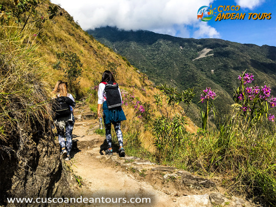
The Classic or Traditional Inca Trail is 40 kilometers away and 4 days of walking (approximately 18 to 24 hours). The route will take you through mountains, until arriving at Machu Picchu in the eyebrow of the Amazon rainforest of Peru.
Some information about the tour of the Inca Trail:
The route crosses archaeological sites such as Llactapata, Runkurakay, Sayacmarca, Phuyupatamarca and Wiñaywayna. The end of the road is the entrance to Machu Picchu through the Intipunku (Puerta del Sol). That was the main gate in time of the Incas. The scenery there is amazing. In most cases, after traveling the Inca Trail, you will return to Cusco by train. Some people decide to stay and relax in the hot springs of Aguas Calientes to return to Cusco the next day.
What is the maximum height of the Inca Trail?
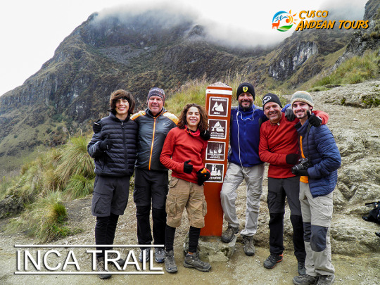
The Inca Trail is considered a difficult expedition not only because of the distance but because of the high altitude at some point along the way. The highest point on the road is at ‘Abra Warmihuañusca’, at 4,224 meters (13,860 feet).
Recommendations on problems with height on the Inca Trail:
The altitude sickness or soroche is a typical malaise in places of high heights. It can cause headaches, nausea, loss of appetite and lack of energy. The best way to combat soroche is to spend a few days acclimatization in Cusco or the Sacred Valley of the Incas. One of the most effective ways is to drink plenty of coca tea (infusion based on coca leaf) or chew it, just as the Incas did hundreds of years ago. In any case, the tour guide has a lot of experience in these discomforts and will know how to help the visitor during the Inca Trail.
Cusco and the entire southern region of Peru is marked by two distinct climatic seasons: the rainy season (from November to March) and the dry season (from April to October). The best time to do the Inca Trail is the dry season. The weather in those months is warm and infrequently rainy.
What to take to combat the weather on the Inca Trail?
If you plan to visit the Inca Trail during the dry season, it is advisable to wear a hat, sunscreen, mosquito repellent, sunglasses, light clothing during the day and warm at night. If you plan to visit the Inca Trail during the rainy season, it is recommended to wear rain poncho, windbreaker, non-slip shoes and walking stick.
Does the walk have to be 4 days?
There is a short version of the Inca Trail that lasts 2 days. This option is ideal for travelers who do not have enough time to make the 4-day route. It often includes a night in a comfortable establishment instead of camp.
More information about the alternative Inca Trail:
There are many alternative walks to Machu Picchu such as Salkantay Trek or Lares Trek. However, the Inca Trail is the only one that will take you directly to the Inca City through the Intipunku (Puerta del Sol). The availability of income to the alternative Inca Trail is not as much in demand as the classic version. It can be booked 2 or 3 weeks in advance.
Is the Inca Trail dangerous? The Inca Trail is not dangerous. The security measures provided include first aid equipment. The tour guides are trained to act effectively in case of any type of emergency.
What dangers can there be on the Inca Trail?
The Inca Trail trails are wide and well signposted. For no reason should tourists risk their lives looking for roads on their own. The maximum height is in the ‘Abra Warmiwañusca’ (4,200 m.a.s.l.). This altitude can cause physical difficulties. Older adults may feel more intense physical wear during the Inca Trail. They should check with their doctor before doing the walk.
Machu Picchu,This stunning site situated on a mountain ridge above the Sacred Valley is the best-preserved relic of Inca civilisation and South America’s most popular attraction with an estimated 3,000 people visiting on a typical day.