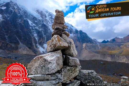
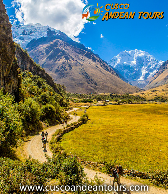
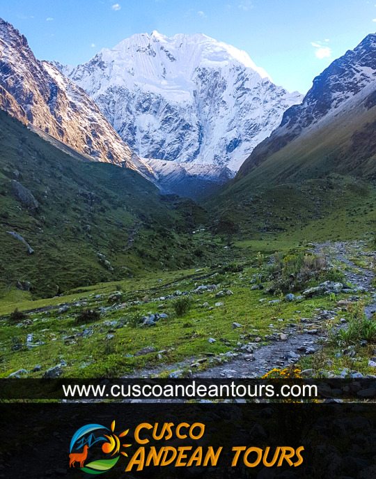
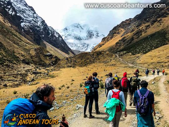
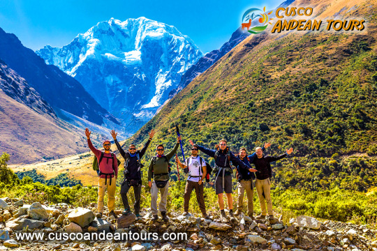
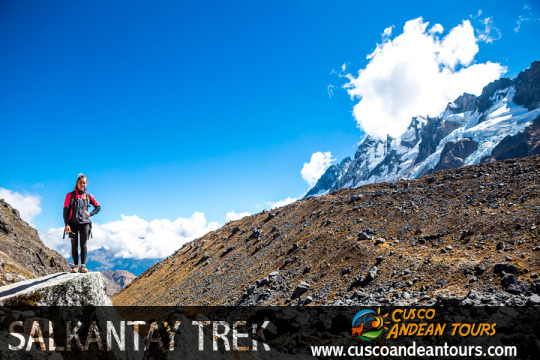
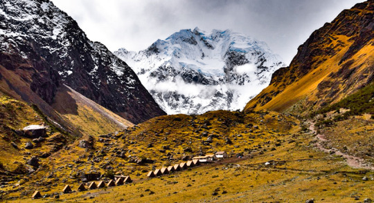
The Salkantay or Salcantay (6,271 m.a.s.l.) is a snowy mountain belonging to the Vilcabamba mountain range. It is the second highest mountain in Cusco after Ausangate (6,384 m.a.s.l.) Its name means wild mountain. Due to its imposing and isolated appearance, it was highly appreciated by the Incas. They put the name ‘Apu’ which means ‘lord’ or ‘sacred’. This snowy mountain was considered one of the most powerful in the region. They worshiped it to the point that they built Machu Picchu in view of its summit. According to the Andean worldview, mountains provided life and decided planting, harvesting and even natural disasters. Because of this, respect and offerings should be given to him. Today, the inhabitants of the Andes continue to consider the mountains as spirits of importance. In Cusco, Salkantay is held in as much esteem as the Incas did. SALKANTAY TREK ROUTE TO MACHU PICCHU INFORMATION
General information
Name: Salkantay Trek.
Kilometers: 72 kilometers approximately.
Climate: minimum of less than 0 ° C in the ‘Abra Salcantay’.
Maximum height: 4,572 m.a.s.l. in the ‘Abra Salcantay’.
Minimum height: 1,800 m.a.s.l. in the town of Santa Teresa.
Difficulty: challenging.
How to do it ?: with a tour or on your own.
When to do it ?: in the dry season (April to October).
Places it covers: Mollepata, Soraypampa, ‘Abra Salkantay’, Chaullay, Santa Teresa, Aguas Calientes and Machu Picchu.
Physical conditions: it is recommended to be in good physical condition.
Recommendations:
The Salkantay trek is the main hiking alternative to the Inca Trail. More and more tourists are encouraged to arrive at Machu Picchu through this 5-day and 4-night trek through amazing landscapes such as the snowy Salcantay. To fully enjoy this adventure, take into account the following recommendations:
It is possible to do this trek on your own or with a tour. Due to the difficulty of the adventure, it is recommended to do it with a tourism agency. Otherwise, you must have experience in mountaineering.
Perhaps the main drawback to this adventure is the "soroche" or altitude sickness. It is advisable to do a previous acclimatization in the city of Cusco.
Most tourism agencies include the main implements such as tents, food and guide. In case of doing it independently, it is recommended to take everything you need.
The cold at the foot of the snowy Salkantay is perhaps another of the main difficulties. It is recommended to wear thermal clothing.
The rainy season (from October to March) is characterized by the highest probability of river precipitation. It is not a good climate for trekking.
In case you do it on your own, do not forget to book the Machu Picchu Ticket in advance. It is the only way to know the Wonder of the World
For the inhabitants of the Andes, reverence for the apus, sacred mountains, converted into local protectors, did not go unnoticed in time, thus, mountains such as Salkantay, among others that surround it, assume an important role in the Andean worldview. For example, the snow of Waqay Willke (5720 masl), within the traditional symbolism of Andean dual thought, is considered the complement of Salkantay which is one of the most powerful and active deities of the place, it is also appreciated by the inhabitants, the father of all the mountains in the region and even today it is the object of great veneration, so Machupicchu and Choquechurco maintain an intimate visual contact with Salkantay and other snowcapped mountains of the Vilcabamba chain, SALKANTAY TREK INFORMATION.
The sacred and administrative llaqta of Machupicchu is located between important snowfalls of the eastern slope of the Vilcabamba mountain range, «Salkantay, (Humantay Yanantay and Tokorhuay that surround it) and Waqay Willke» 1 whose mountains, object of worship, enable a social cohesion which revolves around its veneration, as these are water providers, a vital element, principle of existence in the Andean world, as well as generating fertility in animals, protection of its inhabitants and success in crops.
In the cult of the mountains in the area, religious, political and economic factors are involved; important within the process of social development of their communities, the same that have been present for centuries, and that are and were very familiar to the Andean inhabitants of all times.
The current vision of the inhabitants of the Sacred Mountain (Mollepata, Machupicchu, Santa Teresa, Wayraqmachay, Collpapampa, Totora, Yanama) in force since the time of the Inca society, is shared by Andean peoples, so that the area is known for reverence to the sacred mountains, hardly ignored and that no doubt play a vital function over time. These sacred mountains are located within the delimitation polygon of the Historic Sanctuary of Machipicchu (SHM), declared as such by supreme decree No. 001-81-AA of January 8, 1981, with an area of 32,592 ha. Likewise, in the buffer zone (ZA) of the SHM specified by the head resolution No. 322-2001-INRENA of September 16, 2004, which proposes the extension of the ZA from including continuous immediate hydrographic basins to the SHM area, increasing the air of the ZA of those in force in 71,589 ha to 193,334 ha. Finally, it is also considered within the National Archaeological Park of Vilcabamba-Choquequirao, declared by means of national directive resolution No. 949 / INC, dated October 9, 2002, which resolves: «To approve the Plan of Delimitation of the National Archaeological Park of Vilcabamba (Choquequirao ), Plan Nº V-01, dated July 2002, with an area of 522,878.30 hectares and a perimeter of 367.09 kilometers, at a scale of 1: 125,000, located in the provinces of La Convencion, Anta and Abancay, in the departments of Cusco and Apurímac ».
Evolution and distribution of glaciers in the Salkantay chain At the time when the glacial areas of the Aobamba basin reached their maximum development, the glaciers probably descended to the height of 2950 m and to the extent that the environmental climatic conditions were changing, a process of deglaciation begins, being observed on the one hand that according to the pre-existing morphology, the main glacier current developed along the channel of the Aobamba valley, which during its retreat was subdivided into the areas of the ravines tributaries, generating in turn in the latter, the secondary glacial basins, such as in the cases of the Mesada, Tokorhuay, Paccha Grande, Sisaypampa and Orcospampa streams, which are the most traveled in the upper area of the main basin. On the other hand, on the slopes of the flanks of the valley where the slopes are steep, the glacial retreat of the fronts occurred almost parallel to the longitudinal axis of the main glacier current. Currently, the glaciers that belong to Aobamba are concentrated around the Palkay (5422 m), Salkantay (6264 m) and Tokorhuay (5473 m) hills, obviously year after year they continue to lose size and volume. In the last thirty years the rate of glacial melting has increased rapidly, the causes of such melting being attributed to the greenhouse effects. more cusco tours
This day we leave Cusco early (about 4am) and drive for approximately 3 ½ hrs to Soraypampa where we will start the hardest day of the whole Salkantay trek 4 days 3 nights. We will be walking 7.5km to the highest point of the trek, enjoying magnificent panoramas of snow-capped mountains on the way. Once we reach the top we will have spectacular views of the sacred mountain, Salkantay. At 6245 metres it is the second highest mountain in the Cusco region. After 2 hours downhill we will have our delicious lunch around 1:00 p.m. in Huayracmachay. Then we continue approximately 3 hours downhill to our camp in Chaullay or Collpapampa (2900 metres) where your tent will be ready and waiting for you with a bowl of hot water for washing up. Then there is time to rest, nap or write. Around 7 p.m. we will have happy hour, dinner. Then we’re off to bed and a well-earned sleep.
DAY 2: CHAULLAY - LUCMABAMBA
Around 6.30am, we start with our breakfast before beginning our trek through the high jungle. We cross the Lluskamayo valley and a variety of little brooks to reach La Playa (Sahuayaco) trekking about 6 hours. You will pass through wonderful landscapes and see waterfalls, rivers, beautiful plants and orchids. At La playa (Sahuayaco) we’ll have our lunch and the horses will go back to Mollepata. After lunch and another 30 minutes uphill you will reach our campsite at Lucmabamba. The afternoon is free for you to enjoy our coffee tour or, as an optional extra, take a local van to Santa Teresa to soak in the natural hot spring optional extra. At the end of the day we have our happy hour, dinner and then a briefing for the next day. DAY 3: LUCMABAMBA - AGUAS CALIENTES
We will have our delicious breakfast at 6 am and leave our campsite. After about 5 minutes you will step onto the original Inka Trail, and for the next 3 hours you will follow this historic trail to the summit for your first view of Machu Picchu across the valley. Then we will descend to our lunch spot by the Hydrolectric Station. After lunch we will walk 3 more hours or take a train for 45 minutes to Aguas Calientes where your beautiful hotel and dinner will be waiting for you. DAY 4: AGUAS CALIENTES - MACHU PICCHU!!!
Early morning, after the breakfast at the Hotel, you will go up by walking or you can take the bus to Machu Picchu where you meet with our Tour Guide for a private introductory tour of the Citadel. For the next 2 hours you will learn of the history, the structure and the stories of this important World Wonder. Then you will have free time to take pictures, relax and explore Machu Picchu by yourself. If you have reserved a climb up Huayna Picchu or Machu Picchu Mountain, our Tour Guide show you where you start.
After exploring Machu Picchu, you will walk or take a bus down to Aguas Calientes. There you will collect your luggage at the Hotel and board the train to Ollantaytambo. When you arrive at Ollantaytambo, you will transfer to a van for a ride back to Cusco by van where you will be dropped off at your hotel or hostel.
MORE INFORMATION OF SALKANTAY TREK
For the inhabitants of the Andes, reverence for the apus, sacred mountains, converted into local protectors, did not go unnoticed in time, thus, mountains such as Salkantay, among others that surround it, assume an important role in the Andean worldview. For example, the snow of Waqay Willke (5720 masl), within the traditional symbolism of Andean dual thought, is considered the complement of Salkantay which is one of the most powerful and active deities of the place, it is also appreciated by the inhabitants, the father of all the mountains in the region and even today it is the object of great veneration, so Machupicchu and Choquechurco maintain an intimate visual contact with Salkantay and other snowcaps of the Vilcabamba chain.
The Vilcabamba MOUNTAIN
The sacred and administrative llaqta of Machupicchu is located between important snowfalls of the eastern slope of the Vilcabamba mountain range, «Salkantay, (Humantay Yanantay and Tokorhuay that they surround it) and Waqay Willke »1 whose mountains, object of worship, enable a social cohesion that revolves around its veneration, as these are water providers, vital element, principle of existence in the Andean world, as well as generate fertility in animals, protection of its inhabitants and success in crops.In the cult of the mountains in the area, religious, political and economic factors are involved; important within the process of social development of their communities, the same ones that have been present for centuries, and they are and were very familiar to the Andean inhabitants of all time. The current vision of the inhabitants of the Sacred Mountain (Mollepata, Machupicchu, Santa Teresa, Wayraqmachay, Collpapampa, Totora, Yanama) in force since the time of the Inca society, is shared by Andean peoples, in such a way that the area is known for reverence to the sacred mountains, hardly ignored and that undoubtedly play a vital function over time. SALKANTAY TREK INFORMATION These sacred mountains are located within the delimitation polygon of the Historic Sanctuary of Machipicchu (SHM), declared as such by supreme decree No. 001-81-AA of January 8, 1981, with an area of 32,592 ha. Likewise, in the buffer zone (ZA) of the SHM specified by the head resolution No. 322-2001-INRENA of September 16, 2004, which proposes the extension of the ZA from including continuous immediate hydrographic basins to the SHM area, increasing the air of the ZA of those in force in 71,589 ha to 193,334 ha. Finally, it is also considered within the Vilcabamba-Choquequirao National Archaeological Park, declared by national directive resolution No. 949 / INC, dated October 9, 2002, which resolves: «Approve the Plan for the Delimitation of the National Archaeological Park of Vilcabamba (Choquequirao), Plan No. V-01, dated July 2002, with a area of 522,878.30 hectares and a perimeter of 367.09 kilometers, at a scale of 1: 125,000, located in the provinces of La Convencion, Anta and Abancay, in the departments of Cusco and Apurímac ».
The Salkantay Road to Machu Picchu combines a majestic natural beauty scene of great beauty with the attraction of the world's most famous prehispanic remains. The route begins by sailing through the incaic old road in the road that leads to the town of Machu Picchu and through a cordillera pasture between the snowy Salkantay and Humantay (5,917 msnm), to continue along the broken Aobamba River. from Machu Picchu.
This impressive tour passes through the magnificent mountain Salkantay (6.710 m / 22.014 ft), one of the highest and most impactful of the Peruvian Andes. The earliest of the days will be dominated by the impressive snowfalls of Salkantay and Humantay. The third day will descend to the warm cloudy forest to reach Aguas Calientes the fourth day. The impressive sacred city of the Incas Machu Picchu visits during the last day of the program. This excursion is an interesting alternative for those who have not found space on the Camino Inca route to Machu Picchu. The Salkantay tour was recently named by the National Geographic Adventure Travel magazine among the 25 best tours in the world. Story The Andes are considered a young mountain cadre according to geological studies. They were formed 60 million years ago by the different movements of tectonic plates, so that the location of Cusco in the Andes has one of the best places for hikers. Each mountain range and its noble inhabitants, maintain a special landscape. This variety of landscapes and people, combined with the unique history of their ancestors, the Incas, offers hikers and explorers a true adventure. Climate Semi-tropical, warm and humid days and cold nights with constant rain throughout the year Minimum: Between -5 ° C to 11 ° C Abra Salkantay (Junio) High: Between 20 ° C to 26 ° C Playa Sahuayaco (Junio) Lluvias: November to April Altitude Capital: 3,350 m.s.n.m. (Cusco) Minimum: 2,000 m.s.n.m. (Aguas Calientes) Maximum: 4,650 m.s.n.m. (Open Salkantay) Recommendations He would need acclimation in Cusco of the days before he began the trip. For a good acclimatization you need to rest as bad as possible, eat well, drink plenty of fluids; It is especially the coca mate that has been known to cure and digestive properties. A proper acclimatization avoids that it affects the “soroche” the evil of height, that could cause numerous illnesses to the health. Camino Inca access routes To start the first Camino Salkantay you must take a bus by bus to Poblado de Mollepata. An Andean town that preserves its former colonial houses and the farms of its former inhabitants. This is where Salkantay Machu Picchu trekking starts. Mollepata is located in the district of Mollepata and is 2 h 2 min (98.2 km) away by Carretera and one of the 9 districts of the province of Anta, located in the region of Cusco. Location and Geography The location of Camino Salkantay varies according to the route planted: The Camino Inca Salkantay route begins on the Mollepata pathway crossing CruzPata, Sayllapata, Soraypampa, and Abra Salkantay along the top of the receding road approximately 71 km. In five days you will reach Machu Picchu. Denominations The Camino Salkantay is an alternate route to the traditional Inca Camino that serves as a communication between the city of Cusco and the archaeological site of Machu Picchu and is therefore one of the most demanding trekking routes in Cusco. Each year the hikers from around the world resort to the wondrous 71 kilometers by a well-known road so that you have to show them that it goes from going up the Salkantay to 4600.msnm and wading through the jungle and reaching it city of Machu Picchu.
The snowy Salkantay: complete information What does Salkantay mean? The Salkantay is a snowy whose name translated from Quechua would mean ‘Wild Mountain’. This summit is known as ‘Apu’ (‘Lord’) for its majesty and elevation.
Where is it located? The pu Apu ’Salkantay is located in the Vilcanota Mountain Range in the Andes of southern Peru. This snow is the second largest in Cusco, after Ausangate (Mountain of the 7 Colors). SALKANTAY TREK
How high is the snowy Salkantay? The snowy Salkantay reaches 6,271 meters above sea level (m.s.n.m.). The trek route that leads to Machu Picchu has its highest point at ‘Abra Salcantay’, at 4,650 m.a.s.l. From there you can see the snowy peak.
How's the weather? The snow itself has an extremely cold climate (several degrees Celsius below 0º).
The weather during the Salkantay trek, however, is varied. The intense sun and the cold night in the first days change for the tropical atmosphere of the last.
How is the flora and fauna? The 5 days and 4 nights that the Salkantay trek lasts runs landscapes with a great variety of flora and fauna. Among the species of flowers and plants, the orchid and ichu (Andean grass) stand out. Among the species of birds and animals, it is worth mentioning the llama, alpaca, vizcacha, condor, spectacled bear and the cock of the rocks (national bird of Peru)
Salkantay trek: everything you need to know What is the Salkantay trek? The Salkantay trek is a hiking route that takes the visitor to the Inca City of Machu Picchu. The total walking distance is approximately 70 kilometers (5 days of route).
The Salkantay Route, also known as the "New Inca Trail", is located north of the city of Cusco, following the Cusco - Limatambo - Abancay - Lima highway, making a detour past Limatambo until arriving at Mollepata.
Climate of the snowy Salkantay:
It is very sunny during the day, but a cold at night. The temperature falls below 0 ° C at night during the months of June to September. In the season from December to March it is very rainy reason why it is not recommended to go on these dates.
The best time for the weather, to do this walk is during the months of March to September.
Height of the walk to the snowy Salkantay
This hike reaches a height of 4,600 meters above sea level at its highest point this on the slopes of the same snowy Salkantay. Enter Snow Walk Ausangate 5D to perform this walk. How to get to the snowy Salkantay The buses from Cusco to Mollepata depart very early 4 Am to 5 Am and pass through Limatambo, from Mollepata is where the trek to the Salkantay peak begins, after climbing a step up it is possible to have an impressive pyramidal view of Salkantay, one of the most beautiful snows of Cusco.
From the same Mollepata it takes two days to go down to Huayllabamba and merge with the second day of the Inca Trail.
To get to the snowy Salkantay it is advisable to take the services of our travel agency RAP TRAVEL since we have the necessary capacity to make your vacation come true. What are you going to see on the road On the way there are herds of cattle and sheep, orchids, bear with glasses, medicinal plants of the Inca eponca, small variety of birds, fruit trees such as Orange, Papaya, bananas, etc.
Note: The eye of eyeglasses to see it you have to have a bit of luck.
Recommendations: It is very important that the traveler. Carry your original passport for the respective controls.
MONTHS WHICH TRAVEL IS RECOMMENDED
March: (a little rain)April to October: (an excellent trip)October to November: (a little rain)December to February: (a lot of rain)
DAY 1: CUSCO - MOLLEPATA - SORAYPAMPA - CHAULLAY
This day we leave Cusco early (about 4am) and drive for approximately 3 ½ hrs to Soraypampa where we will start the hardest day of the whole Salkantay trek 4 days 3 nights. We will be walking 7.5km to the highest point of the trek, enjoying magnificent panoramas of snow-capped mountains on the way. Once we reach the top we will have spectacular views of the sacred mountain, Salkantay. At 6245 metres it is the second highest mountain in the Cusco region. After 2 hours downhill we will have our delicious lunch around 1:00 p.m. in Huayracmachay. Then we continue approximately 3 hours downhill to our camp in Chaullay or Collpapampa (2900 metres) where your tent will be ready and waiting for you with a bowl of hot water for washing up. Then there is time to rest, nap or write. Around 7 p.m. we will have happy hour, dinner. Then we’re off to bed and a well-earned sleep. DAY 2: CHAULLAY - LUCMABAMBA
Around 6.30am, we start with our breakfast before beginning our trek through the high jungle. We cross the Lluskamayo valley and a variety of little brooks to reach La Playa (Sahuayaco) trekking about 6 hours. You will pass through wonderful landscapes and see waterfalls, rivers, beautiful plants and orchids. At La playa (Sahuayaco) we’ll have our lunch and the horses will go back to Mollepata. After lunch and another 30 minutes uphill you will reach our campsite at Lucmabamba. The afternoon is free for you to enjoy our coffee tour or, as an optional extra, take a local van to Santa Teresa to soak in the natural hot spring optional extra. At the end of the day we have our happy hour, dinner and then a briefing for the next day. DAY 3: LUCMABAMBA - AGUAS CALIENTES
We will have our delicious breakfast at 6 am and leave our campsite. After about 5 minutes you will step onto the original Inka Trail, and for the next 3 hours you will follow this historic trail to the summit for your first view of Machu Picchu across the valley. Then we will descend to our lunch spot by the Hydrolectric Station. After lunch we will walk 3 more hours or take a train for 45 minutes to Aguas Calientes where your beautiful hotel and dinner will be waiting for you. DAY 4: AGUAS CALIENTES - MACHU PICCHU!!!
Early morning, after the breakfast at the Hotel, you will go up by walking or you can take the bus to Machu Picchu where you meet with our Tour Guide for a private introductory tour of the Citadel. For the next 2 hours you will learn of the history, the structure and the stories of this important World Wonder. Then you will have free time to take pictures, relax and explore Machu Picchu by yourself. If you have reserved a climb up Huayna Picchu or Machu Picchu Mountain, our Tour Guide show you where you start.
After exploring Machu Picchu, you will walk or take a bus down to Aguas Calientes. There you will collect your luggage at the Hotel and board the train to Ollantaytambo. When you arrive at Ollantaytambo, you will transfer to a van for a ride back to Cusco by van where you will be dropped off at your hotel or hostel.
Machu Picchu,This stunning site situated on a mountain ridge above the Sacred Valley is the best-preserved relic of Inca civilisation and South America’s most popular attraction with an estimated 3,000 people visiting on a typical day.