Mostrando entradas con la etiqueta inca trail classic. Mostrar todas las entradas

lunes, 8 de junio de 2020

INFORMACION OF INCA TRAIL TO MACHU PICCHU - CUSCO - PERU

La red de caminos incas – Qhapaq Ñan

La impresionante red de caminos de los incas tuvo una longitud inicial de 60,000 km y unió territorios de las actuales naciones de Colombia, Ecuador, Perú, Bolivia, Chile y Argentina. 39,000 kilómetros sobreviven al día de hoy. El camino inca a Machu Picchu es una de las mejores obras de ingeniería, hecha completamente a mano, sin saber de la existencia de la rueda o el hierro. Irónicamente, es posible que también acelerara el proceso de invasión; los españoles pudieron llegar a todos los rincones del imperio.
Los incas sabían una o dos cosas acerca del agua
Machu Picchu es la asombrosa ciudad inca de Machu Picchu que es visitada por alrededor de 3,000 personas por día, está construida en medio de dos montañas y es uno de los lugares más energéticos del planeta, pero hay algo que la mayoría de personas no sabe; la maravilla no termina con construcciones como el templo del sol o el templo del Cóndor, la maravilla continúa debajo. Machu Picchu fue construida sobre complejos sistemas de canales, drenaje e irrigación subterránea, impidiendo que las intensas lluvias de ceja de selva amazónica dañen sus más de 150 estructuras, sus terrazas agrícolas en las laderas de la montaña, o la red de caminos que llegaban a ella.

INCA TRAIL SHORT 2 DAYS


DAY 01: CUSCO - KM 104 - WIÑAY WAYNA - AGUAS CALIENTES.
Early in the morning at 4 am we will pick up all passengers from their hotels. We will go to Ollantaytambo, where we take the train to 104km (1 hour 20 minutes). When we arrive at 104km we will start the trek, climbing around 3 hours and half to Wiñayhuayna. As we ascend you will be able to take pictures of beautiful landscapes y views into the sacred Wilkanota River. In the archeological site of Wiñaywayna your tour guide will explain about function of this place. After enjoying a delicious box lunch we will continue along the classic Inka Trail to arrive at the Sun Gate(Inti Punku). From this place we will have very beautiful and unforgettable views of Machu Picchu Citadel.
Then after enjoying the views. We go down the Trail around 1 hour to Machu Picchu and enjoy the next part of the tour.
From Machu Picchu to Aguas Calientes village we take the bus (30 min.) and you will be taken the Hotel. In the evening you will have a delicious dinner with the tour guide, who will explain you about the second day.
DURING THE TREK:
  • Meals: lunch, dinner.
  • Accommodations: Aguas Calientes Hotel.
  • Maximum Altitude: 2850 metres
  • Minimum Altitude: 2200 metres.
  • Temperature during day: 17ºC - 25ºC
  • Temperature during night: 13ºC – 14ºC
Day 2: AGUAS CALIENTES - MACHU PICHU - CUSCO
In the morning after breakfast at the Hotel, we will go up to Machu Picchu by bus. In Machu Picchu you will have 2 hours private introductory tour. In this time you will learn about types of amazing constructions, the engineering and the terraces, the most important places in Machu Picchu Archaeological site and how they were used.
Afterward you will have free time to explore Machu Picchu, take pictures and explore more by yourself. If you booked climb to Huaynapicchu or Machu Picchu mountain, you will enjoy a dramatically different view of Machu Picchu Citadel.
When you finish your visit you’ll return to Aguas Calientes by bus. In the village there are a lots to discover. Shops, crafts, Art. Enjoy the hot springs, buy memories, try new foods.
Later we will take the train from Aguas Calientes to Ollantaytambo. (1 ¾ hours.) When you arrive at Ollantaytambo you will meet with our driver to come back by car to your hotel in Cusco (1 ½ hours.)
DURING THE TREK:
  • Meals: Breakfast.
  • Maximum Altitude: 2850 metres.
  • Minimum Altitude: 2200 metres.
  • Temperature during day: 17ºC - 25ºC
  • Temperature during night: 13ºC – 14ºC

INCA TRAIL 4 DAYS 
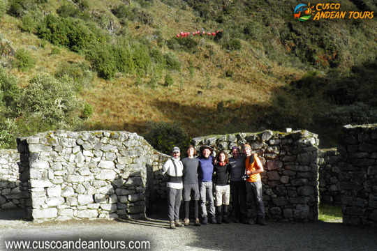


DAY 01: CUSCO - WAYLLABAMBA
We will start the day by collecting you from your hotel for the 1½ hour drive to Ollantaytambo where we will stop for approximately 30 minutes in a local restaurant. You can use toilets, buy water, snacks, chocolates and get the last things you may have forgotten to buy in Cusco. To reach the trail head we drive one more hour after Ollantaytambo to km 82. Before starting our trek we will organize our backpacks and make sure we have all that we need for the first day trek. After crossing the Urubamba River, we walk 3 hours through farmland along the Urubamba river until our first stop and lunch near the first archeological site called Llactapata. After a delicious meal prepared by our chef and porters, we will continue for another 3 hours to reach our campsite in Wayllabamba where we will have dinner and then relax in preparation for the next day.
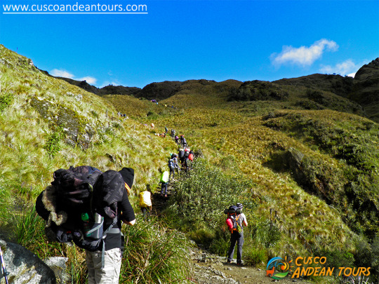
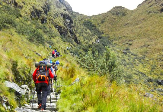
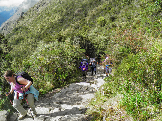
DAY 02: WAYLLABAMBA - PACAYMAYOEarly morning we have to wake-up call, 5:00 a.m. or 5:30 a.m. depending of your tour guide. Warm wash water and a high energy breakfast will be waiting for you. Also you will have some time to refill your water bottle and be given some snacks for the day to help you get over the pass. Wayllabamba campsite to Warmiwañusca (Dead Woman Pass) is an uphill climb of approx. 7 km. This is considered the hardest part of the Trail. However the changes in the vegetation and landscape as you climb through different climatic zones will keep you involved with the hike and focussed on discovering more as you climb.
At the top of the pass you will be greeted with panoramic views to distant mountains. Looking back into the valley you have just climbed out of, congratulate yourself for your accomplishment. Looking ahead you will see your way on toward Machu Picchu.
After the Pass we have approximately 3 km going downhill to reach Pacaymayo campsite. Our team will be waiting for you there with food warm wash water and with your tent already set up. For the rest of the afternoon you will be able to rest and enjoy before happy hour and dinner at the end of the day.
DAY 03: PACAYMAYO - WIÑAYWAYNA
We begin this new day with breakfast. Then, after a short climb you will reach a remarkable Inka lookout called Runcurakay. Your tour guide will describe the importance of this place. Then after 1½ hours more to reach the second pass you’ll be able to enjoy the view from the second highest spot on the trail. There are 1½ hours of stairs down to a dramatic Inka site, Sayacmarca perched high on the ridge. Learn what is known of this place take pictures and learn of the historical background from your guide .
Lunch will be near to our next archeological site Puyupatamarca, a spectacular tumble of buildings where you will have a view of all the mountains around Machu Picchu far below. Then we start our descent, going into rainforest with a beautiful cover of vegetation with orchids, bromeliads, ferns and many other native plants. Also if we are lucky we can see and hear some of the hundreds of birds in the area.
Our three hours down hill to Wiñayhuayna will be our last challenge before we finish the day and enjoy tea time, a delicious dinner, take a nap and prepare for the next best day: Machu Picchu.
DAY 04: WIÑAYWAYNA - MACHU PICCHU
Last day, we wake up early and commence the walk to Machu Picchu (2 hours.) We will mark our arrival when we pass through the Sun Gate (Inti Punku) From this spot, if weather is good, you will have an unforgettable panoramic views of Machu Picchu. After just one more hour downhill you will enter the iconic Inka Citadel. Your tour guide will take you inside Machu Picchu with his knowledge, telling you all about this majestic city for around 2 hours. After this tour, you will have free time to take pictures, feel energies and discover more of Machu Picchu by yourself. Also if you registered to hike up Huayna Picchu or Machu Picchu Mountain this is the time you will do that.
Once you feel you are complete in the Citadel, it will be time to go down to Aguas Calientes. You will take the bus for 25 minutes. In Aguas Calientes you can enjoy your last lunch with the group. Then decide to relax in the hot springs (10 soles) or explore the shops and craft stalls in the Village.
Later in the afternoon you will catch the train to Ollantaytambo (1 hour 50 minutes). In Ollantaytambo you need to get out of the train station and transfer to a bus where the driver will be waiting to take you from Ollantaytambo to Cusco (1½ hours.)

lunes, 30 de marzo de 2020

WIÑAYWAYNA - INCA TRAIL TO MACHU PICCHU

The Inca Trail to Machu Picchu has a significant number of Archaeological Sites, distributed along the route.


  • Llactapata
  • Qoriwayrachina
  • Paucarcancha
  • Warmiwañuska
  • Runkurakay
  • Sayaqmarka
  • Phuyupatamarka
  • Wiñaywayna
  • Intipata
  • Intipunku
  • Inca bridges on the Inca Trail


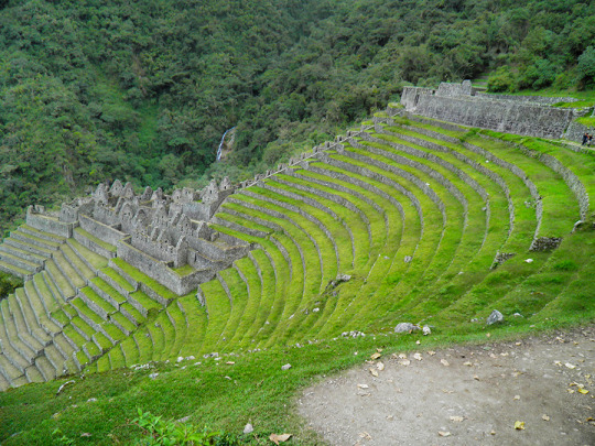
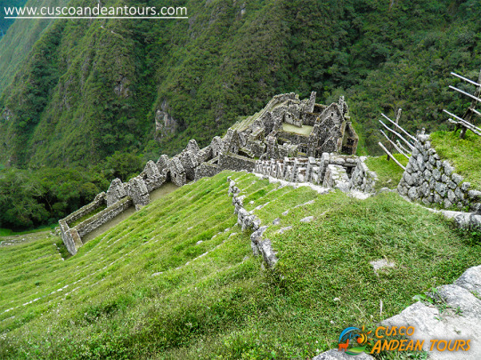
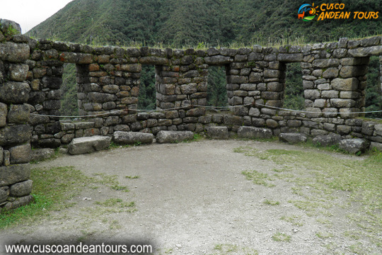
An important site on the route is Wiñaywayna - "Eternamente Joven", it is an archaeological site belonging to the Inca period, built by the Inca Pachacutec, the maximum representative of the Inca Culture, known as the architect of the Inca period. The name corresponds to an orchid that abounds in the place. Wiñaywayna is 2,650 m away. / 8,694 ft. 5 km southeast of the main Llaqta of Machu Picchu.
This architectural complex of Wiñaywayna, corresponds to the plan of a small town, are a group of houses grouped together, in a single courtyard, in the manner of the current condominiums. The possible dwelling areas have trapezoidal-style niches and door openings with a single jamb.
The monument is surrounded by platforms of different sizes, which responded to the function, either for agriculture or containment to prevent soil erosion. You can notice the structures, the gables for the thatched roofs that were fastened with rings.
Likewise, the set of liturgical sources stand out, on a strongly sloped surface, the entire small city is made of granite rock and seen from a high part, clearly, we can notice that it has the same architectural distribution as Machu Picchu.
From this place the Inca Trail, is shown almost horizontal, the path gets smoother, they rise up by long stairs that bring us closer to Inti Punku, the entrance door to Machu Picchu.
INCA TRAIL TO MACHU PICCHU INFORMATION

martes, 24 de marzo de 2020

INFORMATION OF INCA TRAIL TO MACHU PICCHU

One of the main attractions along the route is the ancient network of settlements built in granite rock by the Incas such as Wiñay Wayna and Phuyupatamarca immersed in an overwhelming natural setting. Hundreds of varieties of orchids, multi-colored birds, and dreamy landscapes provide the ideal setting for a route that the walker should walk at least once.


Description of the Inca Trail to Machu Picchu route

Based on the traditional 4-day / 3-night Inca Trail
The total distance of the road is approximately 39.6 km. And begins at km 82 in the place called Pisqacucho. To start the journey you should cross a bridge, then head to the left side through an eucalyptus orchard and start the day calmly.
Almost immediately you will find the archaeological complexes of Q’ente, Pulpituyoc, Kusichaca and Patallaca. From that last point the path will continue along the left bank of the Kusichaca river in the area with the same name where you will not only see the bridge but also find tombs, aqueducts, terraced paths and a canyon. You will continue until you reach the small town of Wayllabamba and Inca aqueducts. It takes around 4 hours to reach 9 km from this point. One will camp there the first night.
The second day is more difficult, because the walker will have to climb up to 4,200 meters, crossing the Warmiwañusqa pass, the first and the highest. If you suffer from "soroche" (altitude sickness) it is best not to stop or descend quickly to the Pakaymayu river valley, where you can camp. This place is 7 km away and it is approximately 8 hours away.
The third day is the longest but the most interesting. You will be ready to visit the most impressive complexes such as Runkuraqay, the second pass at 3,800 meters above sea level, its complex with yellowed niches that perhaps were a small place to rest, guard posts and places for worship after crossing the second step you descend to Yanacocha (The Black Lagoon) and then climb a path with stone steps until you reach another group of buildings which attract the attention of visitors. This point is called Sayaqmarka a pre-Hispanic complex with narrow streets, buildings erected on different levels; sanctuaries, patios, canals and an exterior protective wall. At the top of the buttresses one can see many buildings which lead one to suppose that it was once a temple and an astronomical observatory, which had a permanent water supply and excellent food stores.
Sayaqmarka is a place full of mystery and charm. The approximate distance to Runkuraqay is 5 km. Which takes 2 hours. This complex extends 3,600 meters above sea level. There is a great trail and tunnel through this complex. We recommend camping near the ruins of Phuyupatamarca or 3 km further on in the Wiñay Wayna visitor center, where one can buy food and drinks or use hygienic services. The ruins of Phuyupatamarca are better preserved than we have seen before now.
On the fourth day, which will start around 5:00 a.m., the walker arrives in Machupicchu around 7:00 a.m. after 8 km of walking through the jungle. Follow the indicated route and drink some water at the Wiñay Wayna Visitor Center. The trail is clearly marked but try to avoid getting too close to the edge of the cliff.
Camping in Inti punku is prohibited. You will leave your equipment at the control gate and enjoy the most important monument in this part of the continent. You will have time to visit Machupicchu until noon. Check the train schedule to return to Cusco.
If you plan to stay in the town of Machupicchu (also called “Aguas Calientes”. The distance from the station to the ruined bridge to Machupicchu is 2 km. This takes about 20 minutes down a narrow path, which runs parallel to the line. iron.


Climate and environment

The climate is relatively mild throughout the year, with heavy rains from November to March, dry and hot weather from April to October, which is a recommended time to visit.
The minimum annual temperature ranges from 8 ° to 11.2 ° C. In the months of June, July and August the temperature can often drop below freezing.
The maximum annual temperature varies from 20.4 ° to 26.6 °. The terrain is quite uneven, with several ravines and streams fed by glaciers that eventually pour into the Urubamba River, which crosses the area forming a deep valley that runs through the granite base of Vilcabamba for more than 40 km through a variety of ecosystems.

Landscape of the area

The surroundings are impressive and the balance struck between nature and Inca architecture is astonishing.
The Vilcabamba mountains have wide and high peaks that reach up to 6,000 meters as well as Salkantay and Humantay among others.
The mix of mountains, jungles and valleys create a fantastic world where sunrise and sunset are shrouded in mystery.

Wildlife that exists in the route

It is abundant and varied. The existence of endangered species such as the spectacled bear (Tremarctos omatus), the Andean Cock of the Rocks (Rupicola peruviana), the dwarf deer (Pudu mephistopheles), was one of the reasons for the Peruvian government to decide to declare it a Conservation Unit.
The park includes species such as the cougar, the Andean fox, the river otter, Taruka (Huemul deer), wild cat, ferret, etc. There are birds in Machupicchu such as the Mountain Caracara, hummingbirds, torrent duck, parrots, wild turkey and several small birds with colorful plumages.
There are also reptiles such as the jergón and the coral micrurus snake (lethal for its poison), lizards, toads and numerous fauna of the jungle and the Andes that inhabit the sanctuary. This abundant wildlife makes the Machupicchu sanctuary ideal for tourists and researchers who want to watch or study animals.

Flora to the area

The long natural areas are filled with a variety of forest species, which vary according to habitat. The forest vegetation is represented by trees such as: cedar, romerillo or intimpa, laurel, etc. There are also species such as Ocotea, Pedocarpus, Guarea, Weinmania, Clusia, Cedropia, Cinchena, Eritrina or Pisonay, and oak among others. Decorative plants have made the sanctuary famous. Experts have identified more than 90 species of orchids and various species of begonias and the puya cactus. Most of the area is covered by grasses, shrubs, tree plants. The variety of conditions have created an ideal environment for the growth of diverse plants that goes from the thick jungle like the forest clouds to the highest parts of the mountains.
INFORMATION OF INCA TRAIL TO MACHU PICCHU

martes, 25 de febrero de 2020

The Inca Trail, masterpiece of America, enters the World Heritage Site

The Inca Trail, a master road communication network that extended to six countries in South America, was declared a World Heritage Site by Unesco on Saturday, a distinction that recognizes the ingenuity of a pre-Hispanic system that surprised the world. The trails, which served the Inca to control its empire (Tahuantisuyo), extend from Argentina to Chile, Bolivia, Peru, Ecuador and Colombia, and were linked by a network of roads that constituted the Qhapaq Ñan (in Quechua Inca Trail).


 "This extraordinary system of roads extends through one of the geographical areas of the world with the greatest contrasts," among the Andres, the rainforest, the Pacific coasts and deserts, the Unesco statement said. "The denomination means for the six countries the recognition of one of the most important monuments of the Andean world," said Luis Lumbreras Flores, archaeologist of the Inca Trail Project of the Peruvian Ministry of Culture. The Qhapaq Ñan, the oldest road network in America, ran along the entire Tahuantinsuyo along the Andes Mountains, from western Argentina to southern Colombia. The main road has about 6000 km from south to north. This mountain road parallel to the Pacific Ocean was linked by cross sections that even reached the jungles and the Gran Chaco in Argentina and Bolivia. "There are other sections where the population still travels. It has cobbled areas, with flagstone or land fill, and in some places you can see retaining walls on both sides of the road," said Peruvian archaeologist Cristian Viscount. The distinction will allow to obtain financing from international organizations for the conservation and restoration of the paths and sanctuaries that were built around the road, archaeologists say optimistic. The entire network in coast, mountains and jungle, totaled an extension of 30,000 km, which interconnected the four of them, or cardinal points of the empire, with the mythical capital, Cusco (in Quechua, "navel" or "center").


Peru gathers most of the discovered routes of the old routes. The most famous stretch, and where millions of tourists from all over the world arrive, leave from Cusco to the citadel of Machu Picchu. They are 43 kilometers between forests, with ancient stone steps. The road reaches the Puerta del Sol where it offers majestic views of the Machu Picchu ruins.
INFORMATION OF INCA TRAIL

martes, 14 de mayo de 2019

Useful information of the Inca Trail

The Inca Trail to Machu Picchu is the most famous and best preserved road of the Inca trail. With its cobblestone routes it crosses important archaeological remains such as Huayllabamba, Runcuracay, Sayacmarca, Puyupatamarca, Huíñayhuayna and Intipuncu until arriving at the great citadel of Machu Picchu.


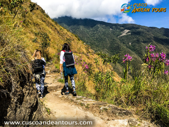
It is necessary to have at least four days to cover it. The geography of the Inca Trail is rugged and allows you to contemplate landscapes of great beauty that include imposing snow, lush jungles and lush forests. The water abounds in the ravines, which are protected from the strong wind, characteristic of the high passes.
informacion-sobre-camino-inca Cusco is one of the greatest archaeological events in world history and even its simple paths are majestic. Due to its condition as a pre-Inca city, it was named the Archeological Capital of South America. In Cusco, on top of each Inca construction, Spanish architecture is added together and together they add centuries of civilization.
Throughout the year, thousands of travelers from all over the world undertake the route of the Inca Trail from Cusco to access the jungle of Peru, and the ancient mysteries that still contain the stones of Machu Picchu.
Along the way there are several ruins of different fortifications in relative good condition, which visually dominate all the valleys.
walk-camino-incaThe Inca trail starts in the town of Cori-huayra-china (Quechua: Quri Wayrachina, 'venteadero de oro'), at kilometer 88 of the Cusco-Quillabamba railway, and takes between Three and four days of walking arrive at Machu Picchu. In the crossing, which crosses an impressive altitudinal slope, with climates and ecosystems as varied as the high Andean high plateau and the misty forests, two passes must be overcome at a great height (the largest of them, Huarmihuañusca, of 4,200 meters of altitude, also known as "Paso de la Mujer Muerta") and ends with the entrance to Machu Picchu through Inti Puncu or "Puerta del Sol".
informacion-camino-inca-peruEn the route the traveler will find a network of styled granite settlements that are along the road (Huiñay Huayna, Puyupatamarca), immersed in natural settings.
As an ideal complement, tourists will also find an exuberant nature, with unique landscapes, hundreds of species of orchids and multicolored birds.
The location of the Inca Trail begins 82 kilometers from the city of Cusco on the way to Machu Picchu and the journey is 42 kilometers.

martes, 23 de abril de 2019

INCA TRAIL TREK TO MACHU PICCHU

INCA TRAIL TREK TO MACHU PICCHU


DAY 01: CUSCO - WAYLLABAMBAWe will start the day by collecting you from your hotel for the 1½ hour drive to Ollantaytambo where we will stop for approximately 30 minutes in a local restaurant. You can use toilets, buy water, snacks, chocolates and get the last things you may have forgotten to buy in Cusco. To reach the trail head we drive one more hour after Ollantaytambo to km 82. Before starting our trek we will organize our backpacks and make sure we have all that we need for the first day trek. After crossing the Urubamba River, we walk 3 hours through farmland along the Urubamba river until our first stop and lunch near the first archeological site called Llactapata. After a delicious meal prepared by our chef and porters, we will continue for another 3 hours to reach our campsite in Wayllabamba where we will have dinner and then relax in preparation for the next day.
DAY 02: WAYLLABAMBA - PACAYMAYOEarly morning we have to wake-up call, 5:00 a.m. or 5:30 a.m. depending of your tour guide. Warm wash water and a high energy breakfast will be waiting for you. Also you will have some time to refill your water bottle and be given some snacks for the day to help you get over the pass. Wayllabamba campsite to Warmiwañusca (Dead Woman Pass) is an uphill climb of approx. 7 km. This is considered the hardest part of the Trail. However the changes in the vegetation and landscape as you climb through different climatic zones will keep you involved with the hike and focussed on discovering more as you climb.
At the top of the pass you will be greeted with panoramic views to distant mountains. Looking back into the valley you have just climbed out of, congratulate yourself for your accomplishment. Looking ahead you will see your way on toward Machu Picchu.
After the Pass we have approximately 3 km going downhill to reach Pacaymayo campsite. Our team will be waiting for you there with food warm wash water and with your tent already set up. For the rest of the afternoon you will be able to rest and enjoy before happy hour and dinner at the end of the day.
DAY 03: PACAYMAYO - WIÑAYWAYNAWe begin this new day with breakfast. Then, after a short climb you will reach a remarkable Inka lookout called Runcurakay. Your tour guide will describe the importance of this place. Then after 1½ hours more to reach the second pass you’ll be able to enjoy the view from the second highest spot on the trail. There are 1½ hours of stairs down to a dramatic Inka site, Sayacmarca perched high on the ridge. Learn what is known of this place take pictures and learn of the historical background from your guide .
Lunch will be near to our next archeological site Puyupatamarca, a spectacular tumble of buildings where you will have a view of all the mountains around Machu Picchu far below. Then we start our descent, going into rainforest with a beautiful cover of vegetation with orchids, bromeliads, ferns and many other native plants. Also if we are lucky we can see and hear some of the hundreds of birds in the area.
Our three hours down hill to Wiñayhuayna will be our last challenge before we finish the day and enjoy tea time, a delicious dinner, take a nap and prepare for the next best day: Machu Picchu.
DAY 04: WIÑAYWAYNA - MACHU PICCHULast day, we wake up early and commence the walk to Machu Picchu (2 hours.) We will mark our arrival when we pass through the Sun Gate (Inti Punku) From this spot, if weather is good, you will have an unforgettable panoramic views of Machu Picchu. After just one more hour downhill you will enter the iconic Inka Citadel. Your tour guide will take you inside Machu Picchu with his knowledge, telling you all about this majestic city for around 2 hours. After this tour, you will have free time to take pictures, feel energies and discover more of Machu Picchu by yourself. Also if you registered to hike up Huayna Picchu or Machu Picchu Mountain this is the time you will do that.
Once you feel you are complete in the Citadel, it will be time to go down to Aguas Calientes. You will take the bus for 25 minutes. In Aguas Calientes you can enjoy your last lunch with the group. Then decide to relax in the hot springs (10 soles) or explore the shops and craft stalls in the Village.
Later in the afternoon you will catch the train to Ollantaytambo (1 hour 50 minutes). In Ollantaytambo you need to get out of the train station and transfer to a bus where the driver will be waiting to take you from Ollantaytambo to Cusco (1½ hours.)