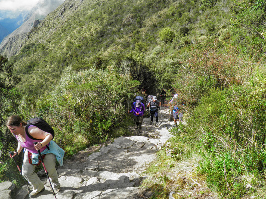
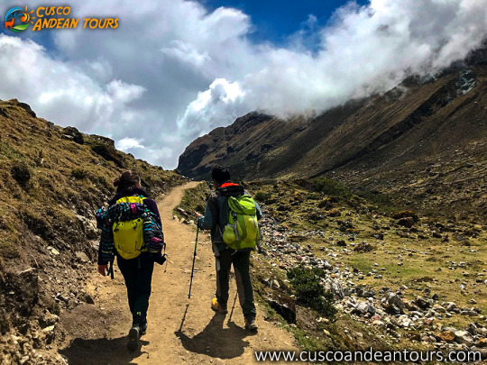
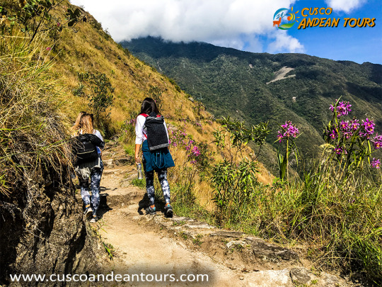
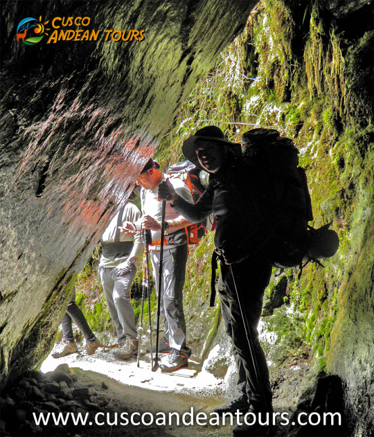
The Inca Trail to Machu Picchu has a significant number of Archaeological Sites, distributed along the route.
Llactapata
Qoriwayrachina
Paucarcancha
Warmiwañuska
Runkurakay
Sayaqmarka
Phuyupatamarka
Wiñaywayna
Intipata
Intipunku
Inca bridges on the Inca Trail
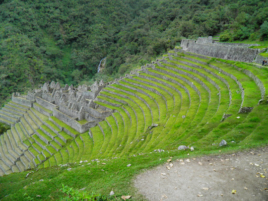
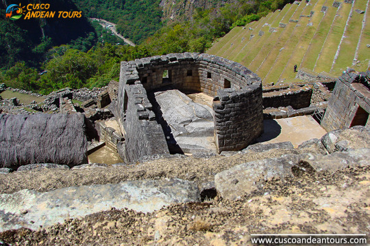
An important site on the route is Wiñaywayna - "Eternamente Joven", it is an archaeological site belonging to the Inca period, built by the Inca Pachacutec, the maximum representative of the Inca Culture, known as the architect of the Inca period. The name corresponds to an orchid that abounds in the place. Wiñaywayna is 2,650 m away. / 8,694 ft. 5 km southeast of the main Llaqta of Machu Picchu. This architectural complex of Wiñaywayna, corresponds to the plan of a small town, are a group of houses grouped together, in a single courtyard, in the manner of the current condominiums. The possible dwelling areas have trapezoidal-style niches and door openings with a single jamb. The monument is surrounded by platforms of different sizes, which responded to the function, either for agriculture or containment to prevent soil erosion. You can notice the structures, the gables for the thatched roofs that were fastened with rings. Likewise, the set of liturgical sources stand out, on a strongly sloped surface, the entire small city is made of granite rock and seen from a high part, clearly, we can notice that it has the same architectural distribution as Machu Picchu. From this place the Inca Trail, is shown almost horizontal, the path gets smoother, they rise up by long stairs that bring us closer to Inti Punku, the entrance door to Machu Picchu. INCA TRAIL TO MACHU PICCHU INFORMATION
DAY 1: CUSCO / CITY TOUR
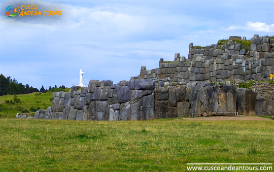
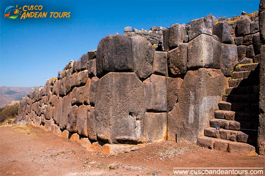
Reception at the airport, transfer to the hotel and you will have a free time available to rest and so avoid altitude sickness. In the afternoon the trip will start with the visit of the Temple Koricancha , The Main Square or Plaza de Armas, The Cathedral and continue to visit the Inca sites: The Fortress Sacsayhuaman the latter side is strategically built on a hill overlooking Cusco and is famous for its enormous carved stones, some of them standing over 9m/30ft tall and weighing over 350 tons, set together whit astounding precision to form the outer walls. Most important Mystical center from Inkas time Qenqo, the military control center Puca pucara and the water temple of Tambomachay. Return to the hotel and free night.
DAY 2: TOUR OF MARAS AND MORAY
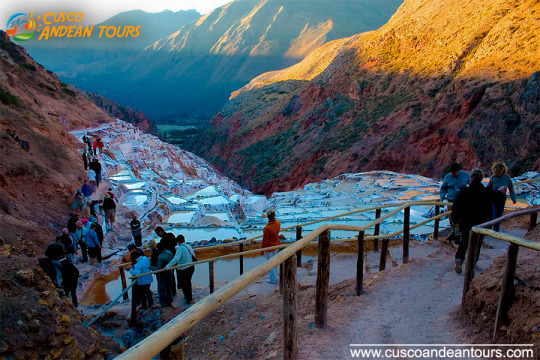
09:00 – 14:00 Tour of Maras (salt mines) and Moray (terraces). Night at hotel in Cusco.
DAY 3: CUSCO/ SACRED VALLEY OF THE INCAS
This day we take a trip to the Sacred Valley of the Incas: visit the Pisac Incas built, the colorful Andean market and the church. Then we pass places like Lamay and Calca on the way to arrive in Urubamba town where we stop for lunch. After lunch visit to Ollantaytambo town, where we can see its typical streets, the impressive archaeological constructions and agricultural terracing, not to mention the splendid views over the sacred valley. Finally, visit the picturesque Andean village of Chinchero where the built of the royal hacienda Of Tupac Inca Yupanqui lie. You can admire the well preserved Inca wall in the main square, and visit the beautiful colonial temple. Built on Inca foundations with interesting paintings. Overnight in Cusco
DAY 4: CUSCO / MACHUPICCHU
Pick up at the hotel to take the train for a full day tour of the Magical citadel of Machu Picchu, it is 112 Km. from Cusco .During the journey we see the Urubamba canyon, Urubamba River and the show capped peaks of the Veronica Mountain. Arriving in Aguas Calientes we go to Machu Picchu where we visit this wonderful Inca Sanctuary also known as “The lost City of the Incas “one of the best known examples of surviving Inca. After the visit, we come back to Aguas Calientes to take the train back to Cusco.
DAY 5: DEPARTURE FROM CUSCO
We will pick you up from your hotel in Cusco and take you to the airport.
DAY 1: CUSCO / CITY TOUR
Reception at the airport, transfer to the hotel and you will have a free time available to rest and so avoid altitude sickness. In the afternoon the trip will start with the visit of the Temple Koricancha , The Main Square or Plaza de Armas, The Cathedral and continue to visit the Inca sites: The Fortress Sacsayhuaman the latter side is strategically built on a hill overlooking Cusco and is famous for its enormous carved stones, some of them standing over 9m/30ft tall and weighing over 350 tons, set together whit astounding precision to form the outer walls. Most important Mystical center from Inkas time Qenqo, the military control center Puca pucara and the water temple of Tambomachay. Return to the hotel and free night.
DAY 2: CUSCO/ SACRED VALLEY OF THE INCAS
This day we take a trip to the Sacred Valley of the Incas: visit the Pisac Incas built, the colorful Andean market and the church. Then we pass places like Lamay and Calca on the way to arrive in Urubamba town where we stop for lunch. After lunch visit to Ollantaytambo town, where we can see its typical streets, the impressive archaeological constructions and agricultural terracing, not to mention the splendid views over the sacred valley. Finally, visit the picturesque Andean village of Chinchero where the built of the royal hacienda Of Tupac Inca Yupanqui lie. You can admire the well preserved Inca wall in the main square, and visit the beautiful colonial temple. Built on Inca foundations with interesting paintings. Overnight in Cusco
DAY 3: CUSCO / MACHUPICCHU
Pick up at the hotel to take the train for a full day tour of the Magical citadel of Machu Picchu, it is 112 Km. from Cusco .During the journey we see the Urubamba canyon, Urubamba River and the show capped peaks of the Veronica Mountain. Arriving in Aguas Calientes we go to Machu Picchu where we visit this wonderful Inca Sanctuary also known as “The lost City of the Incas “one of the best known examples of surviving Inca. After the visit, we come back to Aguas Calientes to take the train back to Cusco.
DAY 4: DEPARTURE FROM CUSCO
We will pick you up from your hotel in Cusco and take you to the airport.
DAY 1: CITY TOUR CUSCO
We'll be waiting for you at the airport in Cusco on your arrival date , take you to the hotel where you will rest for an hour , you'll have a cup of coca tea and we will pick you up from your Hotel in the afternoon (from 13:30 hrs to 18:30 hrs) to start with the tour around Cusco and outskirts. Tour around Cusco and outskirts: We pick you up from your Hotel to start visiting the following attractives , with aprofessional guide: - The Koricancha Palace andConvent of Santo Domingo Religious center known as "The Temple of the Sun" where you will admire the impressive engineering used in its construction. The Cathedral:Colonial religious monument of extraordinary artistic value. Sacsayhuaman: Located 3 km from the city of Cusco,impressive stone fortress monumental and magnificent architecture, famous for its enormous carved stones,some of which are at9 m/ 30 feettall and weigh of 350 tons. Here is where the Inty Raymi or Fiesta del Sol in June take place every year. Qenqo: Ceremonial and ritual center, amphitheater where sacrifices were made. Puca-Pucara: An old tambo (resting place), monitoring placethroughout the Inka Empire Routes. Tambomachay: At 7 Km. From the city of Cusco,ceremonial center of worship of water , traditionally known as the place of water.Excursiontime: around 5 hours. Frequency : everyday in the afternoons.
DAY 2: MACHU PICCHU TOUR
From 05:45 hrs to 06:00 hrs., we pick you up from your Hotel inCusco (3400 m.a.s.l.) and drive you to the Train Station, located in Poroy, then we get aboard the train and the trip from Cusco starts heading toAguas Calientes (2000 mosl).Our Guide Will be waiting there , he will lead us to the bus station,rising by a zigzag pathfor 30 minutes to the incredible Machu Picchu, known as the lost city of the Incas.Once we get to Machu-Picchu, We'll pass throught the control, where we'll hand in our entrance tickets and where our guided tour will start, visitingthe main square, the Circular tower, the sacred solar clock, the royal rooms, the temple of the three windows and the cementeries, it lasts around two hours. Afterwards you'll be givenenoughtime to have a walk around the citadel and have your meals ,at any restaurant in Aguas Calientes or if you wish atSantuary Lodge (this is not included). In the afternoon, betwen 15:30 hrs and 17:00 hrs we'll return on train to Cusco, we'll be waiting for you at the train station and then we'll take you back to your hotel.
DAY 3: FAREWELL:
We'll be at your hotel at least two hours before your flightleaves to take you to the airport Where you should check your plane ticket and pay the airport tax, we'll see you to the departure launge.
Cusco (Qosqo in Quechua), means navel of the world, and is one of the largest regions of Peru. Its geographical location has allowed it to develop agriculturally, standing out in the cultivation of corn, quinoa, barley, potatoes, tea and coffee. Today Tourism is its main source of income, due to the great archaeological wealth left by the Tahuantinsuyo empire and the passage of the Spanish. It is without a doubt, the city that preserves the most beautiful and important archaeological monuments of Peru and America, among them Macchu Pichu, being in this way the first tourist destination in our country, an important tourist destination for those who come to appreciate the impressive Inca architecture; stone work carried out with originality and perfection. In its surroundings there are many Inca and Colonial archaeological remains such as the Macchu Picchu archaeological site, located 130 km northeast of the city of Cusco, 600 m approx. on the Urubamba river. Inside this Inca citadel a total of 150 houses is calculated; one-room houses, highlighting the solar clock (or Intihuatana), an astronomical observatory that was built in a strategic place in the citadel, from where the Incas could observe the movements of the sun. cusco tours
Among its main archaeological monuments we can mention the fortress of SacsayHuamán, Ollantaytambo, Písac, Kenko, Acllahuasi, the archaeological site of Tambomachay, among other sites of archaeological and tourist importance. Important architectural remains of the colonial style are still preserved from the Spanish past, among them the Cathedral Basilica, the temple and the convent of La Merced, the church of the company of Jesus, the pulpit of San Blas, the churches of Santa Catalina , Santa Clara and San Cristóbal, Santo Domingo, and museums and paintings of the Cusqueña School.
The Sacred Valley for the Incas
With the river feeding the valley, its fertile lands were one of the main centers of food production during the time of the Incas; some places, like Moray, were even used as agricultural laboratories, to experiment with plant species brought from all over the empire. The Incas cultivated potatoes, white corn, coca, fruits and vegetables, on terraces like those seen in many valley towns specially designed for this purpose. Today the valley produces lucuma, peach, avocado, and one of the best corn kernels in the world. Sacred Valley Tour
But it was more than just an important agricultural center; the Urubamba river valley, "Willcamayu" for the Incas, was one of the most important elements in the religious cosmology of the Incas. They believed that the flow of the Urubamba was closely linked to the constellations and mountains, they also believed that it was the counterpart of the Milky Way on earth.
Where is the Sacred Valley of the Incas located?
The Urubamba river valley or "Sacred Valley of the Incas" is located 15 km northeast of the city of Cusco, reached by a paved road. A drive to one of the nearest towns will take you around 40 minutes. From there you can move to the other towns in the valley.
What is the climate like in the valley?
The Sacred Valley of the Incas is located 2,800 meters above sea level, 600 meters below Cusco, and enjoys one of the best climates in this region, daytime temperatures vary between 19 ° and 24 ° C. This privileged climate made the Incas take it as their main center of agricultural production, experimentation and research. Today travelers use the valley to acclimatize, before starting their tours of Cusco and Machu Picchu, and without a doubt one of the best ways to avoid altitude sickness.
What to see in the Sacred Valley of the Incas?
Known to the Incas as Willcamayu, the beautiful valley stretches from the town of Pisac to Ollantaytambo, along the Urubamba River. The ancient Inca settlements in these cities are presented as checkpoints, before entering the "Inca trail" that leads to the sacred city of the Incas, Machu Picchu; they are simply amazing, and one of the best previews of what you will see in wonder.
MARAS AND MORAY INFORMATION
What does Moray mean?
The word Moray would have different origins. In the Quechua language (language of the Incas) it means: a territory occupied since ancient times.
Although the origin of the name of Moray is not known for sure, it is presumed that it had to do with the corn harvest called 'Aymoray', or with the month of May named in the same way by the Incas (sowing month in the calendar inca).
Moray is also presumed to come from the name of the dehydrated potato known as the 'moraya' (white chuño). Cusco tours
History
Before the Incas, this part of the Sacred Valley of the Incas was inhabited by the ‘Maras’ and ‘Ayamarcas’ ethnic groups, who occupied a large part of the current territory of the Sacred Valley of the Incas.
After the Inca conquest, the construction of large buildings and platforms began in the territory of the Sacred Valley. Thus, the Moray platforms were built, which were used by the Incas as an important agricultural control center. There the production of the coca leaf was carried out, a plant considered sacred to the Incas.
Investigations do not clearly indicate whether during the colony (from 1532) the Moray platforms were worked. The truth is that it was not until 1932 that the Shirppe Johnson’s expedition flew over the place, discovering the existence of the platforms, then covered by thick vegetation.
During the 20th century, various investigations were carried out on Moray. Perhaps the most valuable of all was made by anthropologist John Earls who established that it was an experimental agricultural center.
How's the weather?
The climate in Moray is dry and temperate. The temperature varies from 21ºC. (69ºF). during the day until 1ºC. (33ºF). at night.
From October to April the rainy season elapses where river precipitation is frequent. From May to September the dry season occurs where rains are not so frequent.
April, May and June are believed to be the best time to visit Moray.
What am I going to see in Moray?
Beautiful landscapes - The set of platforms that make up Moray are visually beautiful to human eyes and, of course, in front of a camera lens. Many people come there to take their picture postcard and post it on their social networks.
Circular platforms - The circular platforms of Moray were a very important place for Inca agriculture. It is believed that it was a center of experimental studies that the Incas used to plant products that, under other conditions, could not be cultivated.
Adventure sports - There are tours to the Moray platforms that include adventure by bicycle or even ATV. These services can be obtained at any tourism agency located in the Historic Center of Cusco.
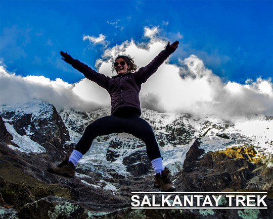
For the inhabitants of the Andes, reverence for the apus, sacred mountains, converted into local protectors, did not go unnoticed in time, thus, mountains such as Salkantay, among others that surround it, assume an important role in the Andean worldview. For example, the snow of Waqay Willke (5720 masl), within the traditional symbolism of Andean dual thought, is considered the complement of Salkantay which is one of the most powerful and active deities of the place, it is also appreciated by the inhabitants, the father of all the mountains in the region and even today it is the object of great veneration, so Machupicchu and Choquechurco maintain an intimate visual contact with Salkantay and other snowcapped mountains of the Vilcabamba chain, SALKANTAY TREK INFORMATION.
The sacred and administrative llaqta of Machupicchu is located between important snowfalls of the eastern slope of the Vilcabamba mountain range, «Salkantay, (Humantay Yanantay and Tokorhuay that surround it) and Waqay Willke» 1 whose mountains, object of worship, enable a social cohesion which revolves around its veneration, as these are water providers, a vital element, principle of existence in the Andean world, as well as generating fertility in animals, protection of its inhabitants and success in crops.
In the cult of the mountains in the area, religious, political and economic factors are involved; important within the process of social development of their communities, the same that have been present for centuries, and that are and were very familiar to the Andean inhabitants of all times.
The current vision of the inhabitants of the Sacred Mountain (Mollepata, Machupicchu, Santa Teresa, Wayraqmachay, Collpapampa, Totora, Yanama) in force since the time of the Inca society, is shared by Andean peoples, so that the area is known for reverence to the sacred mountains, hardly ignored and that no doubt play a vital function over time. These sacred mountains are located within the delimitation polygon of the Historic Sanctuary of Machipicchu (SHM), declared as such by supreme decree No. 001-81-AA of January 8, 1981, with an area of 32,592 ha. Likewise, in the buffer zone (ZA) of the SHM specified by the head resolution No. 322-2001-INRENA of September 16, 2004, which proposes the extension of the ZA from including continuous immediate hydrographic basins to the SHM area, increasing the air of the ZA of those in force in 71,589 ha to 193,334 ha. Finally, it is also considered within the National Archaeological Park of Vilcabamba-Choquequirao, declared by means of national directive resolution No. 949 / INC, dated October 9, 2002, which resolves: «To approve the Plan of Delimitation of the National Archaeological Park of Vilcabamba (Choquequirao ), Plan Nº V-01, dated July 2002, with an area of 522,878.30 hectares and a perimeter of 367.09 kilometers, at a scale of 1: 125,000, located in the provinces of La Convencion, Anta and Abancay, in the departments of Cusco and Apurímac ».
Evolution and distribution of glaciers in the Salkantay chain At the time when the glacial areas of the Aobamba basin reached their maximum development, the glaciers probably descended to the height of 2950 m and to the extent that the environmental climatic conditions were changing, a process of deglaciation begins, being observed on the one hand that according to the pre-existing morphology, the main glacier current developed along the channel of the Aobamba valley, which during its retreat was subdivided into the areas of the ravines tributaries, generating in turn in the latter, the secondary glacial basins, such as in the cases of the Mesada, Tokorhuay, Paccha Grande, Sisaypampa and Orcospampa streams, which are the most traveled in the upper area of the main basin. On the other hand, on the slopes of the flanks of the valley where the slopes are steep, the glacial retreat of the fronts occurred almost parallel to the longitudinal axis of the main glacier current. Currently, the glaciers that belong to Aobamba are concentrated around the Palkay (5422 m), Salkantay (6264 m) and Tokorhuay (5473 m) hills, obviously year after year they continue to lose size and volume. In the last thirty years the rate of glacial melting has increased rapidly, the causes of such melting being attributed to the greenhouse effects. more cusco tours
Humantay Lagoon is located in the community of Soraypampa, in the district of Mollepata, Cusco. To get to Cusco, you can take different bus companies such as Civa and Palomino. These companies have a ticket price of 40 soles and 100 soles departing from Arequipa and Lima, respectively.
Arriving in Cusco you have to take a mobility to Mollepata. In the Arcopata bus terminal you can find a large number of companies that will take you to Mollepata for approximately 15 soles. When you arrive in Mollepata you have to take a taxi to Soraypampa. This trip, because it lasts longer, has an approximate cost of 70 soles. When you arrive in Soraypampa you have to walk for an hour and a half to Humantay Lagoon or rent a horse. The entrance cost for the lagoon is approximately 10 soles.
To return, we recommend that you agree with the taxi driver who took you to wait for you or pick you up. This is because, as the destination is very far from the nearest town, you may not find return mobility. HUMANTAY LAKEINFORMACION:
1. Take a walk in the snow
To get to the lagoon you have to travel a path that crosses the mountain and snowy Humantay. This is a unique and beautiful experience for all those who like trekking or hiking on nature trails.
The hike is a stretch of 3.5 km for an hour and a half, so we recommend that you assume this adventure if you have any previous experience in doing this activity at 4200 m.a.s.l.
2. Observe the rituals
In the Humantay lagoon an ancient ritual is performed in honor of Mother Earth, Pachamama. Arriving at the lagoon, you can be part of this ceremony by placing stones for gratitude for having successfully reached the lagoon.
According to the residents of the nearby town, the Humantay is the youngest son of the Apu Salkantay. These are responsible for distributing the water that falls through the snow.
3. Taste the typical local dishes
As in every corner of Peru, gastronomy is the essential element in each destination that is visited.
In Soraypampa, you can taste very traditional dishes of the town, such as tamales with potatoes and guinea pig, the slipped wheat with pellejón, pataca with dry giblets, scrambled chochos, stew of chumos, cream of huaynas and more.
The traditional drinks that you can not miss is the already famous chicha de jora, the hot and the mixed.
4. Marvel at the scenario of the Peruvian highlands
The Humantay Lagoon is surrounded by a lot of vegetation typical of the scenarios of the Peruvian highlands. Also, from there you can see the snowy Humantay and the rest of the Vilcanota Range.
Take advantage of this unique view to get in touch with nature and let yourself be enveloped by its tranquility and mysticism.
The Humantay Lagoon is a natural attraction that is not always part of the tourist tours of Cusco. However, it is one of the most impressive and beautiful natural scenarios that this department has, so we recommend you visit it.
The Inca Trail, a master road communication network that extended to six countries in South America, was declared a World Heritage Site by Unesco on Saturday, a distinction that recognizes the ingenuity of a pre-Hispanic system that surprised the world. The trails, which served the Inca to control its empire (Tahuantisuyo), extend from Argentina to Chile, Bolivia, Peru, Ecuador and Colombia, and were linked by a network of roads that constituted the Qhapaq Ñan (in Quechua Inca Trail).
"This extraordinary system of roads extends through one of the geographical areas of the world with the greatest contrasts," among the Andres, the rainforest, the Pacific coasts and deserts, the Unesco statement said. "The denomination means for the six countries the recognition of one of the most important monuments of the Andean world," said Luis Lumbreras Flores, archaeologist of the Inca Trail Project of the Peruvian Ministry of Culture. The Qhapaq Ñan, the oldest road network in America, ran along the entire Tahuantinsuyo along the Andes Mountains, from western Argentina to southern Colombia. The main road has about 6000 km from south to north. This mountain road parallel to the Pacific Ocean was linked by cross sections that even reached the jungles and the Gran Chaco in Argentina and Bolivia. "There are other sections where the population still travels. It has cobbled areas, with flagstone or land fill, and in some places you can see retaining walls on both sides of the road," said Peruvian archaeologist Cristian Viscount. The distinction will allow to obtain financing from international organizations for the conservation and restoration of the paths and sanctuaries that were built around the road, archaeologists say optimistic. The entire network in coast, mountains and jungle, totaled an extension of 30,000 km, which interconnected the four of them, or cardinal points of the empire, with the mythical capital, Cusco (in Quechua, "navel" or "center").
Peru gathers most of the discovered routes of the old routes. The most famous stretch, and where millions of tourists from all over the world arrive, leave from Cusco to the citadel of Machu Picchu. They are 43 kilometers between forests, with ancient stone steps. The road reaches the Puerta del Sol where it offers majestic views of the Machu Picchu ruins.
INFORMATION OF INCA TRAIL
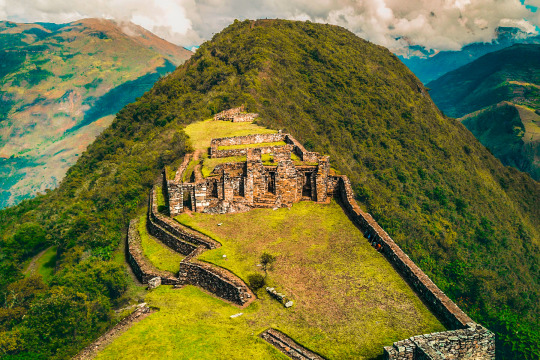
The Inca history still keeps infinity of secrets. One of them is Choquequirao: the one known as the last Inca bastion and sister citadel of Machu Picchu is still a mystery to researchers in this South American culture.
Choquequirao is located between the jungle and the Peruvian Andes, on a mountain 3033 meters above sea level and has a great peculiarity: it can only be accessed by walking, on a 62 km round trip and with descents and rises from 3100 to 1400 and vice versa.
Is this effort worth it? Without a doubt. Its difficult access makes Choquequirao one of the most charming places in all of Peru: with an almost intact fauna and flora and with less than 25 visitors per day.
How to get to Choquequirao? The easy way (and expensive) is to do it with a tour, which charges you around 300 dollars with everything included. But today we want to talk about the most adventurous and cheap way to visit this citadel: on your own.
Get to San Pedro de Cachora
The starting point of Choquequirao is the small town of San Pedro de Cachora, in the department of Abancay. To get here, you can do it from Cusco or from Lima, via Abancay.
We recommend you spend a night in Cachora to start the hike the next day very early.
From San Pedro de Cachora to the Santa Rosa campsite
The starting point of is the Capullylloc viewpoint, located 7 kilometers from San Pedro de Cachora. Although many people make this stretch walking, we recommend doing it by taxi and thus save energy for the rest of the way.
The first part of the route is a great descent until you reach Playa Rosalina, where there is a camp where you can stay for the night, but if you still have energy, we recommend you simply take a short break and continue to the Santa campsite Pink. From Santa Rosa to Choquequirao
As soon as the first rays of sun come out, it is time to continue with the road and thus we will reach our destination avoiding the hottest moment of the day.
From Santa Rosa to Choquequirao you will go through a long curve and climb road. Before reaching the Inca citadel, you will go through the town of Marampata, where you can stop for lunch and recharge. From this point to Choquequirao it is only about an hour away where you will go through a more jungle area full of different types of butterflies.
Arrival to Choquequirao
Once in Choquequirao you have the option to see the citadel in what you have left during the day or spend the night there, since there is a campsite, and take the next day to explore the construction with more tranquility.
As Choquequirao is not 100% discovered (most buildings still remain under vegetation), the citadel can be traversed quickly. Do not miss the main square and its surroundings and the llamas platforms (the visit to the latter requires extra effort, but it is very worthwhile!)
Tour of San Pedro de Cachora
After enjoying Choquequirao, the return to San Pedro de Cachora you must do it the same way you came. Our advice is that you leave the citadel very early and arrive at the Cocamasana camp. Here you can spend the night and resume the road the next day: you will only have 14 kilometers left to arrive!
Frequent questions
Food: to avoid carrying a lot of weight, we recommend you take only a few snacks (fruit, nuts, etc.) in your backpack. In all campsites you will find families offering food dishes at an economical price. Water: there are different places to buy or recharge your water bottle along the way, yes, if you prefer to refill it, we recommend you take purifying tablets to clean the water. Camping: the campsites on the way to Choquequirao charge around S / 5 for letting you camp there, while the one in the citadel is totally free. Some of them have tents to rent but others do not, so it is advisable to bring your own. Cargo mules: the road to Choquequirao is long and tedious, so if you see that you can not with all the cargo you carry in your backpack you will always have the option to pay a muleteer and take your things in a cargo mule . Of course, this always with responsibility and without burdening the animal in excess. Signaling: the road is perfectly signposted, so the risk of getting lost until reaching Choquequirao is nil. Dates of visit: it is advisable to avoid the visit to Choquequirao between the months of January and March, since it is the rainy season and the soils can be very muddy. Price: the general admission price to Choquequirao is S / 60.
Information of Choquequirao Trek
For the inhabitants of the Andes, reverence for the apus, sacred mountains, converted into local protectors, did not go unnoticed in time, thus, mountains such as Salkantay, among others that surround it, assume an important role in the Andean worldview. For example, the snow of Waqay Willke (5720 masl), within the traditional symbolism of Andean dual thought, is considered the complement of Salkantay which is one of the most powerful and active deities of the place, it is also appreciated by the inhabitants, the father of all the mountains in the region and even today it is the object of great veneration, so Machupicchu and Choquechurco maintain an intimate visual contact with Salkantay and other snowcaps of the Vilcabamba chain.
The Vilcabamba MOUNTAIN
The sacred and administrative llaqta of Machupicchu is located between important snowfalls of the eastern slope of the Vilcabamba mountain range, «Salkantay, (Humantay Yanantay and Tokorhuay that they surround it) and Waqay Willke »1 whose mountains, object of worship, enable a social cohesion that revolves around its veneration, as these are water providers, vital element, principle of existence in the Andean world, as well as generate fertility in animals, protection of its inhabitants and success in crops.In the cult of the mountains in the area, religious, political and economic factors are involved; important within the process of social development of their communities, the same ones that have been present for centuries, and they are and were very familiar to the Andean inhabitants of all time. The current vision of the inhabitants of the Sacred Mountain (Mollepata, Machupicchu, Santa Teresa, Wayraqmachay, Collpapampa, Totora, Yanama) in force since the time of the Inca society, is shared by Andean peoples, in such a way that the area is known for reverence to the sacred mountains, hardly ignored and that undoubtedly play a vital function over time. SALKANTAY TREK INFORMATION These sacred mountains are located within the delimitation polygon of the Historic Sanctuary of Machipicchu (SHM), declared as such by supreme decree No. 001-81-AA of January 8, 1981, with an area of 32,592 ha. Likewise, in the buffer zone (ZA) of the SHM specified by the head resolution No. 322-2001-INRENA of September 16, 2004, which proposes the extension of the ZA from including continuous immediate hydrographic basins to the SHM area, increasing the air of the ZA of those in force in 71,589 ha to 193,334 ha. Finally, it is also considered within the Vilcabamba-Choquequirao National Archaeological Park, declared by national directive resolution No. 949 / INC, dated October 9, 2002, which resolves: «Approve the Plan for the Delimitation of the National Archaeological Park of Vilcabamba (Choquequirao), Plan No. V-01, dated July 2002, with a area of 522,878.30 hectares and a perimeter of 367.09 kilometers, at a scale of 1: 125,000, located in the provinces of La Convencion, Anta and Abancay, in the departments of Cusco and Apurímac ».
The snowy Salkantay (6271m) is one of the highest mountains in the Cusco region, along with the Ausangate snowy in the Vilcanota mountain range which is located further south.
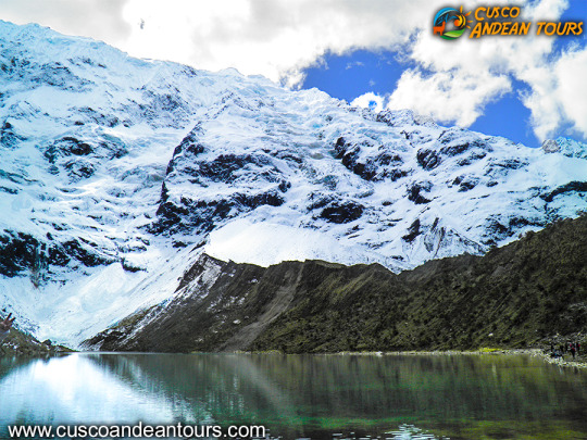
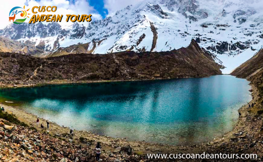
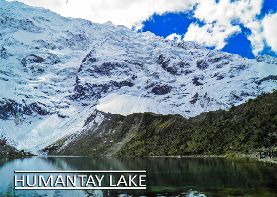
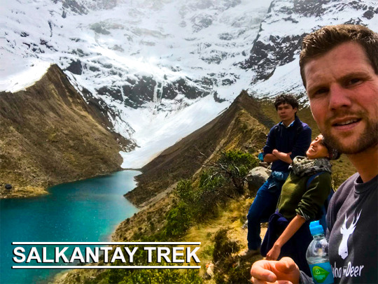
Humantay, is a snow-covered mountain that is part of the Vilcabamba mountain range and gives rise to the formation of this splendid turquoise-colored lagoon that is fed by the mountain glaciers and is a jewel of nature on the route of the Apu Salkantay.
The Humantay lagoon is located in the province of Anta, Cusco area and that is how the ancient city of Cusco surprises us again by presenting a new alternative for travelers who wish to enjoy nature and the natural landscape at the foot of a Snowy surrounded by imposing glaciers, this hike is impressive worth doing since the landscapes are incredible and the bravest, you can even take a dip in the icy waters of the lagoon.
You leave Cusco very early by car for 2 hours approx. to the town of Mollepata, where breakfast is usually taken and the last provisions are obtained, then it starts again by car for 1 more hour until arriving at the community of Soraypampa from where the trek begins uphill about an hour and about two to two, while walking you will perceive the panorama of snow-capped mountains, stunning natural landscapes and the great diversity of flora and fauna until you reach Humantay Lagoon where you will enjoy the breathtaking views of Lake Humantay and the surrounding mountains of this wonderful place, on the way back, the walk begins until you reach Soraypampa and from there return by car to Cusco.
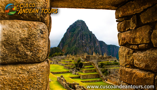
The Inca City of Machu Picchu, is located within the so-called Historic Sanctuary of Machu Picchu, the built area of the Inca City is 530 meters long and 200 meters wide. It has 172 enclosures and the entire complex is divided into two large areas; following the architectural principles of Duality of the Inca Culture (those above or Hanan and those below or Hurin).
The Inca City is divided into two zones:
The agricultural zone, formed by sets of cultivation terraces. The urban area, which is where the occupants lived and where religious activities were carried out. Both areas are divided by a staircase that goes along the mountain. Each of these sectors, in turn are divided into sub-sectors Hanan and Hurin, which have 19 urban complexes (whose names were placed after their discovery), 13 agricultural complexes, a central plaza, 2 smaller squares and 8 roads. It should be noted that much of what is seen today is the product of recent restorations and reconstructions, as mentioned in the current archeology books, where 1919 images are compared with current ones.
What places to visit within the Inca City of Machu Picchu?
Just like other Inca cities or llaqtas, Machu Picchu also follows the principles of duality and quadripartition.
It is divided into two main sectors: the urban and agricultural sectors that are separated by the dry moat. Each of these sectors is divided into two sub-sectors: El Alto or Hanan and El Bajo or Urin that have 19 urban complexes (Residence of the nobility and specialists, temples, huacas, workshops, warehouses and others) , 13 agricultural complexes, a central square, 2 smaller squares and 8 roads. The east side of Machu Picchu, presents just over 60% of the whole of its construction.
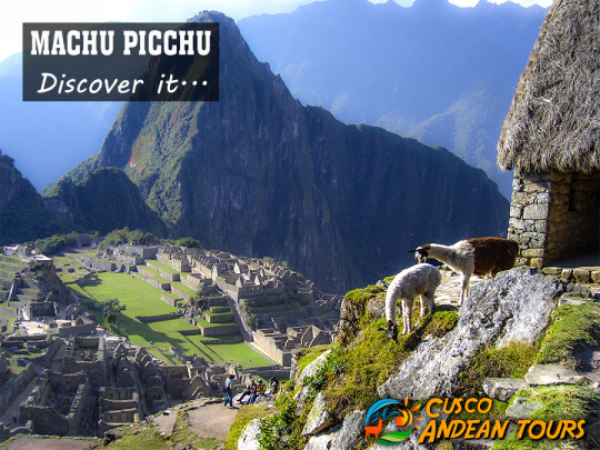
"Machu Picchu" is the name given to an "Inca City" or "Llaqta", built in the mid-fifteenth century (1380 - 1400), on a mountain of 2490 meters above sea level, which is located within a cultural and ecological complex known as the Historic Sanctuary of Machu Picchu. The construction is attributed to the ninth Inca Pachacutec Inca of the Tahuantinsuyo between 1438 - 1470, and is considered as a representative work of Inca architecture and engineering was probably a Sacred City used exclusively as a Religious Sanctuary. Machu Picchu, has been considered in 1983 as a World Heritage Site and on July 7, 2007, it was declared as one of the new seven wonders of the modern world.
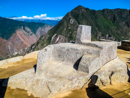
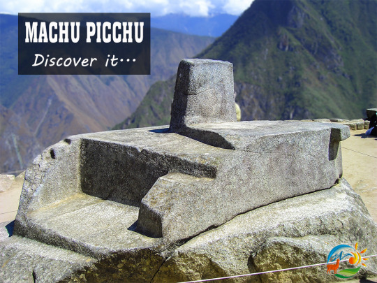
The structure known as the Intihuatana in Machu Picchu, is a “carved” rock on a rocky outcrop, located on top of the space known as the same name (Intihuatana); You can access it by a line of stairs. This incredible rock is characterized by presenting various polished planes with incredible accuracy and dexterity, it is carved in the same rock that serves as a pedestal. However, it is not only a carved (or molded) rock, but it also served as a solar clock and has been known for years as "the rock that radiates energy"; Although it is currently forbidden to touch it, it will be enough to put the palms of your hands a few centimeters to feel its energy.
More information Of Machu Picchu Tour
What is the Intihuatana?
It is a lithic piece in the shape of a polygon, has a height of 1 meter by 2 meters in diameter, carved in one piece; its different faces cast shadows, in relation to the movement of the sun and the different seasons of the year. The rock has some small stairs (for the priest to climb) and a table at the top, surely to put the offerings. The entire sculpture is dedicated to the sunrise; with it, the Incas could make precise observations of the movement of the sun, measurements of the weather and seasonal changes.
In this way they could verify exactly when the climatic changes would occur, possible variations and determined the beginning of the agricultural activities throughout the year; they also saw the movement of the stars and could calculate the time, thanks to the shadow produced by the carved pillar in the central part.
What does Intihuatana mean?
The literary translation of Intihuatana in Quechua native language is: Inti, which means "sun", and watana which means "to bind or tie up". The Intihuatana was designated as a place of astronomical observation, although it must have had a more religious significance due to its location among the main structures of the city, making it a perfect altar for the practice of sacred rituals. The Intihuatana, "where the sun is tied", is finely carved, with precise and mathematically defined cuts.
The pyramid of the Intihuatana
This incredible pyramid building is located in the “hanan” sector of the urban area of Machu Picchu, exactly on the slopes of a hill designed to take the shape of a pyramid. This was possible after turning the skirts of the hill into overlapping terraces to take that pyramid shape.
You can access the Intihuatana through two long stairways located north and south of the building; one of them is formed by 78 steps exquisitely carved in the rock of the mountain, many of which are carved in a single piece of the rocky massif of the hill. Both stairways lead to a kind of open chamber, whose walls have the same detail in the work of their stones.
From this chamber you can reach the top of the building, which is surrounded by some of the most important places in the city, the sacred square or the temple of the 3 windows give it a spiritual character and a religious meaning.
In the middle of the chamber is one of the most fascinating structures of Machu Picchu; the "Intihuatana" was used as a tool for measuring the passage of time and for extensive astronomy studies. The Intihuatana is carved in such a way that it is an excellent tool for measuring time based on the movements of the sun; the shadows cast during the different summer periods mark exactly solstices and equinoxes.
It works as a solar hours meter because its four vertices are directed to the 4 cardinal points (north, south, east and west); the same method used today as a reference to mark a point in the global positioning system (GPS).
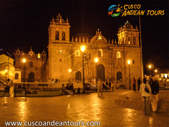
The place where the main square of Cusco is located, was in ancient times a swampy area, which during the time of the Incas was dried and transformed into an administrative, cultural and religious center of the Tahuantinsuyo Empire, after the conquest was occupied by the Spaniards, who surrounded it with temples and residences that were built on buildings and foundations of ancient Inca palaces and constructions; Tupac Amaru II was executed in the main square of the city of Cusco in 1781. It is currently the core of Cusco, and is surrounded by jewelers, travel agencies, tourist restaurants, and the same temples of the period of the conquest, merging the Andean and Hispanic architecture.
Controversy by the name of the main aquare of Cusco The true Quechua name with which it was called the current
main aquare
of Cusco, at the time of the Incas, is still unknown. Authors such as María Rostworowski claim that she was called Aucaypata, place of the warrior; Other authors such as Víctor Angles say it was Huacaypata, the place of crying, and others such as the American George Squier (in 1863) say it was called Huacapata, a sacred place.
Víctor Angles, a student of the Inca culture, explains that the square was formed by two sectors: Huacaypata and Cusipata (all coincide in the name of the latter). Both denominations would have a symbolic meaning since the first means place of crying the second means place of rejoicing (at present, that place is still called Plaza Rejoicing). According to Angles, this was due to meditation ceremonies performed by the Inca nobility in the square. These rituals ended in tears. It is currently known as Huacaypata.
Historical review
The place where the
main aquare
of Cusco is located, was a swampy area dried during the time of the Inca empire, using sand brought from the coasts of the Empire; the drying is initiated by the Inca Sinchi Roca, and was concluded by the Inca Pachacutec. To talk about the main square of Cusco
is to talk about a place full of history, which was initially a swamp, which over the years, became one of the main tourist attractions of the city of Cusco.
This square was the administrative, cultural and religious nucleus of the capital of Tahuantinsuyo, one of the largest empires in America and the World. With the arrival of the Spaniards, the
main aquare
was surrounded by temples and mansions, built on the structures of Inca palaces and buildings that existed there.
In this place, José Gabriel Condorcanqui Noguera (Túpac Amaru II) was also executed on May 18, 1781; Eminent character in Peruvian history, who revealed himself against the Spanish invasion. In the current
main aquare
of Cusco, you can find travel agencies, jewelers, tourist restaurants and temples dating from the colonial era.
The
main aquare
today
Currently, the
main aquare
is located in the historic center of Cusco, and is surrounded by tourist shops. The colonial temples built around it remain as such, some of them also function as museums.
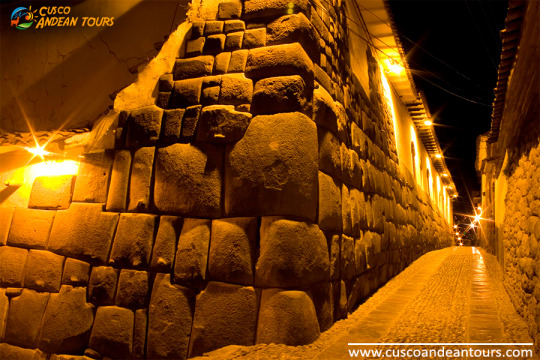
The buildings mostly retain some Inca walls fused with the Hispanic architecture of the colony. The importance of the area makes it one of the most expensive in the city. In some cases, renting a store can cost up to $ 1,500 per month. A few years ago, fast-food restaurants like the American company McDonald’s and others like Bembos, KFC and Starbucks opened in the place.
The main square is still the place where many of Cusco's folk festivals are celebrated, such as Santuranticuy, Semana Santa, Corpus Christi, and other more modern ones, such as national holidays, Cusco parties, New Year, etc. It also holds free concerts, some parades of institutions and allegories, as well as political rallies.
It is located 57 km northwest of the city of Cusco.
Moray is made up of 4 slightly elliptical galleries, which the inhabitants call "muyus". The largest gallery has a depth of 45 m and the average height of each platform is 1.80 m.
For researchers, Moray's circular platforms functioned as an agricultural research center, where each level offered a different climate environment allowing different plants to be grown experimentally.
The platforms were built on retaining walls filled with fertile land. He watered them through complex irrigation systems. At the bottom of the platforms, there is a system that stores the water coming from the rains. Following this practice, more than 250 plant species were cultivated.
Other studies indicate that the place was used for astronomical observation and to monitor the climatic changes that could occur, by monitoring the sunlight and the shadows generated by the high mountains in the area.
General dataLocation: Moray is 57 km northwest of the city of Cusco.
Average temperature: The average temperatures range between 4.2 ° C and 19.6 ° C.
Season: Cusco has two well-marked seasons: one rainy, between November and March, and one dry (the most recommended for your visit) between April and October.
Important: Entrance with tourist ticket.
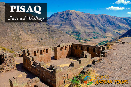
Pisac is a town that is located 30 km from Cusco, where we can find the ruins of the Sacred Valley that are part of one of the most important sites in terms of archeology. Its bases are based on a solid history, built with each piece rich in culture by the Inca communities.
A town with a lot of tradition, an Andean town built on indigenous remains from the time of Viceroy Francisco de Toledo, where you can perceive the culture in its people, traditions such as Quechua masses, cultural festivals, sculptures and archaeological buildings that make part of its charm and even the way crops are carried out with the application of astronomy, a science used in the past by its inhabitants. Pisac that comes from the word Quechua pisaq or p'isaqaq, which means partridge, the same form that has the area for which it is very characteristic, in addition this term has a special importance, because it refers to spirituality, with the mystical , with the spiritual values that the human being must develop.
This place is very distinctive in the country for its ancient stories that give it a unique value that enhances every part of its ornate houses, in which every detail is appreciated. This iconic town attracts millions of tourists every year for its attractive and cozy space, where we can find from restaurants with typical food, hotels, places where you can buy handicrafts made by the population to the square of Pisac, where there are a variety of things We can buy to take a nice memory. sacred Valley
The legends that have passed through the years are of astonishment and of great importance for those who visit the place, since they do not go unnoticed and always pay attention to emotions and senses.
One of his best-known stories is that of a peculiar statue that tells an Inca legend, in which the town chief named Huayllapuma had a daughter, called Inquill, whom he had to marry the man he could build, in just one night, the bridge over the river Vilacmayo (a bridge of great importance for the defense of the place). Despite the hard task, Asto Rímac (a handsome prince) decided to accept the challenge, and ask for the princess's hand. The authorities of the place arranged everything so that Asto Rímac began the work, while the princess had to climb a hill without turning; because, otherwise, she and her fiance would turn into stone. Almost at dawn, the prince had finished with the work, but Inquill, unable to bear more, turned around and was turned into stone until today.
What makes this place unique and special are its legends, which tell much more than a culture, it is a way of life that has been impregnated in people, in their homes, even in the way they perform different activities.
Machu Picchu - Cusco Peru
One of the 7 wonders of the world
Machu Picchu is in the middle of mountains of steep slope and is flanked by the deep canyon that forms the Urubamba River as it passes through this part of the Vilcanota basin.
The citadel of Machu Picchu is located at 2,360 m.a.s.l.
The landscape is formed by a series of hills and mountains of great slope, with almost vertical slopes and deep and narrow gorges where sound and turbulent rivers run.
Machu Picchu Cusco Peru
Machu Picchu - Inca City
Every time we face a place whose written history does not exist, the temptation to imagine how it was and who were those who lived there in their time of splendor of the Inca citadel Machu Picchu is very great. Read more Inca City
Description Machu Picchu
The Inca citadel of Machu Picchu is located 130 kilometers north-west of Cusco, in the province of Urubamba, on the crest of the Machu Picchu hill. Archaeologists have divided Machu Picchu into 3 major sectors: Read more
Description of Machu Picchu
Engineering
It is necessary to point out that the Inca constructions of the Inca citadel of Machu Picchu were characterized by adapting their forms to the conditions of the land on which they settled. They reserved the natural flat soils for the fields of ... Read more Engineering Machu Picchu
Natural environment
The natural environment of Machu Picchu is forested, tropical and rainy. It is located in the middle of mountains of steep slope and is flanked by the deep canyon that forms the Urubamba River as it passes through this part of the Vilcanota basin ... Read more Natural Environment
People of Machu Picchu
Inca society had a rigid social structure in its ethnic and functional relations, from which power was born.
The class structure did not respond so much to the economic position ... Read more Machu Picchu Villagers
Flora and fauna
Due to its natural beauty, the original and harmonious intervention of the Incas in the landscape of Machu Picchu, this Inca citadel has been declared as a natural and cultural park that has been incorporated into the protected areas of the world and ... Read more Flora and fauna
Urubamba Valley
For the Incas the Urubamba Valley is the entrance to the jungle, the Antisuyo the land of the "chunchos".
The Historic Sanctuary - National Archaeological Park of Machupicchu (SHM-PANM) is a cultural and natural area inscribed on the UNESCO World Heritage List. With an area of 37302 hectares, it is one of the areas with the greatest biodiversity in Peru and houses more than 60 archaeological monuments articulated through a complex network of Inka roads.
The most important monument of SHM-PANM is the llaqta or Inka City of Machupicchu, which was planned and built around 1450 A.D. during the Inka Pachakuti government. The work demanded the participation of specialists in architecture, engineering and astronomy, in addition to a large number of labor. More than 50% of the effort required in its construction was used in the preparation of the land, foundation and drainage system. Its construction responds to the need of the Inka State to have a religious, political and administrative center within a sacred space considered the link between the Andes and the Amazon.
The llaqta of Machupicchu was abandoned during the second half of the 16th century; however, it was never lost since it was visited and occasionally inhabited. There are colonial documents that refer to the llaqta of Machupicchu as the "Seat of the Incas" or the "Old Town of the Inga Named Guaynapicchu." In 1874, the engineer Herman Göhring produced a cartographic document in which they are presented for the first time place names "Machu Picchu" and "Huaina Picchu." In 1911, Professor Hiram Bingham visited the llaqta and was impressed with its beauty and majesty. The following year, he returned with a multidisciplinary team of professionals who conducted excavations and research in the area.
Since the 1930s, the Peruvian State has been promoting research, conservation and enhancement of the Historic Sanctuary and the Machupicchu llaqta, which represents a masterpiece of art, architecture and engineering in perfect harmony with nature and is the most important legacy of the Inka civilization to humanity.
Cusco without a doubt does not cease to surprise us since in it there are the most curious and rare landscapes sometimes we can even say almost interplanetary landscapes such as the mountain of colors place you can know about them here that is the mountain of colors
The Humantay lagoon is formed as a thaw product of a large snow that is also part of a mountain range called Vilcabamba mountain range. What makes the Humantay lagoon characteristic is the natural color that it possesses, since it does not have much marine flora in its waters, it has an indescribable color in words, but understandable to the eyes, forming a unique landscape when travelers seek to capture the ideal moment with Its cameras that are so eager to capture landscapes, experiences and moments, all this and more make it an ideal place to visit if you travel to Cusco Peru.
However, the geographical environment of this lagoon is also unique since it serves as the first camp on the Salkantay tour.
HOW TO GET TO LA LAGUNA DE HUMANTAY
Very early in the morning we will embark a 2 and a half hour trip from the city of Cusco to the town of Mollepata, this time is enough to enjoy the Andean landscape and the warm valleys that bring such harmony with them. In this town we can enjoy breakfast, since you will embark again on the bus to travel to the community of Soraypampa.
Soraypampa is the town from which we will depart in the direction of the Humantay lagoon, the only thing that needs to be done is to follow a one-way road, it is possible to say that there is no worry of getting lost since the end of this road is the Humantay lagoon.
The Humantay lagoon witnessed several events made by its own visitors made as hand requests, land payments, ceremonies with Andean masters, coin tossing to conceive a wish and romantic postcards that easily become virilized on social networks thanks to the Unique landscape of this place.
For the return to Cusco we will take the same route not before enjoying a lunch with Andean Novo food as well as the organic products of the area.
1.-Before starting the Salkantay Trek you must book the tickets to Machu Picchu, especially if you want to climb some of the mountains
2.- The route is the same as with a tour, depending on the capacity of the hiker it could take more or less days.
3.- The ascent begins in Mollepata and it is recommended to bring both food and sleeping equipment for only five days, and thus avoid carrying excessive luggage. Among the necessary things you should bring: sleeping bags, shoes, backpack, jacket and trekking pants, hat or hat, water bottle, toiletries, snacks, waterproof jacket, sunscreen, water purifying tablets and cash . If you decide to trek Salkantay to Machu Picchu through a tourist agency (recommended for your safety), they include professional and experienced tour guides, entrance tickets to Machu Picchu, breakfast, lunch and dinner, sleeping tents, necessary transports and horses for carry luggage Before starting the Salkantay trek it is advisable to acclimatize in the city of Cusco one or two days. Due to the height, the ideal is to avoid consuming alcoholic beverages or very fatty foods. Although you do not need to be in excellent physical condition, try to do some exercises before leaving for the Salkantay trek. Wear warm clothes, no matter what season of the year you travel, being the best time from April to October, which is the dry and safest time and although the days are sunnier, the nights are colder. The difference between doing the Salkantay trek with an agency and doing it independently, not only lies in the price if there is also the possibility of suffering an accident, get lost or discouraged in half way. In addition, you will have to carry your luggage in tow, while with the tour the horse service is included for the transfer of luggage. Whatever your decision, enjoy a wonderful Salkantay trek to Machu Picchu, do it in an organized and prudent way, and so you can enjoy an unforgettable trip and you can tell all your friends about your adventures.
Salcantay located in the Cordillera Vilcabamba, department of Cusco, rises to 6271 meters above sea level.
To get to it, you will cross beautiful Andean landscapes, open 5,000 meters. and the possibility of observing Condors and Alpacas in their natural habitat. You can take baths in natural hot springs from the depths of the earth, different fruit plants and a variety of orchids.
The Cordillera de Vilcabamba, where the Salcantay massif is located, is a beautiful and lonely area. Dominated by the same Apu Salcantay has numerous high-elevation snowfalls, such as Tucarhuay (5,910 m.a.s.l.), Veronica (5,682 m.a.s.l.) and Huacayhuilca (5,361 m.a.s.l.), among others.
All of them are visible from the Puyupatamarca area during the Inca Trail to Machu Picchu. Geography is difficult and capricious around the contour of this attractive mountain complex. The Salkantay is surrounded by deep valleys and gorges, which makes its tour interesting but at the same time exhausting.
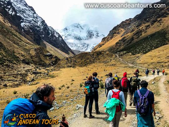
Although the difficulty of this Trek is slightly higher than that of the Inca Trail, it is not a high level Trek. Indeed, it is longer (5 days instead of 4), taller, more wild but there is also your interest.
This Trek does not disappoint the most demanding or lovers of nature, hiking, emotions; those same emotions that make him feel invulnerable, only in the world, on the roof of the world, in a nutshell ... feel alive!
To make the excursion you must contact a specialized tourism agency.
The Qhapaq Ñan, is the word that defines the road system of the Inca Civilization and is definitely the best material test, which can give us an idea of the magnitude of this empire, becoming one of the greatest achievements in indigenous America. An estimated 23 thousand km is calculated, although other studies say that up to 40 thousand km could be registered, from an extensive network of roads, built on one of the most rugged territories in the world, which communicates the cities and settlements of the state most important in America, before the Spanish invasion.
This network of roads crossed the Empire of the Incas, along roads drawn from north to south (from end to end) along the coast, mountains and jungle; through the Cordillera de los Andes, with small sections, which communicated from the east of its territory to the Pacific coast. Designed in harmony with the topography of the place, wide in some areas, very narrow in others, with completely cobbled sections and others simply of land.
Like all the important cities of the Empire, the city of Machu Picchu, connected to Cusco (capital of the Empire), through the Inca Trail that we have traveled so far, at least two important accesses to the Sacred City (Inca Trail and Camino Salkantay), although there may be two others; one that descended through the Urubamba valley from Ollantaytambo, and another that crossed the high part of the Andes. And together with these, a complex network of secondary roads, to communicate the existing settlements throughout the region.
The world-famous Inca Trail to Machu Picchu, is only part of this complex network of roads, which goes up the Urubamba river basin to the Inca City, named for being the most suitable name. At present it is considered by many, the most beautiful of all, for the complement present between its landscapes and its history, you can visit it in three or four days, on a perfectly planned tour.
This Inca Trail to Machu Picchu, allowed to join production sites, with storage and administration centers. It is located in the middle of the jungle, which provides adequate environmental conditions for the production of specific foods. It is very likely that the entire Empire was supplied from this area. Therefore, this road articulated Machu Picchu with the capital and this with the rest of the cities.
The gigantic network of roads of the Inca Empire (Qhapaq Ñan) was built with the main purpose of keeping a huge territory communicated, this allowed to mobilize armies very quickly for the time. But it had other very important uses, as it served as trade routes, acting as an economic articulator, in a civilization with a tendency to redistribution and exchange, in the same way that Machu Picchu's corn or coca reached Huánuco, In Huánuco, surplus production (potatoes and others) was redistributed in other locations, such as Machu Picchu. Another extremely important purpose was the representation of the central power of the empire, as it was thought ideologically; -Yes, I know Cusco because I have seen the road- Then, the road was the essential ideological representation of the power of the Empire, both economic and ideological.
This path, a means of communication and transport par excellence, fundamental in economic articulation and ideological dissemination, was essential for the existence of such a vast territory. It crossed the central squares of the main towns of the Empire, joining places of worship, commerce and administration, passing through water sources, an element (fundamental for life) that symbolized the goodness of Mother Earth and the reproduction of life.
And despite the information available, the Inca Trail is only a small branch of the Empire's road network, an important tourist attraction in Peru and one of the largest in the world. Although the fact in itself, of knowing new places, what we offer is fantastic, goes beyond a visit to the Machu Picchu Sanctuary in Peru; We offer an approach to the culture of the people who built those places, to the people who currently inhabit those places, their customs and their history. So you can transform visible material evidence into an experiential learning experience.
Machu Picchu,This stunning site situated on a mountain ridge above the Sacred Valley is the best-preserved relic of Inca civilisation and South America’s most popular attraction with an estimated 3,000 people visiting on a typical day.