Mostrando entradas con la etiqueta machu picchu information. Mostrar todas las entradas

lunes, 9 de marzo de 2020

GENERAL INFORMATION OF THE ARCHAEOLOGICAL COMPLEX OF CHOQUEQUIRAO

Location

It is located at 13 ° 32 'south latitude and 72 ° 44' west longitude. It is located at 3035 m.a.s.l. in the foothills of the snowy Salcantay, north of the Apurimac river valley, in the province of La Convencion in the department of Cusco. It is approximately at a distance of 47 km. with reference to the town of Cachora (department of Apurimac).
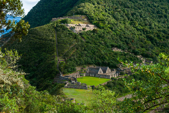

We can mention that the Choquequirao environment is one of the richest in biodiversity. All these species have been conditioned despite temperature variations such as sun throughout the day and inclement frosts during the night. The fauna of the place is mainly composed of condors, tarucas, vizcachas, foxes, skunks, pumas, hummingbirds, spectacled bears and the popular rock cock, the national bird of Peru. Giant ferns, ichu and a great variety of orchids stand out in its flora, where the wakanki variety stands out. CLASSIC CHOQUEQUIRAO TREK INFORMATION

Weather

Because of its geographical position, Choquequirao has a warm climate alternated with cold temperatures at night. The average annual temperature is 17ºC.

History

During the Inca civilization it was a cultural as well as religious center for the region. Well, it is presumed that this citadel was used as a checkpoint to ensure access to the areas of Vilcabamba, which connected the jungle with other important centers such as Písac and Machu Picchu. It is also estimated that the citadel played an important role serving as a link between the Amazon rainforest and the capital of the Inca empire (Cusco).


At the time of transition that lasted approximately 40 years, Choquequirao is considered one of the last strongholds of resistance and refuge of the Incas, who by orders of Manco Inca, left the city of Cusco to protect themselves in the cities of the Vilcabamba region, when around 1535 Cusco was controlled by the Spanish. It was in this place (and in general throughout the Vilcabamba Valley) where Manco Inca and the last Inca descendants of Vilcabamba where they resisted the attack of the Spaniards, until the capture and execution of Túpac Amaru I that happened in the year 1572.

Biodiversity

The environment of Choquequirao is one of the richest in biodiversity, biologists, ecologists and experts mention it, however in this area, it is not known exactly the number of species in plants and animals that exist, despite this deficiency and From the few scientific studies carried out, it has been possible to determine the existence of various life forms.
Among the most relevant species are: Al condor, the fox, the skunk, the puma, the spectacled bear, the taruca, the vizcachas, the pica flowers, the tall toucan, the quetzales and the tigrillos. All these species have been conditioned despite temperature variations such as the sun throughout the day and the frosty during the night. This space can also be seen to the cock of the rocks, national bird of Peru.
The flora of the place is composed of giant ferns and a great variety of orchids, where the wakanki variety stands out. At the bottom of the great valley and under the thermal effect of the watercourse that runs through it, the forests of the mountain eyebrow provide their warmth and ideal conditions for a huge variety of coca, achiote, corn, cocoa, coffee and fruit crops.
From the environmental point of view, the main value of these presented ecosystems lies in the role played by the lush forests that grow in the high parts of the mountains for the maintenance of the water balance of the region, capturing rainwater and driving it without causing erosion towards the Apurimac river.
CHOQUEQUIRAO TREK TO MACHU PICCHU INFORMATION

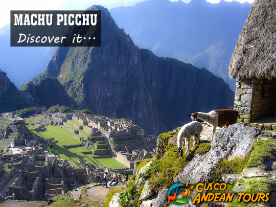
sábado, 1 de febrero de 2020

visit within the Inca City of Machu Picchu

Description and distribution of the Inca City

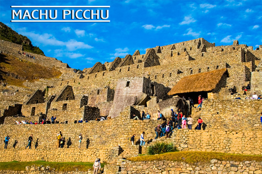
The Inca City of Machu Picchu, is located within the so-called Historic Sanctuary of Machu Picchu, the built area of ​​the Inca City is 530 meters long and 200 meters wide. It has 172 enclosures and the entire complex is divided into two large areas; following the architectural principles of Duality of the Inca Culture (those above or Hanan and those below or Hurin).


The Inca City is divided into two zones:
The agricultural zone, formed by sets of cultivation terraces.
The urban area, which is where the occupants lived and where religious activities were carried out.
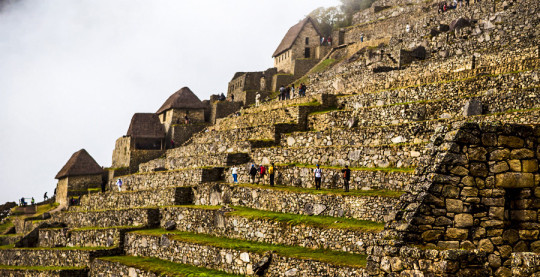
Both areas are divided by a staircase that goes along the mountain. Each of these sectors, in turn are divided into sub-sectors Hanan and Hurin, which have 19 urban complexes (whose names were placed after their discovery), 13 agricultural complexes, a central plaza, 2 smaller squares and 8 roads. It should be noted that much of what is seen today is the product of recent restorations and reconstructions, as mentioned in the current archeology books, where 1919 images are compared with current ones.

What places to visit within the Inca City of Machu Picchu?

Just like other Inca cities or llaqtas, Machu Picchu also follows the principles of duality and quadripartition.
It is divided into two main sectors: the urban and agricultural sectors that are separated by the dry moat. Each of these sectors is divided into two sub-sectors: El Alto or Hanan and El Bajo or Urin that have 19 urban complexes (Residence of the nobility and specialists, temples, huacas, workshops, warehouses and others) , 13 agricultural complexes, a central square, 2 smaller squares and 8 roads. The east side of Machu Picchu, presents just over 60% of the whole of its construction.
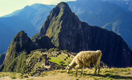
"Machu Picchu" is the name given to an "Inca City" or "Llaqta", built in the mid-fifteenth century (1380 - 1400), on a mountain of 2490 meters above sea level, which is located within a cultural and ecological complex known as the Historic Sanctuary of Machu Picchu. The construction is attributed to the ninth Inca Pachacutec Inca of the Tahuantinsuyo between 1438 - 1470, and is considered as a representative work of Inca architecture and engineering was probably a Sacred City used exclusively as a Religious Sanctuary.
Machu Picchu, has been considered in 1983 as a World Heritage Site and on July 7, 2007, it was declared as one of the new seven wonders of the modern world.

jueves, 30 de enero de 2020

Intihuatana: the stone that radiates energy - MACHU PICCHU

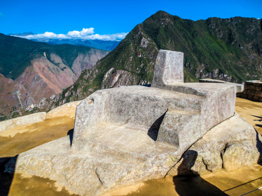
The structure known as the Intihuatana in Machu Picchu, is a “carved” rock on a rocky outcrop, located on top of the space known as the same name (Intihuatana); You can access it by a line of stairs. This incredible rock is characterized by presenting various polished planes with incredible accuracy and dexterity, it is carved in the same rock that serves as a pedestal. However, it is not only a carved (or molded) rock, but it also served as a solar clock and has been known for years as "the rock that radiates energy"; Although it is currently forbidden to touch it, it will be enough to put the palms of your hands a few centimeters to feel its energy.
More information Of Machu Picchu Tour


What is the Intihuatana?

It is a lithic piece in the shape of a polygon, has a height of 1 meter by 2 meters in diameter, carved in one piece; its different faces cast shadows, in relation to the movement of the sun and the different seasons of the year. The rock has some small stairs (for the priest to climb) and a table at the top, surely to put the offerings. The entire sculpture is dedicated to the sunrise; with it, the Incas could make precise observations of the movement of the sun, measurements of the weather and seasonal changes.
In this way they could verify exactly when the climatic changes would occur, possible variations and determined the beginning of the agricultural activities throughout the year; they also saw the movement of the stars and could calculate the time, thanks to the shadow produced by the carved pillar in the central part.

What does Intihuatana mean?

The literary translation of Intihuatana in Quechua native language is: Inti, which means "sun", and watana which means "to bind or tie up". The Intihuatana was designated as a place of astronomical observation, although it must have had a more religious significance due to its location among the main structures of the city, making it a perfect altar for the practice of sacred rituals. The Intihuatana, "where the sun is tied", is finely carved, with precise and mathematically defined cuts.

The pyramid of the Intihuatana


This incredible pyramid building is located in the “hanan” sector of the urban area of ​​Machu Picchu, exactly on the slopes of a hill designed to take the shape of a pyramid. This was possible after turning the skirts of the hill into overlapping terraces to take that pyramid shape.
You can access the Intihuatana through two long stairways located north and south of the building; one of them is formed by 78 steps exquisitely carved in the rock of the mountain, many of which are carved in a single piece of the rocky massif of the hill. Both stairways lead to a kind of open chamber, whose walls have the same detail in the work of their stones.
From this chamber you can reach the top of the building, which is surrounded by some of the most important places in the city, the sacred square or the temple of the 3 windows give it a spiritual character and a religious meaning.
In the middle of the chamber is one of the most fascinating structures of Machu Picchu; the "Intihuatana" was used as a tool for measuring the passage of time and for extensive astronomy studies. The Intihuatana is carved in such a way that it is an excellent tool for measuring time based on the movements of the sun; the shadows cast during the different summer periods mark exactly solstices and equinoxes.
It works as a solar hours meter because its four vertices are directed to the 4 cardinal points (north, south, east and west); the same method used today as a reference to mark a point in the global positioning system (GPS).

lunes, 9 de diciembre de 2019

MACHU PICCHU AND SACRED VALLEY

DAY 1: CUSCO – OLLANTAYTAMBO – AGUAS CALIENTES
We will start our Sacred Valley and Machu Picchu tour  with pick you up in your hotel at approximately 8:00 am after picking up additional passengers in your group, you will begin the 40 minute drive to Pisac in the Sacred Valley. On the way we will stop a couple times in order to see the beautiful landscapes and local Marquet Corao or Pisaq .


After we will continue to visit Urubamba and enjoy food there. (optional you can book your lunch with us day before departure) .
then we will go to Ollantaytambo and enjot the amazing templo of sun and the archeological site . In this place we will finish the tour approximately 4:30 p.m. then we need go to the train station because our train will leave at 16:36 pm or 7:00 p.m. (depent on availability - time will be confirm by e-mail) to Aguas Calientes you will go to the train station to board the train (Please you have to be 20 minutes before in the train station). This is a 2 hours approx. Journey to Aguas Calientes, where we will be waiting and settle you into the Hotel. Overnight in Aguas Calientes.  
Places we will visit in our Sacred Valley and Machu Picchu tour  on the 1first day:
  • Pisac Market
  • Corao view Point of Sacred valley
  • Pisac Archaeological Site
  • Urubamba ( Buffet lunch) Tunupa Restaurant . 25 USD.
  • Ollantaytambo Archaeological Site  
DAY 1: CUSCO – OLLANTAYTAMBO – AGUAS CALIENTES
In the Morning, we will have breakfast in the hotel,(optional you can take with you breakfast if for any reson you leave the hotel before 5:00 am) then you will take the bus up from Aguas Calientes to Machu Picchu, it takes 30 minutes drive up to the main gate to visit Machu Picchu.
When you arrive to Machu Picchu, you will meet with our Tour English or Spanish Guide and enjoy  the explanation for 2 hours approx. group tour exploring Machu Picchu.
After finish your journey  with the professional Tour Guide, you will have more time to spend in Machupicchu. Also if you booked a climb up Huayna Picchu or Machu Picchu Mountain you will have enough time to walk and have a different views of Machu Picchu Citadel.
All passanger after the guided tour will have the chance to explore Machu Picchu sitadel by their self.
In the afternoon you will have to go down to Aguas Caliente (return by bus or walking) to Aguas Calientes.
In the night, you will take the train from Aguas Calientes to Ollantaytambo. According the time in your train tickets, return to Ollantaytambo, in Ollantaytambo the transfer is going to pick up you at the bus to return to Cusco.
Final Bus stop in Cusco is at San Francisco or Regocijo Square near to the Main Square ( Plaza de armas).
Note: You can request to be drop off in your hotel, hostel or homestay. If you need that please send us the  Name and address.

lunes, 23 de septiembre de 2019

Cusco Andean Tours: the cheapest route to get to Machu Picchu


If you want to start organizing your trip to Machu Picchu know that you do not necessarily have to enter the Inca trail or by train; Moreover, these routes are out of reach of travelers who are fair with the budget. This is the reason we made this post, we will show you the cheapest way to get to Machu Picchu, through Santa Teresa.
Arrive in Machu Picchu through Santa Teresa
There are four ways to get to Machu Picchu and all depart from the city of Cusco, it is a city through which you will have to go to get to Machu Picchu. But do not be overwhelmed if you did not find income to the Inca Trail or if by checking the availability of train tickets, only the most expensive tickets remain; There is a cheaper route through which for some time many people are entering Machu Picchu.
The route through Santa Teresa is the cheapest and least frequented route to get to Machu Picchu, you can also do it on your own on public transport or on an organized tour. We explain both options.
Arrive at hydroelectric on an organized tour
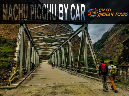
On an organized tour, you will board a van that will take you from the city of Cusco to the town of Santa Teresa, the roads run through ravines of hundreds of meters; Ok, it's not the most relaxed trip in the world but the views are spectacular. After a stop in Santa Teresa to eat, continue for some time to the hydroelectric train station, the trip can be somewhat tedious, so good cheer and good music.
Once the hydroelectric begins the walk following the train tracks to the town of Aguas Calientes, they are 10 kilometers long and can be done in two or two and a half hours. Enjoy this route because you can see landscapes flooded with plants and animals (birds).
The end of the route is the town of Aguas Calientes, there you will stay in a hotel and meet with the rest of the group for dinner, after this you can enjoy the town but only for a moment, because the next day you will have your visit to the Inca city of Machu Picchu. From the town of Aguas Calientes (Machu Picchu town) you can reach the entrance gate of the national park by bus or walk up, if you choose to go up by bus, you will find the ticket office before the Ruinas bridge, very close to the final train station to Macchu Picchu. In any case we must arrive early to Machu Picchu.
Tip: Before going to rest for the day to climb Machu Picchu, buy water and groceries, believe us, they are very necessary for your tour of the Inca city.

jueves, 15 de agosto de 2019

How to get to Machu Picchu

Can I get to Machu Picchu on my own?
Many people have the idea that it is impossible to reach Machu Picchu without being part of an organized tour, but this is far from the truth. Something that should be taken into account, is that there is an order in the organization of the trip to Machu Picchu, and must follow if you want to reach Machu Picchu without problems. Well to the point!
Or you can take our service at: Machu Picchu Tour


How to get to Machu Picchu on your own
These are the steps you have to follow to get to Machu Picchu on your own; We remind you that you have to follow them in the order in which we show them.
Reserve Machu Picchu Tickets
The first thing you will have to do “and most importantly” is to reserve the Machu Picchu Tickets; If you find availability, we recommend you book the ticket that includes the Huayna Picchu mountain (Machu Picchu + Huayna Picchu ticket), you will not regret it. Something you can't do is wait to get to Cusco to buy the tickets. In case you did not know, in most cases Machu Picchu tickets must be booked at least 4 weeks in advance, this will give you the necessary time to book train tickets, hotels and even guides, since coming in season High (from May to September), everything will have to be booked well in advance.
Reserve Train Tickets
Securing train tickets "round trip" is the second step to get to Machu Picchu without the help of a travel agency. The high season causes train tickets to sell out quickly in all available services. So, if you do not want to have the Machu Picchu tickets in your hands and find no way to get to Machu Picchu - it happens more often than you think -, then, just know when you are going to enter Machu Picchu, book the train tickets .
Arrive in Aguas Calientes (Machu Picchu Pueblo)
If you have done all of the above, you should now know how to get to Aguas Calientes (Machu Picchu town). Getting to Machu Picchu is not difficult, even more so if you can use your smarthphone to know its exact location and how to get to certain places. Once in Cusco, you will have to get up very early and go to Pavitos Street, here you will find minibuses and minivans that will charge you around S / 15 (US $ 4) to take you to the town of Ollantaytambo. "Keep your train departure schedule in mind."
From Ollantaytambo to Machu Picchu it is even easier. When you arrive in Ollantaytambo, you can take a “motorcycle taxi”, it is very fun and the easiest way to get to Ollantaytambo station, this will cost you between S / 2 and S / 5 soles (US $ 0.70 and US $ 1.50 ). If time permits, do not miss the opportunity to tour the ruins of Ollantaytambo; It is one of the best prior to the Inca City of Machu Picchu. Once at Ollantaytambo station, look for your train and board it. The tour of the Sacred Valley of the Incas is one of the most beautiful short train routes in the world, so enjoy it. The train will take you to the city of Aguas Calientes, at the foot of the Machu Picchu Mountain.
Recommendation: you will enjoy Machu Picchu more if you can arrive a day before the day of your visit to the city of Aguas Calientes.
Book your hotel
You can expect to get to Aguas Calientes to book your hotel. If there is something that abounds in Aguas Calientes, they are hotels; You can find hotels of all prices and categories. If you only have one day in Aguas Calientes and Machu Picchu, you can skip this step.
Very Important: If you are planning to visit Machu Picchu during the high season (from May to September), you will have to book your hotel, in Cusco or Aguas Calientes, after booking train tickets.
Getting from Aguas Calientes to Machu Picchu
If you arrive a day before your visit to Aguas Calientes, you can take the first bus from Aguas Calientes to Machu Picchu; but if your visit is one day, know that you can buy the bus tickets to Machu Picchu, next to the train station in Aguas Calientes, just before the Ruinas Bridge; These tickets cannot be booked in advance, purchased online, or by third parties. You can only buy your ticket in person and with your passport. If you want to know more about the bus tickets from Aguas Calientes to Machu Picchu, enter here.
At the entrance to Machu Picchu
Before allowing you to enter Machu Picchu, you will be asked to present the copy of your Machu Picchu ticket along with your original valid Passport, if you do not present these documents you will be prevented from entering Machu Picchu, and everything will have been in vain; so do not forget that your documents must be valid when entering Machu Picchu.

miércoles, 17 de abril de 2019

MACHU PICCHU INFORMATION

MACHU PICCHU TOUR
PHYSICAL CHARACTERISTICS OF MACHU PICCHU


The site is located in the zone of the high forest, and includes part of a mountain mass of great dissection of the high plateau of the Andes, that rises abruptly from the valley of the Urubamba river. The area around the ruins of Machu Picchu is made up of many exposed pinnacles of rock to support the thin soils, although in the area there are also sites with complex soil systems for soil conservation, known as terraces or Inca terraces. . The Urubamba basin is a zone of alluvium, almost continuous, of agricultural land for farming and grazing. Geologically the area is very complex, it is a combination of Cretaceous-Tertiary marine sedimentary rocks and intrusive volcanic material, such as lavas and granites. The sedimentary deposits are Ordovician schists, shales and quartzites. Rivers and streams feed the main system of the Urubamba River Valley, as well as a series of small valleys in the north such as Quillabamba (MAA, 1986).
CLIMATE OF MACHU PICCHU
The average annual temperature varies between 16 ° C and the annual rainfall ranges between 1500 mm and 3000 mm at low altitudes. At 2,500 m altitude the average temperature is 10.2 ° C, and the annual rainfall is 2170 mm. The dry weather season lasts from May to September and the wet weather season from October to April.
VEGETATION OF MACHU PICCHU
The site has been influenced by man for many centuries, leading to a combination of artificial habitats, páramo grasslands, Polylepis thickets, partially degraded virgin forests and old farmlands that have once again become forests or scrub. At lower altitudes, forests predominate, their extent depends on human interference, especially during the Inca period. The vegetation rises from the subtropical dry forest along the river valleys to the very humid low montane forest. The trees represented in the most dense forest in danger of extinction locally include the mahogany Swietenia macrophylla and species of the following genera: cedar, Podocarpus (the only conifer in Peru), Lauraceae Ocotea, Cunoniaceae Weinmannia, Nectandra and Cecropia. A number of tree ferns are present, including Cyathea sp. and also the palms like Geromoina sp. Guasca and SP Riupala. (MAA, 1981). Junks Phragmites sp., Willows and alders are produced around rivers and streams, grasslands open at the same time, bushes and scattered thickets of Polylepis sp. and bamboo are found near the ruins (Parker et al, 1982). The high altitude subalpine paramo includes many grasses, Festuca sp., Stipa sp. and Puya sp. as p. raimondii (I). The ridges of the mountains are characterized by Gaudua bamboo sp. (Parker et al., 1982).
FAUNA DE MACHU PICCHU
The park was established to protect the landscape of the famous archaeological site of Machu Picchu, founded by the Inca culture. It is thought that it was a real Inca residence and perhaps it was the center for collecting coca from the surrounding plantations. The site was finally ruined, it was covered by the invading forest and 'lost by science' until its discovery in 1911. There are also remains of the Inca Trail in the area, and local legends, including that of the spectacled bear. , which is believed to serve as a messenger between spirits of high elevations and those of the jungle (Anon, 1981).
Birds of Machu Picchu - Photo Gallery (5)
Picaflores of Machu Picchu - Photo Gallery (8)
CULTURAL HERITAGE
The park was established to protect the landscape of the famous archaeological site of Machu Picchu, founded by the Inca culture. It is thought that it was a real Inca residence and perhaps it was the center for collecting coca from the surrounding plantations. The site was finally hidden, was covered by the forest and was 'lost by science' until its discovery in 1911. There are also remains of the Inca Trail in the area, and the spectacled bear that is believed to serve as a messenger among the spirits of high elevations and those of the jungle (Anon, 1981).
LOCAL HUMAN POPULATION
Much of the park area is settled with many small farming communities and farms, especially on the lower slopes. The original inhabitants were experts in irrigation and built terraces and drainages that extended long distances through irregular terrain. Agriculture (corn and barley) and livestock grazing (llamas, cattle and sheep) are the dominant economic activities and occur in more than 20,000 hectares of the park. The local economy is also supported by tourists who visit the Inca ruins (MAA, 1981, Peyton, 1983). The nearby city of Cusco was the Inca capital and remains an important city with more than 105,000 inhabitants. It is the administrative and commercial center of a considerable part of the Urubamba basin (INRENA, pers., 1995).

jueves, 11 de abril de 2019

FULL INFORMATION OF MACHU PICCHU

The most famous and spectacular Sanctuary of Machupicchu of the Continent, considered by UNESCO as Cultural Patrimony of Humanity. In addition to the archaeological wonders, it has an exotic flora with more than 180 species of orchids, as well as abundant fauna, including the spectacled bear and the cock of the rocks (rupícola Peruvianis), a national bird.


The Historical Sanctuary of Machupicchu is a cultural and natural heritage that has 35 archaeological groups, the main one being the citadel of Machu Picchu; it shelters 10% of the flora and 20% of the fauna existing in Peru.
Machu picchu is one of the archaeological remains that arouses a particular interest in the entire world and is undoubtedly the best expression that demonstrates the capacity of building that the Andean man tube. Many theories about Machupicchu are proposed, of which we have the following:
The first theory indicates that this city was unknown to Spaniards because their structures remained almost intact until the time of their discovery, which did not happen with the other architectural constructions belonging to the Inka era that were known by the Spaniards since they were They were destroyed in their by them. And for the lack of data written in the chronicles since none mention it.
The second theory indicates that it was the refuge of the Ñustas or virgins of the sun, for which it was Sacred City, this theory is given because the arrival of the Spaniards, the Inca rulers, in order to avoid more thefts, made escape to these chosen women to a secret place in the Andes, being this place the city of Machupicchu; this theory is also explained by the discovery of 107 human remains of which the majority were female remains. A third theory states that Machupicchu was the last Capital of the Empire and that Vilcabamba was the last Inca refuge where the Incas retired under the command of Manco Inca in 1536 when he was defeated by the Spaniards after besieging Cusco.
>> MEANING OF THE WORD MACHUPICCHU: The Quechua name is due to the toponymy of the mountain that is called Machupicchu, Quechua word that decomposed means Machu = old, Picchu = mountain. This would mean an old mountain. It is unknown what the ancient name of the historic sanctuary of Machupicchu would have been.
>> LOCATION: The archaeological zone is located on the left bank of the Vilcanota River; in the Quebrada de Kusichaca, in the district of Machupicchu, province of Urubamba, department of Cusco.
>> AREA: The Historic Sanctuary of Machupicchu has an area of ​​32,592 hectares.
>> ALTITUDE: It is 2490 meters above sea level, taking as reference the Main Square of the archaeological site.
>> CLIMATE: Because it is in a subtropical zone it has a temperature that
It oscillates between 8º to 22º C. The rainiest months go from December to April.

miércoles, 10 de abril de 2019

MACHU PICCHU TOURS INFORMATION

Machu Picchu tour,This stunning site situated on a mountain ridge above the Sacred Valley is the best-preserved relic of Inca civilisation and South America’s most popular attraction with an estimated 3,000 people visiting on a typical day.


Day 1 – Cusco – Ollantaytambo – Machu Picchu
We will pick up you in the early morning from your hotel and then transfered to the train station in Ollantaytambo, you will take the train to Aguas Calientes, enjoy the train, the landscapes. Then we will arrive to Aguas Calientes, where a representative from our agency will welcome you and then will escort you to the local bus station to catch the bus that goes up to Machu Picchu.
Bus ride to Machu Picchu lasts approx. 30 minutes and it follows a steep winding path, offering spectacular views of the surrounding mountains. Upon our arrival, we will get into the archaeological zone of Machu Picchu and our guide will show us the most important sectors of this great Inka City, such as the great Intiwatana, The Sun Temple, the urban sector, the agricultural sector among others. Machu Picchu was long thought to be legendary.
The guided tour in Machu Picchu will last about 2 hours, and afterwards you will have free time to explore the ruins on your own.
If you want to climb Huayna Picchu, a very popular climb with spectacular views, we recommend you to book preferably three months beforehand. (There is daily limit of 400 persons per day allowed to climb, so pre-book if you don’t want to miss out. Cost: $25) The round trip walking to the peak of Huayna Picchu is about an hour and a half. It is definitely worth it for the stunning views from the top! As an alternative to the Huayna Picchu climb you can choose to visit Machu Picchu mountain which gives the ancient Inka townsite its name. This is a new option that lets you see Machu Picchu archeological site from the highest peak. It is less crowded so you don’t have to book early. Cost: $25)
After visit this wonder. Depend of your time train tickets, you will take the bus down to Aguas Calientes, where you will have time for lunch and also to explore this colorful town that utterly filled with souvenirs shops, restaurants, bars, internet cafes etc.
In the night, you will take the train from Aguas Calientes to Ollantaytambo. According the time in your train tickets, return to Ollantaytambo, in Ollantaytambo the transfer is going to pick up you at the bus to return to Cusco.