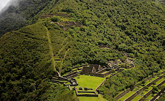
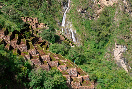
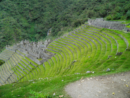
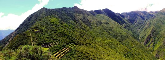
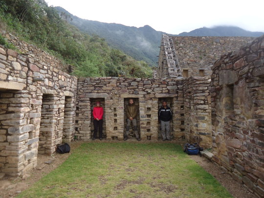
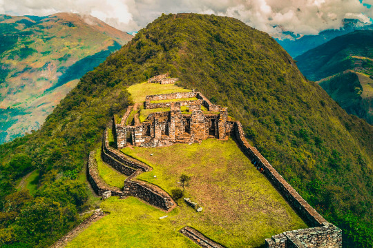
Also known as the sacred sister of Machu Picchu, Choquequirao (which means “Cradle of Gold”) is today the archaeological complex of an ancient, remote and spectacular Inca city, which takes place at the junction of three important rivers and the Salcantay mountain. behind their backs. MORE INFORMATION OF CHOQUEQUIRAO TREK Archeologists estimate that the city has been explored and cleaned between 30% and 40%, estimating that it far exceeds the famous Machu Pichu in size. Chosen by travelers who prefer to avoid the large masses of tourists, or by lovers of hiking and unspoilt nature, this ancient Inca city in southern Peru offers anyone who is encouraged to visit it an unforgettable and unforgettable experience. .
Below you will be able to find the necessary information so that you do not stop adding Choquequirao to the list of places to visit as soon as possible:
How to get to the old city?
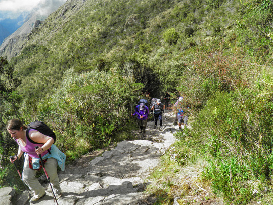
To get to Choquequirao it is necessary to take a four-day (preferably guided) walk. In case of doing it on your own, you have to go first to the small town of Cachora.
You can take a bus from Cusco, on a trip that takes about five hours and from this place you can rent mules and a guide, and in this way save a few dollars, which are the ones charged by the tourism agencies that sell the different excursions. The 4-day walk to make the round trip is 3 times more difficult than the famous Inca Trail, and also requires camping or sleeping in one of the towns that serve as stops.
Once there, you must pay the entrance to the park, which costs 60 soles for adults (about $ 18) and 30 soles for minors or students ($ 9). CHOQUEQUIRAO TREK INFORMATION
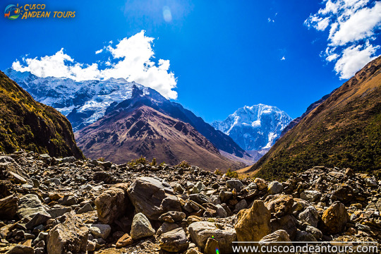
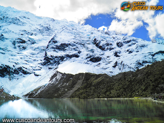
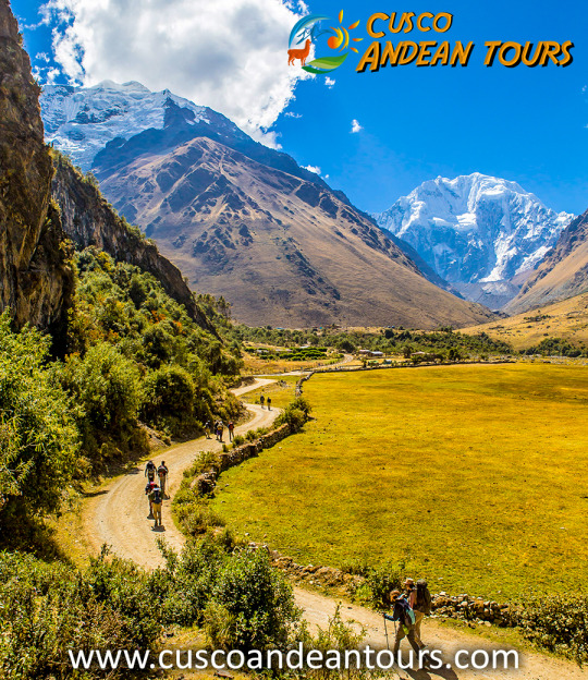
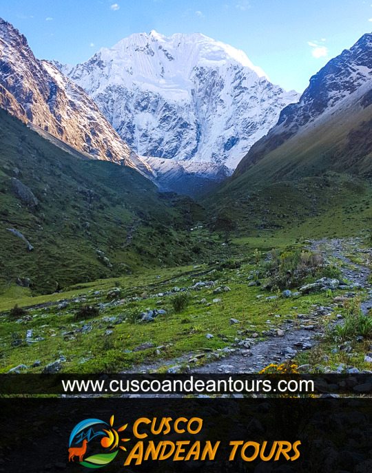
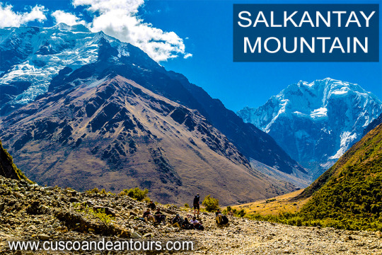
The Salkantay or Salcantay (6,271 m.a.s.l.) is a snowy mountain belonging to the Vilcabamba mountain range. It is the second highest mountain in Cusco after Ausangate (6,384 m.a.s.l.) Its name means wild mountain. Due to its imposing and isolated appearance, it was highly appreciated by the Incas. They put the name ‘Apu’ which means ‘lord’ or ‘sacred’. This snowy mountain was considered one of the most powerful in the region. They worshiped it to the point that they built Machu Picchu in view of its summit. According to the Andean worldview, mountains provided life and decided planting, harvesting and even natural disasters. Because of this, respect and offerings should be given to him. Today, the inhabitants of the Andes continue to consider the mountains as spirits of importance. In Cusco, Salkantay is held in as much esteem as the Incas did. SALKANTAY TREK ROUTE TO MACHU PICCHU INFORMATION
General information
Name: Salkantay Trek.
Kilometers: 72 kilometers approximately.
Climate: minimum of less than 0 ° C in the ‘Abra Salcantay’.
Maximum height: 4,572 m.a.s.l. in the ‘Abra Salcantay’.
Minimum height: 1,800 m.a.s.l. in the town of Santa Teresa.
Difficulty: challenging.
How to do it ?: with a tour or on your own.
When to do it ?: in the dry season (April to October).
Places it covers: Mollepata, Soraypampa, ‘Abra Salkantay’, Chaullay, Santa Teresa, Aguas Calientes and Machu Picchu.
Physical conditions: it is recommended to be in good physical condition.
Recommendations:
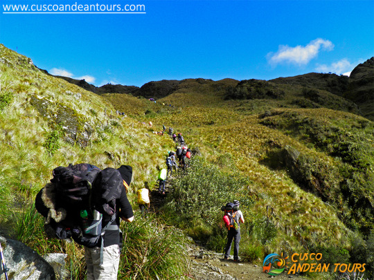
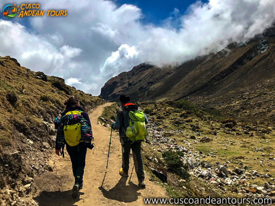
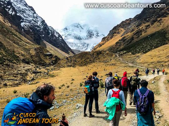
The Salkantay trek is the main hiking alternative to the Inca Trail. More and more tourists are encouraged to arrive at Machu Picchu through this 5-day and 4-night trek through amazing landscapes such as the snowy Salcantay. To fully enjoy this adventure, take into account the following recommendations:
It is possible to do this trek on your own or with a tour. Due to the difficulty of the adventure, it is recommended to do it with a tourism agency. Otherwise, you must have experience in mountaineering.
Perhaps the main drawback to this adventure is the "soroche" or altitude sickness. It is advisable to do a previous acclimatization in the city of Cusco.
Most tourism agencies include the main implements such as tents, food and guide. In case of doing it independently, it is recommended to take everything you need.
The cold at the foot of the snowy Salkantay is perhaps another of the main difficulties. It is recommended to wear thermal clothing.
The rainy season (from October to March) is characterized by the highest probability of river precipitation. It is not a good climate for trekking.
In case you do it on your own, do not forget to book the Machu Picchu Ticket in advance. It is the only way to know the Wonder of the World
The Inca Trail to Machu Picchu has a significant number of Archaeological Sites, distributed along the route.
Llactapata
Qoriwayrachina
Paucarcancha
Warmiwañuska
Runkurakay
Sayaqmarka
Phuyupatamarka
Wiñaywayna
Intipata
Intipunku
Inca bridges on the Inca Trail
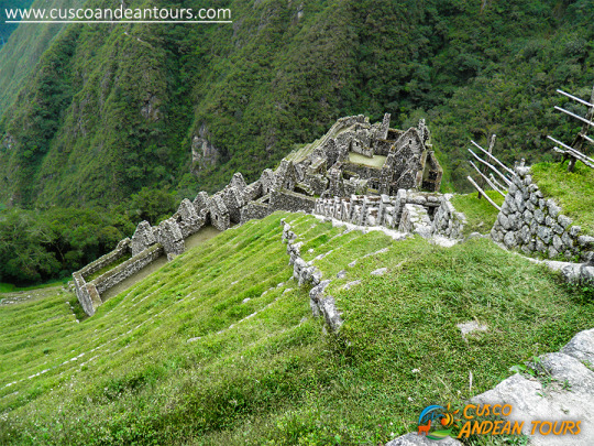
An important site on the route is Wiñaywayna - "Eternamente Joven", it is an archaeological site belonging to the Inca period, built by the Inca Pachacutec, the maximum representative of the Inca Culture, known as the architect of the Inca period. The name corresponds to an orchid that abounds in the place. Wiñaywayna is 2,650 m away. / 8,694 ft. 5 km southeast of the main Llaqta of Machu Picchu. This architectural complex of Wiñaywayna, corresponds to the plan of a small town, are a group of houses grouped together, in a single courtyard, in the manner of the current condominiums. The possible dwelling areas have trapezoidal-style niches and door openings with a single jamb. The monument is surrounded by platforms of different sizes, which responded to the function, either for agriculture or containment to prevent soil erosion. You can notice the structures, the gables for the thatched roofs that were fastened with rings. Likewise, the set of liturgical sources stand out, on a strongly sloped surface, the entire small city is made of granite rock and seen from a high part, clearly, we can notice that it has the same architectural distribution as Machu Picchu. From this place the Inca Trail, is shown almost horizontal, the path gets smoother, they rise up by long stairs that bring us closer to Inti Punku, the entrance door to Machu Picchu. INCA TRAIL TO MACHU PICCHU INFORMATION
Choquequirao is as impressive as Machu Picchu? This ancient Inca city is known as the younger sister of the Wonder of the World. Some tourists who made the 2-day hike to visit it even say that Choquequirao is better. It is true? Learn the truth about this new archaeological site in Cusco, Peru.
MORE INFORMATION OF CHOQUEQUIRAO TO MACHU PICCHU
What is Choquequirao really?
Choquequirao is an Inca urban center with features common to others in Cusco, especially Machu Picchu.
The similarity with Machu Picchu is largely due to the similarity of the geography of the place where the enclosure was built.
According to various investigations, Choquequirao would also be a fortress and a ceremonial center. The truth is that due to its hidden location in a high and distant mountain; It was a strategic point for various purposes.
Over the years, like Machu Picchu, Choquequirao was abandoned and covered by the jungle until its re-discovery.
Unlike Machu Picchu, there is no train or bus to get to Choquequirao. The only way is to do it on foot through 32 kilometers of incredible landscapes.
Day 1: Cusco - Cachora - Playa Rosalina - Santa Rosa
We will pick up you from your Hotel at 5.00 am in our private transport and drive towards Cachora (4 hours approx.) the starting point of the trek where we meet our horsemen and horses. Then we start our hike climbing for 2 hours approx. to Capuliyoc where may we enjoy beautiful views of the surrounding mountains. We continue after Capuliyoc, descending for two more hours to Chiquisca and our delicious lunch made by our chef. After lunch we keep going down the mountain until we reach Playa Rosalina campsite. After crossing the Apurimac River we start the climb to Santa Rosa, zigzagging up a steep slope (2 hours approx.) where those who wish may try Cambray the “typical drink” here, made locally from a sugar cane extract. Day 2: Santa Rosa - Archaeological Site of Choquequirao
We will wake up for breakfast and so we can have an early departure from Santa Rosa. Afterwards, we continue our hike slowly climbing for 2 hours approx to Marampata.
Then we continue to enjoy this day we will dedicate ourselves exclusively to enjoying all the magic of history and splendor of Choquequirao, we will enjoy a complete guided tour of the Choquequirao complex, including a visit to the high parts (Hanan), and the lower parts (Urin). There will be time to know explore the site with its 8 sectors, its barns, houses and temples. You will see the three stages of the excavation of this late Inca-town: the excavated buildings and constructions; the ruins currently in the process of excavation and finally the unexplored areas and terraces with the secrets they may hold of this last refuge of the dying Inca empire. And throughout the day we will keep an eye to the sky for a glimpse of the majestic flight of condors. With luck on the high steep slopes of Chocuequirao, they can pass very close to you. We will enjoy our lunch and then we will return to our Maranpata campsite for rest. Day 3: Choquequirao - Playa Rosalina - Chiquisca
This morning we enjoy our delicious breakfast and start our 1 ½ hour walk back towards Maranpata and a descent to Playa Rosalina for lunch and a some relaxation time. After lunch we climb for 2 hours to Chiquisca campsite where dinner will be waiting for us.
In Chiquisca you can have a shower and eat some exotic local fruits from this area. Day 4: Chiquiska - Cachora - Cusco
We leave camp after breakfast to start the two to three hours climb to Abra Capuliyoc. We will leave Chiquisca campsite early because the sun can be very strong after 10 am, so we plan to to arrive at Capuliyoc by then. Then it is an easy two hours more back to Cachora where we have our lunch. In the afternoon, we met our private transport which will be waiting to take us back to Cusco. Estimated arrival time around 5.00pm.
The Salkantay Trek is one of the beautiful routes that cross the immense mountains of the Andes, and to be able to make this trek you will need all the necessary information to make your trip unforgettable.
On this page you will find useful information about different aspects of the trek in Salkantay such as the location, altitude, degree of difficulty of the trek and the main tourist attractions that we can visit throughout the trek.
This information is constantly and responsibly updated because for us your health and safety is the main concern and the main basis of our services, we hope that all this information is useful to you: Nevado Salkantay location: The Salkantay Snow Mountain, (6272 masl) or also called Apu Salkantay is located north of the city of Cusco, it is the highest mountain range on the eastern flank of the Vilcabamba mountain range. The Quechua name of this snowy mountain means "Wild Mountain" because it is a snowy mountain that is difficult to climb to the top. cusco tours information. How to get to Salkantay: To get to the beginning of our walk we will pick you up from your hotel in Cusco with direction to Mollepata. The journey takes approximately 3 hours to 3 hours and 30 minutes.
Description
Salkantay trek express 4 days, is one of the most popular alternative treks after the classic Inca trail to the Inca citadel of Machu Picchu, in this route you will see one of the most important apus of Cusco.
DAY 1: CUSCO - MOLLEPATA - SORAYPAMPA - CHAULLAY
This day we leave Cusco early (about 4am) and drive for approximately 3 ½ hrs to Soraypampa where we will start the hardest day of the whole Salkantay trek 4 days 3 nights. We will be walking 7.5km to the highest point of the trek, enjoying magnificent panoramas of snow-capped mountains on the way. Once we reach the top we will have spectacular views of the sacred mountain, Salkantay. At 6245 metres it is the second highest mountain in the Cusco region. After 2 hours downhill we will have our delicious lunch around 1:00 p.m. in Huayracmachay. Then we continue approximately 3 hours downhill to our camp in Chaullay or Collpapampa (2900 metres) where your tent will be ready and waiting for you with a bowl of hot water for washing up. Then there is time to rest, nap or write. Around 7 p.m. we will have happy hour, dinner. Then we’re off to bed and a well-earned sleep. DAY 2: CHAULLAY - LUCMABAMBA
Around 6.30am, we start with our breakfast before beginning our trek through the high jungle. We cross the Lluskamayo valley and a variety of little brooks to reach La Playa (Sahuayaco) trekking about 6 hours. You will pass through wonderful landscapes and see waterfalls, rivers, beautiful plants and orchids. At La playa (Sahuayaco) we’ll have our lunch and the horses will go back to Mollepata. After lunch and another 30 minutes uphill you will reach our campsite at Lucmabamba. The afternoon is free for you to enjoy our coffee tour or, as an optional extra, take a local van to Santa Teresa to soak in the natural hot spring optional extra. At the end of the day we have our happy hour, dinner and then a briefing for the next day. DAY 3: LUCMABAMBA - AGUAS CALIENTES
We will have our delicious breakfast at 6 am and leave our campsite. After about 5 minutes you will step onto the original Inka Trail, and for the next 3 hours you will follow this historic trail to the summit for your first view of Machu Picchu across the valley. Then we will descend to our lunch spot by the Hydrolectric Station. After lunch we will walk 3 more hours or take a train for 45 minutes to Aguas Calientes where your beautiful hotel and dinner will be waiting for you. DAY 4: AGUAS CALIENTES - MACHU PICCHU!!!
Early morning, after the breakfast at the Hotel, you will go up by walking or you can take the bus to Machu Picchu where you meet with our Tour Guide for a private introductory tour of the Citadel. For the next 2 hours you will learn of the history, the structure and the stories of this important World Wonder. Then you will have free time to take pictures, relax and explore Machu Picchu by yourself. If you have reserved a climb up Huayna Picchu or Machu Picchu Mountain, our Tour Guide show you where you start.
After exploring Machu Picchu, you will walk or take a bus down to Aguas Calientes. There you will collect your luggage at the Hotel and board the train to Ollantaytambo. When you arrive at Ollantaytambo, you will transfer to a van for a ride back to Cusco by van where you will be dropped off at your hotel or hostel.
SALKANTAY TREK TO MACHU PICCHU INFORMATION.
One of the main attractions along the route is the ancient network of settlements built in granite rock by the Incas such as Wiñay Wayna and Phuyupatamarca immersed in an overwhelming natural setting. Hundreds of varieties of orchids, multi-colored birds, and dreamy landscapes provide the ideal setting for a route that the walker should walk at least once.
Description of the Inca Trail to Machu Picchu route
Based on the traditional 4-day / 3-night Inca Trail
The total distance of the road is approximately 39.6 km. And begins at km 82 in the place called Pisqacucho. To start the journey you should cross a bridge, then head to the left side through an eucalyptus orchard and start the day calmly.
Almost immediately you will find the archaeological complexes of Q’ente, Pulpituyoc, Kusichaca and Patallaca. From that last point the path will continue along the left bank of the Kusichaca river in the area with the same name where you will not only see the bridge but also find tombs, aqueducts, terraced paths and a canyon. You will continue until you reach the small town of Wayllabamba and Inca aqueducts. It takes around 4 hours to reach 9 km from this point. One will camp there the first night.
The second day is more difficult, because the walker will have to climb up to 4,200 meters, crossing the Warmiwañusqa pass, the first and the highest. If you suffer from "soroche" (altitude sickness) it is best not to stop or descend quickly to the Pakaymayu river valley, where you can camp. This place is 7 km away and it is approximately 8 hours away.
The third day is the longest but the most interesting. You will be ready to visit the most impressive complexes such as Runkuraqay, the second pass at 3,800 meters above sea level, its complex with yellowed niches that perhaps were a small place to rest, guard posts and places for worship after crossing the second step you descend to Yanacocha (The Black Lagoon) and then climb a path with stone steps until you reach another group of buildings which attract the attention of visitors. This point is called Sayaqmarka a pre-Hispanic complex with narrow streets, buildings erected on different levels; sanctuaries, patios, canals and an exterior protective wall. At the top of the buttresses one can see many buildings which lead one to suppose that it was once a temple and an astronomical observatory, which had a permanent water supply and excellent food stores.
Sayaqmarka is a place full of mystery and charm. The approximate distance to Runkuraqay is 5 km. Which takes 2 hours. This complex extends 3,600 meters above sea level. There is a great trail and tunnel through this complex. We recommend camping near the ruins of Phuyupatamarca or 3 km further on in the Wiñay Wayna visitor center, where one can buy food and drinks or use hygienic services. The ruins of Phuyupatamarca are better preserved than we have seen before now.
On the fourth day, which will start around 5:00 a.m., the walker arrives in Machupicchu around 7:00 a.m. after 8 km of walking through the jungle. Follow the indicated route and drink some water at the Wiñay Wayna Visitor Center. The trail is clearly marked but try to avoid getting too close to the edge of the cliff.
Camping in Inti punku is prohibited. You will leave your equipment at the control gate and enjoy the most important monument in this part of the continent. You will have time to visit Machupicchu until noon. Check the train schedule to return to Cusco.
If you plan to stay in the town of Machupicchu (also called “Aguas Calientes”. The distance from the station to the ruined bridge to Machupicchu is 2 km. This takes about 20 minutes down a narrow path, which runs parallel to the line. iron.
Climate and environment
The climate is relatively mild throughout the year, with heavy rains from November to March, dry and hot weather from April to October, which is a recommended time to visit.
The minimum annual temperature ranges from 8 ° to 11.2 ° C. In the months of June, July and August the temperature can often drop below freezing.
The maximum annual temperature varies from 20.4 ° to 26.6 °. The terrain is quite uneven, with several ravines and streams fed by glaciers that eventually pour into the Urubamba River, which crosses the area forming a deep valley that runs through the granite base of Vilcabamba for more than 40 km through a variety of ecosystems.
Landscape of the area
The surroundings are impressive and the balance struck between nature and Inca architecture is astonishing.
The Vilcabamba mountains have wide and high peaks that reach up to 6,000 meters as well as Salkantay and Humantay among others.
The mix of mountains, jungles and valleys create a fantastic world where sunrise and sunset are shrouded in mystery.
Wildlife that exists in the route
It is abundant and varied. The existence of endangered species such as the spectacled bear (Tremarctos omatus), the Andean Cock of the Rocks (Rupicola peruviana), the dwarf deer (Pudu mephistopheles), was one of the reasons for the Peruvian government to decide to declare it a Conservation Unit.
The park includes species such as the cougar, the Andean fox, the river otter, Taruka (Huemul deer), wild cat, ferret, etc. There are birds in Machupicchu such as the Mountain Caracara, hummingbirds, torrent duck, parrots, wild turkey and several small birds with colorful plumages.
There are also reptiles such as the jergón and the coral micrurus snake (lethal for its poison), lizards, toads and numerous fauna of the jungle and the Andes that inhabit the sanctuary. This abundant wildlife makes the Machupicchu sanctuary ideal for tourists and researchers who want to watch or study animals.
Flora to the area
The long natural areas are filled with a variety of forest species, which vary according to habitat. The forest vegetation is represented by trees such as: cedar, romerillo or intimpa, laurel, etc. There are also species such as Ocotea, Pedocarpus, Guarea, Weinmania, Clusia, Cedropia, Cinchena, Eritrina or Pisonay, and oak among others. Decorative plants have made the sanctuary famous. Experts have identified more than 90 species of orchids and various species of begonias and the puya cactus. Most of the area is covered by grasses, shrubs, tree plants. The variety of conditions have created an ideal environment for the growth of diverse plants that goes from the thick jungle like the forest clouds to the highest parts of the mountains.
INFORMATION OF INCA TRAIL TO MACHU PICCHU
DAY 1: CUSCO / CITY TOUR
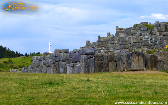
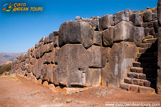
Reception at the airport, transfer to the hotel and you will have a free time available to rest and so avoid altitude sickness. In the afternoon the trip will start with the visit of the Temple Koricancha , The Main Square or Plaza de Armas, The Cathedral and continue to visit the Inca sites: The Fortress Sacsayhuaman the latter side is strategically built on a hill overlooking Cusco and is famous for its enormous carved stones, some of them standing over 9m/30ft tall and weighing over 350 tons, set together whit astounding precision to form the outer walls. Most important Mystical center from Inkas time Qenqo, the military control center Puca pucara and the water temple of Tambomachay. Return to the hotel and free night.
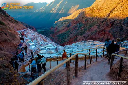
DAY 2: TOUR OF MARAS AND MORAY
09:00 – 14:00 Tour of Maras (salt mines) and Moray (terraces). Night at hotel in Cusco.
DAY 3: CUSCO/ SACRED VALLEY OF THE INCAS
This day we take a trip to the Sacred Valley of the Incas: visit the Pisac Incas built, the colorful Andean market and the church. Then we pass places like Lamay and Calca on the way to arrive in Urubamba town where we stop for lunch. After lunch visit to Ollantaytambo town, where we can see its typical streets, the impressive archaeological constructions and agricultural terracing, not to mention the splendid views over the sacred valley. Finally, visit the picturesque Andean village of Chinchero where the built of the royal hacienda Of Tupac Inca Yupanqui lie. You can admire the well preserved Inca wall in the main square, and visit the beautiful colonial temple. Built on Inca foundations with interesting paintings. Overnight in Cusco
DAY 4: CUSCO / MACHUPICCHU
Pick up at the hotel to take the train for a full day tour of the Magical citadel of Machu Picchu, it is 112 Km. from Cusco .During the journey we see the Urubamba canyon, Urubamba River and the show capped peaks of the Veronica Mountain. Arriving in Aguas Calientes we go to Machu Picchu where we visit this wonderful Inca Sanctuary also known as “The lost City of the Incas “one of the best known examples of surviving Inca. After the visit, we come back to Aguas Calientes to take the train back to Cusco.
DAY 5: DEPARTURE FROM CUSCO
We will pick you up from your hotel in Cusco and take you to the airport.
DAY 1: CUSCO / CITY TOUR
Reception at the airport, transfer to the hotel and you will have a free time available to rest and so avoid altitude sickness. In the afternoon the trip will start with the visit of the Temple Koricancha , The Main Square or Plaza de Armas, The Cathedral and continue to visit the Inca sites: The Fortress Sacsayhuaman the latter side is strategically built on a hill overlooking Cusco and is famous for its enormous carved stones, some of them standing over 9m/30ft tall and weighing over 350 tons, set together whit astounding precision to form the outer walls. Most important Mystical center from Inkas time Qenqo, the military control center Puca pucara and the water temple of Tambomachay. Return to the hotel and free night.
DAY 2: CUSCO/ SACRED VALLEY OF THE INCAS
This day we take a trip to the Sacred Valley of the Incas: visit the Pisac Incas built, the colorful Andean market and the church. Then we pass places like Lamay and Calca on the way to arrive in Urubamba town where we stop for lunch. After lunch visit to Ollantaytambo town, where we can see its typical streets, the impressive archaeological constructions and agricultural terracing, not to mention the splendid views over the sacred valley. Finally, visit the picturesque Andean village of Chinchero where the built of the royal hacienda Of Tupac Inca Yupanqui lie. You can admire the well preserved Inca wall in the main square, and visit the beautiful colonial temple. Built on Inca foundations with interesting paintings. Overnight in Cusco
DAY 3: CUSCO / MACHUPICCHU
Pick up at the hotel to take the train for a full day tour of the Magical citadel of Machu Picchu, it is 112 Km. from Cusco .During the journey we see the Urubamba canyon, Urubamba River and the show capped peaks of the Veronica Mountain. Arriving in Aguas Calientes we go to Machu Picchu where we visit this wonderful Inca Sanctuary also known as “The lost City of the Incas “one of the best known examples of surviving Inca. After the visit, we come back to Aguas Calientes to take the train back to Cusco.
DAY 4: DEPARTURE FROM CUSCO
We will pick you up from your hotel in Cusco and take you to the airport.
DAY 1: CITY TOUR CUSCO
We'll be waiting for you at the airport in Cusco on your arrival date , take you to the hotel where you will rest for an hour , you'll have a cup of coca tea and we will pick you up from your Hotel in the afternoon (from 13:30 hrs to 18:30 hrs) to start with the tour around Cusco and outskirts. Tour around Cusco and outskirts: We pick you up from your Hotel to start visiting the following attractives , with aprofessional guide: - The Koricancha Palace andConvent of Santo Domingo Religious center known as "The Temple of the Sun" where you will admire the impressive engineering used in its construction. The Cathedral:Colonial religious monument of extraordinary artistic value. Sacsayhuaman: Located 3 km from the city of Cusco,impressive stone fortress monumental and magnificent architecture, famous for its enormous carved stones,some of which are at9 m/ 30 feettall and weigh of 350 tons. Here is where the Inty Raymi or Fiesta del Sol in June take place every year. Qenqo: Ceremonial and ritual center, amphitheater where sacrifices were made. Puca-Pucara: An old tambo (resting place), monitoring placethroughout the Inka Empire Routes. Tambomachay: At 7 Km. From the city of Cusco,ceremonial center of worship of water , traditionally known as the place of water.Excursiontime: around 5 hours. Frequency : everyday in the afternoons.
DAY 2: MACHU PICCHU TOUR
From 05:45 hrs to 06:00 hrs., we pick you up from your Hotel inCusco (3400 m.a.s.l.) and drive you to the Train Station, located in Poroy, then we get aboard the train and the trip from Cusco starts heading toAguas Calientes (2000 mosl).Our Guide Will be waiting there , he will lead us to the bus station,rising by a zigzag pathfor 30 minutes to the incredible Machu Picchu, known as the lost city of the Incas.Once we get to Machu-Picchu, We'll pass throught the control, where we'll hand in our entrance tickets and where our guided tour will start, visitingthe main square, the Circular tower, the sacred solar clock, the royal rooms, the temple of the three windows and the cementeries, it lasts around two hours. Afterwards you'll be givenenoughtime to have a walk around the citadel and have your meals ,at any restaurant in Aguas Calientes or if you wish atSantuary Lodge (this is not included). In the afternoon, betwen 15:30 hrs and 17:00 hrs we'll return on train to Cusco, we'll be waiting for you at the train station and then we'll take you back to your hotel.
DAY 3: FAREWELL:
We'll be at your hotel at least two hours before your flightleaves to take you to the airport Where you should check your plane ticket and pay the airport tax, we'll see you to the departure launge.
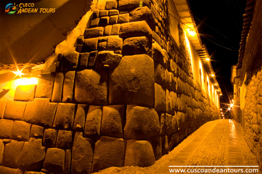
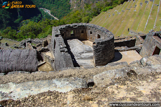
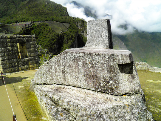
Cusco (Qosqo in Quechua), means navel of the world, and is one of the largest regions of Peru. Its geographical location has allowed it to develop agriculturally, standing out in the cultivation of corn, quinoa, barley, potatoes, tea and coffee. Today Tourism is its main source of income, due to the great archaeological wealth left by the Tahuantinsuyo empire and the passage of the Spanish. It is without a doubt, the city that preserves the most beautiful and important archaeological monuments of Peru and America, among them Macchu Pichu, being in this way the first tourist destination in our country, an important tourist destination for those who come to appreciate the impressive Inca architecture; stone work carried out with originality and perfection. In its surroundings there are many Inca and Colonial archaeological remains such as the Macchu Picchu archaeological site, located 130 km northeast of the city of Cusco, 600 m approx. on the Urubamba river. Inside this Inca citadel a total of 150 houses is calculated; one-room houses, highlighting the solar clock (or Intihuatana), an astronomical observatory that was built in a strategic place in the citadel, from where the Incas could observe the movements of the sun. cusco tours
Among its main archaeological monuments we can mention the fortress of SacsayHuamán, Ollantaytambo, Písac, Kenko, Acllahuasi, the archaeological site of Tambomachay, among other sites of archaeological and tourist importance. Important architectural remains of the colonial style are still preserved from the Spanish past, among them the Cathedral Basilica, the temple and the convent of La Merced, the church of the company of Jesus, the pulpit of San Blas, the churches of Santa Catalina , Santa Clara and San Cristóbal, Santo Domingo, and museums and paintings of the Cusqueña School.
The Sacred Valley for the Incas
With the river feeding the valley, its fertile lands were one of the main centers of food production during the time of the Incas; some places, like Moray, were even used as agricultural laboratories, to experiment with plant species brought from all over the empire. The Incas cultivated potatoes, white corn, coca, fruits and vegetables, on terraces like those seen in many valley towns specially designed for this purpose. Today the valley produces lucuma, peach, avocado, and one of the best corn kernels in the world. Sacred Valley Tour
But it was more than just an important agricultural center; the Urubamba river valley, "Willcamayu" for the Incas, was one of the most important elements in the religious cosmology of the Incas. They believed that the flow of the Urubamba was closely linked to the constellations and mountains, they also believed that it was the counterpart of the Milky Way on earth.
Where is the Sacred Valley of the Incas located?
The Urubamba river valley or "Sacred Valley of the Incas" is located 15 km northeast of the city of Cusco, reached by a paved road. A drive to one of the nearest towns will take you around 40 minutes. From there you can move to the other towns in the valley.
What is the climate like in the valley?
The Sacred Valley of the Incas is located 2,800 meters above sea level, 600 meters below Cusco, and enjoys one of the best climates in this region, daytime temperatures vary between 19 ° and 24 ° C. This privileged climate made the Incas take it as their main center of agricultural production, experimentation and research. Today travelers use the valley to acclimatize, before starting their tours of Cusco and Machu Picchu, and without a doubt one of the best ways to avoid altitude sickness.
What to see in the Sacred Valley of the Incas?
Known to the Incas as Willcamayu, the beautiful valley stretches from the town of Pisac to Ollantaytambo, along the Urubamba River. The ancient Inca settlements in these cities are presented as checkpoints, before entering the "Inca trail" that leads to the sacred city of the Incas, Machu Picchu; they are simply amazing, and one of the best previews of what you will see in wonder.
MARAS AND MORAY INFORMATION
What does Moray mean?
The word Moray would have different origins. In the Quechua language (language of the Incas) it means: a territory occupied since ancient times.
Although the origin of the name of Moray is not known for sure, it is presumed that it had to do with the corn harvest called 'Aymoray', or with the month of May named in the same way by the Incas (sowing month in the calendar inca).
Moray is also presumed to come from the name of the dehydrated potato known as the 'moraya' (white chuño). Cusco tours
History
Before the Incas, this part of the Sacred Valley of the Incas was inhabited by the ‘Maras’ and ‘Ayamarcas’ ethnic groups, who occupied a large part of the current territory of the Sacred Valley of the Incas.
After the Inca conquest, the construction of large buildings and platforms began in the territory of the Sacred Valley. Thus, the Moray platforms were built, which were used by the Incas as an important agricultural control center. There the production of the coca leaf was carried out, a plant considered sacred to the Incas.
Investigations do not clearly indicate whether during the colony (from 1532) the Moray platforms were worked. The truth is that it was not until 1932 that the Shirppe Johnson’s expedition flew over the place, discovering the existence of the platforms, then covered by thick vegetation.
During the 20th century, various investigations were carried out on Moray. Perhaps the most valuable of all was made by anthropologist John Earls who established that it was an experimental agricultural center.
How's the weather?
The climate in Moray is dry and temperate. The temperature varies from 21ºC. (69ºF). during the day until 1ºC. (33ºF). at night.
From October to April the rainy season elapses where river precipitation is frequent. From May to September the dry season occurs where rains are not so frequent.
April, May and June are believed to be the best time to visit Moray.
What am I going to see in Moray?
Beautiful landscapes - The set of platforms that make up Moray are visually beautiful to human eyes and, of course, in front of a camera lens. Many people come there to take their picture postcard and post it on their social networks.
Circular platforms - The circular platforms of Moray were a very important place for Inca agriculture. It is believed that it was a center of experimental studies that the Incas used to plant products that, under other conditions, could not be cultivated.
Adventure sports - There are tours to the Moray platforms that include adventure by bicycle or even ATV. These services can be obtained at any tourism agency located in the Historic Center of Cusco.
Hiram Bingham ‘rediscovered’ the Lost City of the Incas in 1911. However, Machu Picchu was already known to some local families, long before the arrival of the Yale University professor.
According to the Cusco writer Américo Rivas, 9 years before the arrival of Hiram Bingham at Machu Picchu, the Peruvian farmer Agustín Lizárraga visited the Inca Citadel. In the place he left his name written as proof of his visit.
Hiram Bingham baptized Machu Picchu as the ‘Lost City of the Incas’, because when he arrived there; He believed that it was the city of Vilcabamba, the last refuge of the Incas after the conquest.
Bingham's team extracted a total of 40,000 artifacts from the Inca City of Machu Picchu to be taken to Yale University.
These objects included silver statues, jewelry, bones, ceramics, and even mummies. Most of these objects have been returned to Peru as of 2014.
Chosen Wonder of the World
Machu Picchu was declared in 1983 as a Cultural Heritage of Humanity by Unesco.
Machu Picchu was declared one of the new 7 Wonders of the World in 2007. In addition, the Taj Mahal, the Great Wall of China and four other impressive places were included.
Machu Picchu is the most visited tourist attraction in Peru, South America and one of the main destinations in the world.
Machu Picchu was chosen in 2016 as the best destination in the world in a vote by the users of the travel website ‘TripAdvisor’.
The construction of Machu Picchu
The ‘Lost City of the Incas’ is located in the middle of two mountains, 2,430 meters high. These two mountains seen from the ‘Casa del Guardián’ form the classic postcard of Machu Picchu.
Machu Picchu is a Quechua word (the language of the Incas) that means ‘Old Mountain’.
The City of Machu Picchu was built as a royal residence for the Inca and his family in the mid 1400 AD, by the Inca Pachacútec.
Since its re-discovery, more than 30% of Machu Picchu has been rebuilt to give a clearer idea of what the structures originally looked like. The restoration continues today.
Machu Picchu was built around 1450 during the height of the Inca Empire. In 1572, a little over a century later, it was abandoned after the arrival of the Spanish.
The Inca Inca Citadel of Machu Picchu ’
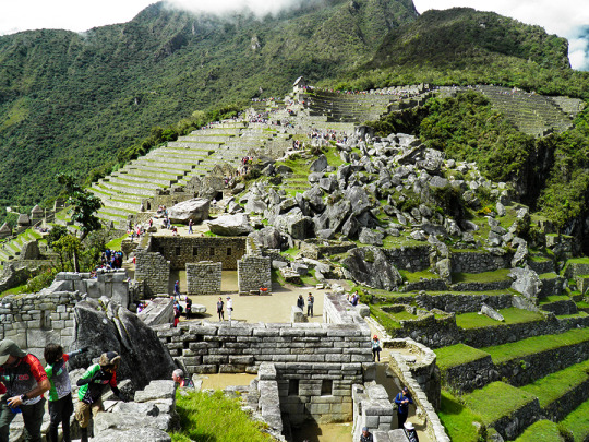
Machu Picchu buildings are made of stones that fit perfectly and have remained that way for more than 500 years without the use of any type of forge, mortar or glue. More Unformation Of Machu Picchu Tour
More than 50% of Machu Picchu is underground as a base for some buildings or as water channels and drains for rainwater, irrigation and consumption.
Machu Picchu is divided into 2 zones: agricultural and urban. It is estimated that just over 1,000 people lived in this city hidden in the mountains.
Machu Picchu was never finished, it was only abandoned. Thanks to this, the Spanish could not destroy or modify it as they did with other Inca cities.
Machu Picchu had enough water sources and enough terraces to comfortably support more than 4,000 people. This is four times the population that once inhabited the city.
The Inca Trail to Machu Picchu is considered one of the best walks in the world. Without a doubt, it is one of the most spectacular way to enter Machu Picchu.
The incredible Huayna Picchu mountain
The Machu Picchu National Park houses the Huayna Picchu mountain. This mountain is so popular that if you want to come in the high season, tickets must be reserved 6 months in advance.
To get to the top of the Huayna Picchu mountain you will go through trails and stairs. In some cases, the stairs are built on the side of cliffs several hundred meters away.
Just seeing the images of the Huayna Picchu road discourages many people. However, there have never been any accidents to regret.
In the middle of the Huayna Picchu mountain is the Great Cavern or Temple of the Moon. The function is this mysterious construction in the middle of the cave is still a mystery.
Huayna Picchu is considered one of the most incredible short walks in the world. The entrance ticket is the most desired in Machu Picchu. Machu Picchu Tour Information
Machu Picchu in danger
There is a restriction to enter the airspace of the Machu Picchu National Park. Despite this, the Inca City was flown over by helicopter for Peruvian President Ollanta Humala in 2016.
There was a monolith in the Main Plaza of Machu Picchu. This was removed on two occasions for the plaza to act as a heliport. The first time for the kings of Spain and the second for a group of leaders of the Andean Community of Nations.
The second time this monolith was removed, it was destroyed and buried in the vicinity of the Main Plaza.
Machu Picchu is on the watchlist of the 100 most endangered historical monuments in the world.
Machu Picchu is the most important tourist attraction in Peru. This causes it to be continuously threatened by commercial forces that promote the construction of luxury hotels and tourist restaurants near the wonder.
The mysteries at Machu Picchu
Machu Picchu can surprise anyone who visits it for the first time. Especially when you consider that the construction of the city was carried out without using draft animals, iron tools or the wheel.
It is still a mystery how the huge rocks moved from the quarries (30 km), to the location of the Inca City on the mountain.
Many of these rocks weigh more than 150 tons. It is believed that they were pulled by hundreds of men, but this is unlikely, especially due to the rugged terrain and inaccessible city.
More and more people are coming to Machu Picchu in search of their energy.
The Intihuatana (Solar Clock) is an Inca structure located near the Main Plaza of Machu Picchu. It is believed to emit energy. Many tourists put their hand out to feel it.
5 things few know about Machu Picchu
Currently, there is a family that claims Machu Picchu as their property by inheritance. The dispute with the Peruvian state is in the courts of Cusco.
Machu Picchu was built with a stone assembling technique called ‘Sillar’. The perfect fit of its walls and its slight inclination is still maintained despite its location between two geological faults.
Unesco has set a limit of visitors per day. The objective is to preserve the Inca Citadel of Machu Picchu in the face of excessive tourism traffic.
Machu Picchu is still a mystery. A secret door was recently discovered where the tomb of Pachacutec, the Inca who ordered the construction of the Inca City, would be found.
From the top of Machu Picchu you can see a human face in profile in the conformation of the mountain. The face of an Inca! Machu Picchu Tours
DAY 1: CUSCO - OCONGATE - TINKI COMMUNITY
We leave the city of Cusco in a private transport, in the direction of Tinki (3800m/12464ft). On the way we stop in Urcos, where we may visit a beautiful lake with the same name. We then go on to Cattca, where we can appreciate the region’s spectacular views and finally pass through Ocongate, capital of the district with the same name and only half an hour away from our destination. After an approximated of 6-hour drive, we arrive at Tinki, Tinki will be our first campsite and start the trek the next morning.
DAY 2: TINKI - PACCHANTA - QOMERQOCHA LAGOON
After breakfast, we will spend some time visiting the Tinki public school and will have the chance to meet the children of the neighboring communities that study at this place. Then We then leave Tinki and start a 2,5h walk towards Pacchanta (4100m/13448ft), where we stop for lunch. Pacchanta is a rural community that boasts some well-known hot springs where we can enjoy a nice dip, offering awesome views of Ausangate Mountain. In the afternoon we follow our trek through a slight climb up the Pacchanta valley, having the chance to spot llamas and alpacas, until we reach the beautiful Qomercocha lagoon where we set our camp and have dinner. Our campsite will be set in a spectacular spot with amazing views of Ausangate. RAINBOW MOUNTAIN AND AUSANGATE ROUTE INFORMATION
DAY 3: QOMERQOCHA LAGOON TO YANAMAYO
We leave Qomercocha lagoon around at 7.00 am and continue on towards the first mountain pass of our trek, the Abra Q´ampa at 5000m/16400ft, which we will reach after about 4h. then We will descend towards the Ticllaqocha Lagoons, a beautiful group of little turquoise lagoons next to which we have lunch. In the afternoon we continue our hike for an additional 2-3h until we reach Yanamayo where we set our camp in an impressive valley overlooked by the impressive Tres Picos.
DAY 4: YANAMAYO TO CONDORPASO
We leave camp and start a gradual climb up toward Yanaqocha or “Black Lagoon” its name being due to the dark color of its waters. We will go over Yanaqocha mountain pass (5050m/16564ft) to then discover a surprisingly beautiful valley with an explosion of colored mountains, three spectacular lagoons and the presence of llamas and alpacas, which we will cross to head towards our next mountain pass (5100m/16728ft). From this point, an additional hour of hike leads us to Condor pass, our next campsite, located very close to the mountain pass of the same name which will be our challenge for the next day. AUSANGATE TREK CLASSIC INFORMATION
DAY 5: CONDOR PASS TO SOURCE OF SIBINACOCHA LAGOON
After breakfast, we continue on a gradual climb up the valley that takes us to the mountain pass Abra del Condor (5200m/17056ft) after an approximated two hour walk. We have spectacular views of the Vilcanota mountain range and the Sibinacocha Lagoon, our next milestone, where can see wild vicuñas. Immediately. we continue our hike for 3 hours, crossing another mountain pass on the way and then descending into the valley of the Sibinacocha Lagoon’s source. We will camp next to the lagoon and very close from its source. The lagoon boasts a wide bio-diversity, where we can see Andean Coots, “Huallatas” or Andean Geese as well as Andean Ducks from our camp.
DAY 6: SOURCE OF SIBINACOCHA LAGOON TO CCASCANA
Today, we depart early to walk along the shores of the Sibinacocha Lagoon for 3h until we reach the Yayamari community, (5500m/18040ft). We then continue accross a pampa where we will most probably see hundreds of llamas, alpacas and hopefully vicuñas, to then follow towards the Abra Ccascana at 5000m/16400ft, which will lead us to the lagoon of the same name, in where we will set our last camp and we may have the chance to spot ¨Huallatas¨ or Andean geese and maybe even flamingos.
DAY 7: CCASCARA TO PHINAYA VILLAGE AND BACK TO CUSCO
After our breakfast, we leave Ccascara to walk for 3 and 30 minutes towards Phinaya. This is a small Andean community with a beautiful little church, where we will have lunch. In the afternoon, we meet our private transport that will drive us back to Cusco, where we expect to arrive after nightfall.
MORE INFORMATION OF AUSANGATE AND SIBINACOCHA
For the inhabitants of the Andes, reverence for the apus, sacred mountains, converted into local protectors, did not go unnoticed in time, thus, mountains such as Salkantay, among others that surround it, assume an important role in the Andean worldview. For example, the snow of Waqay Willke (5720 masl), within the traditional symbolism of Andean dual thought, is considered the complement of Salkantay which is one of the most powerful and active deities of the place, it is also appreciated by the inhabitants, the father of all the mountains in the region and even today it is the object of great veneration, so Machupicchu and Choquechurco maintain an intimate visual contact with Salkantay and other snowcapped mountains of the Vilcabamba chain, SALKANTAY TREK INFORMATION.
The sacred and administrative llaqta of Machupicchu is located between important snowfalls of the eastern slope of the Vilcabamba mountain range, «Salkantay, (Humantay Yanantay and Tokorhuay that surround it) and Waqay Willke» 1 whose mountains, object of worship, enable a social cohesion which revolves around its veneration, as these are water providers, a vital element, principle of existence in the Andean world, as well as generating fertility in animals, protection of its inhabitants and success in crops.
In the cult of the mountains in the area, religious, political and economic factors are involved; important within the process of social development of their communities, the same that have been present for centuries, and that are and were very familiar to the Andean inhabitants of all times.
The current vision of the inhabitants of the Sacred Mountain (Mollepata, Machupicchu, Santa Teresa, Wayraqmachay, Collpapampa, Totora, Yanama) in force since the time of the Inca society, is shared by Andean peoples, so that the area is known for reverence to the sacred mountains, hardly ignored and that no doubt play a vital function over time. These sacred mountains are located within the delimitation polygon of the Historic Sanctuary of Machipicchu (SHM), declared as such by supreme decree No. 001-81-AA of January 8, 1981, with an area of 32,592 ha. Likewise, in the buffer zone (ZA) of the SHM specified by the head resolution No. 322-2001-INRENA of September 16, 2004, which proposes the extension of the ZA from including continuous immediate hydrographic basins to the SHM area, increasing the air of the ZA of those in force in 71,589 ha to 193,334 ha. Finally, it is also considered within the National Archaeological Park of Vilcabamba-Choquequirao, declared by means of national directive resolution No. 949 / INC, dated October 9, 2002, which resolves: «To approve the Plan of Delimitation of the National Archaeological Park of Vilcabamba (Choquequirao ), Plan Nº V-01, dated July 2002, with an area of 522,878.30 hectares and a perimeter of 367.09 kilometers, at a scale of 1: 125,000, located in the provinces of La Convencion, Anta and Abancay, in the departments of Cusco and Apurímac ».
Evolution and distribution of glaciers in the Salkantay chain At the time when the glacial areas of the Aobamba basin reached their maximum development, the glaciers probably descended to the height of 2950 m and to the extent that the environmental climatic conditions were changing, a process of deglaciation begins, being observed on the one hand that according to the pre-existing morphology, the main glacier current developed along the channel of the Aobamba valley, which during its retreat was subdivided into the areas of the ravines tributaries, generating in turn in the latter, the secondary glacial basins, such as in the cases of the Mesada, Tokorhuay, Paccha Grande, Sisaypampa and Orcospampa streams, which are the most traveled in the upper area of the main basin. On the other hand, on the slopes of the flanks of the valley where the slopes are steep, the glacial retreat of the fronts occurred almost parallel to the longitudinal axis of the main glacier current. Currently, the glaciers that belong to Aobamba are concentrated around the Palkay (5422 m), Salkantay (6264 m) and Tokorhuay (5473 m) hills, obviously year after year they continue to lose size and volume. In the last thirty years the rate of glacial melting has increased rapidly, the causes of such melting being attributed to the greenhouse effects. more cusco tours
Humantay Lagoon is located in the community of Soraypampa, in the district of Mollepata, Cusco. To get to Cusco, you can take different bus companies such as Civa and Palomino. These companies have a ticket price of 40 soles and 100 soles departing from Arequipa and Lima, respectively.
Arriving in Cusco you have to take a mobility to Mollepata. In the Arcopata bus terminal you can find a large number of companies that will take you to Mollepata for approximately 15 soles. When you arrive in Mollepata you have to take a taxi to Soraypampa. This trip, because it lasts longer, has an approximate cost of 70 soles. When you arrive in Soraypampa you have to walk for an hour and a half to Humantay Lagoon or rent a horse. The entrance cost for the lagoon is approximately 10 soles.
To return, we recommend that you agree with the taxi driver who took you to wait for you or pick you up. This is because, as the destination is very far from the nearest town, you may not find return mobility. HUMANTAY LAKEINFORMACION:
1. Take a walk in the snow
To get to the lagoon you have to travel a path that crosses the mountain and snowy Humantay. This is a unique and beautiful experience for all those who like trekking or hiking on nature trails.
The hike is a stretch of 3.5 km for an hour and a half, so we recommend that you assume this adventure if you have any previous experience in doing this activity at 4200 m.a.s.l.
2. Observe the rituals
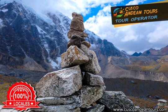
In the Humantay lagoon an ancient ritual is performed in honor of Mother Earth, Pachamama. Arriving at the lagoon, you can be part of this ceremony by placing stones for gratitude for having successfully reached the lagoon.
According to the residents of the nearby town, the Humantay is the youngest son of the Apu Salkantay. These are responsible for distributing the water that falls through the snow.
3. Taste the typical local dishes
As in every corner of Peru, gastronomy is the essential element in each destination that is visited.
In Soraypampa, you can taste very traditional dishes of the town, such as tamales with potatoes and guinea pig, the slipped wheat with pellejón, pataca with dry giblets, scrambled chochos, stew of chumos, cream of huaynas and more.
The traditional drinks that you can not miss is the already famous chicha de jora, the hot and the mixed.
4. Marvel at the scenario of the Peruvian highlands
The Humantay Lagoon is surrounded by a lot of vegetation typical of the scenarios of the Peruvian highlands. Also, from there you can see the snowy Humantay and the rest of the Vilcanota Range.
Take advantage of this unique view to get in touch with nature and let yourself be enveloped by its tranquility and mysticism.
The Humantay Lagoon is a natural attraction that is not always part of the tourist tours of Cusco. However, it is one of the most impressive and beautiful natural scenarios that this department has, so we recommend you visit it.
Depending on the route you choose, the distance between Cusco and the Mountain of Colors will vary as follows:
Through the Cusipata route:
Cusco - Phulawasipata: 102 km (paved road and float trail).
Phulawasipata - Mountain of Colors (road): 3 km.
Through the Pitumarca route:
Cusco - Pampachiri: 139 km (paved road and float trail).
Pampachiri - Mountain of Colors (road): 4.8 km.
Difficulty of the hike to the Rainbow Mountain
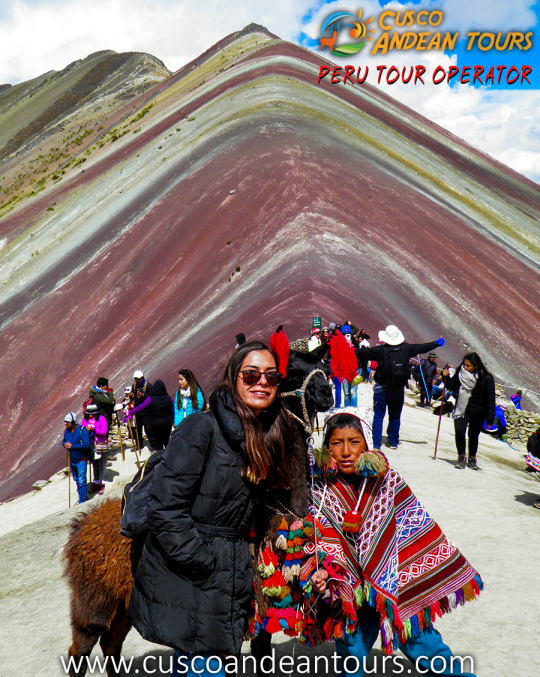
The 7-color mountain hike has a medium-moderate difficulty.
Most of the route is slightly steep with few steep slopes that do not pose any difficulty. However, it is not the road that hinders the ascent. But the fact of finding you at more than 5,000 meters that can sometimes affect the normal breathing of some visitors. Well, the higher the amount of oxygen is less.
Therefore, it is recommended that you are in good health and are in good physical condition. And if possible, your excursion to Vinicunca should be done after having acclimatized to the climate of Cuzco.
Best time to go to the Rainbow Mountain
Your visit to the hill of seven colors does not have to become an Odyssey. Otherwise, your visit to this natural wonder should be one of the best experiences of your life. Therefore, we recommend choosing the months of the dry season (May to November) that are characterized by frigid nights, sunny days and clear skies.
And for your safety, we do not recommend the rainy season months (December - March). Well, it is these months, you are more likely to encounter cloudy skies, rainy days, even storms and showers.
In some years, even in the dry season, snow falls on Vinicunca. Therefore, to avoid any setback. Before traveling, don't forget to make a weather consultation about how the weather will be in Vinicunca.
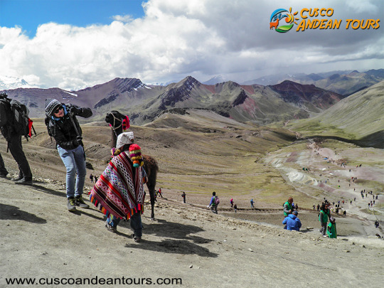
Appreciate the capricious natural colors of the mountain of colors that resemble the colors of the rainbow.
Observe the incredible natural landscapes that surround the hill of colors, such as the snowy peaks of the Ausangate snowy mountain.
Take walks around Vinicunca to other nearby natural attractions such as the Red Valley.
Participate in cultural interaction activities with the inhabitants of the area, who are dedicated to the grazing of South American camelids.
Enjoy an excellent and incredible day, breathing fresh air, walking more than 5000 meters above sea level, connecting with mother nature and reflecting on the fragile natural balance.
What to take to the Rainbow Mountain?
Since you are leaving the city towards the heart of the mountains of the Peruvian Andes. Ideally, take with you:
Identification document.
Cash for your personal expenses and to pay the entrance fee to Vinicunca (10 soles, foreign tourist; and 5 soles, national tourist).
Sun block, sunglasses, wide-brimmed raincoat and raincoats (in the rainy season).
Coat, gloves, windbreakers, trekking pants and trekking shoes.
Camera with extra battery.
Water, snacks and some fruits.
Personal medications, if required or under medication.
If you require it, you can also consider the option of renting horses. The cost of the horse is 50 soles (one way) and 80 soles (round trip).
Tips and Recommendations
To enjoy a comfortable and safe trip, consider these tips:
Travel between the dry season, between the months of April to November.
Try to be in good health and be in good physical condition.
Bring your trekking equipment: wide-brimmed hat, small backpack, trekking shoes, warm clothes, sunscreen, trekking poles, rain poncho, water and food.
Buy water and food in the city of Cusco or in Cusipata or Pitumarca, the only places where you will find a store.
Do not travel with children under 12 years.
Finally, before hiking to Vinicunca, do not forget to acclimatize to the climate of the Cusco region. In this way you will avoid altitude sickness (soroche).
DAY 1: CUSCO - OCONGATE - TINKI COMMUNITY
We leave the city of Cusco in a private transport, in the direction of Tinki (3800m/12464ft). On the way we stop in Urcos, where we may visit a beautiful lake with the same name. We then go on to Cattca, where we can appreciate the region’s spectacular views and finally pass through Ocongate, capital of the district with the same name and only half an hour away from our destination. After an approximated of 6-hour drive, we arrive at Tinki, Tinki will be our first campsite and start the trek the next morning.
DAY 2: TINKI - PACCHANTA - QOMERQOCHA LAGOON
After breakfast, we will spend some time visiting the Tinki public school and will have the chance to meet the children of the neighboring communities that study at this place. Then We then leave Tinki and start a 2,5h walk towards Pacchanta (4100m/13448ft), where we stop for lunch. Pacchanta is a rural community that boasts some well-known hot springs where we can enjoy a nice dip, offering awesome views of Ausangate Mountain. In the afternoon we follow our trek through a slight climb up the Pacchanta valley, having the chance to spot llamas and alpacas, until we reach the beautiful Qomercocha lagoon where we set our camp and have dinner. Our campsite will be set in a spectacular spot with amazing views of Ausangate.
DAY 3: QOMERQOCHA LAGOON TO YANAMAYO
We leave Qomercocha lagoon around at 7.00 am and continue on towards the first mountain pass of our trek, the Abra Q´ampa at 5000m/16400ft, which we will reach after about 4h. then We will descend towards the Ticllaqocha Lagoons, a beautiful group of little turquoise lagoons next to which we have lunch. In the afternoon we continue our hike for an additional 2-3h until we reach Yanamayo where we set our camp in an impressive valley overlooked by the impressive Tres Picos.
DAY 4: YANAMAYO TO CONDORPASO
We leave camp and start a gradual climb up toward Yanaqocha or “Black Lagoon” its name being due to the dark color of its waters. We will go over Yanaqocha mountain pass (5050m/16564ft) to then discover a surprisingly beautiful valley with an explosion of colored mountains, three spectacular lagoons and the presence of llamas and alpacas, which we will cross to head towards our next mountain pass (5100m/16728ft). From this point, an additional hour of hike leads us to Condor pass, our next campsite, located very close to the mountain pass of the same name which will be our challenge for the next day.
DAY 5: CONDOR PASS TO SOURCE OF SIBINACOCHA LAGOON
After breakfast, we continue on a gradual climb up the valley that takes us to the mountain pass Abra del Condor (5200m/17056ft) after an approximated two hour walk. We have spectacular views of the Vilcanota mountain range and the Sibinacocha Lagoon, our next milestone, where can see wild vicuñas. Immediately. we continue our hike for 3 hours, crossing another mountain pass on the way and then descending into the valley of the Sibinacocha Lagoon’s source. We will camp next to the lagoon and very close from its source. The lagoon boasts a wide bio-diversity, where we can see Andean Coots, “Huallatas” or Andean Geese as well as Andean Ducks from our camp.
DAY 6: SOURCE OF SIBINACOCHA LAGOON TO CCASCANA
Today, we depart early to walk along the shores of the Sibinacocha Lagoon for 3h until we reach the Yayamari community, (5500m/18040ft). We then continue accross a pampa where we will most probably see hundreds of llamas, alpacas and hopefully vicuñas, to then follow towards the Abra Ccascana at 5000m/16400ft, which will lead us to the lagoon of the same name, in where we will set our last camp and we may have the chance to spot ¨Huallatas¨ or Andean geese and maybe even flamingos.
DAY 7: CCASCARA TO PHINAYA VILLAGE AND BACK TO CUSCO
After our breakfast, we leave Ccascara to walk for 3 and 30 minutes towards Phinaya. This is a small Andean community with a beautiful little church, where we will have lunch. In the afternoon, we meet our private transport that will drive us back to Cusco, where we expect to arrive after nightfall. AUSANGATE TREK INFORMATION
Every year, hundreds of climbers visit the mountain region of Peru. However, there are not many who know the existence of Ausangate, one of the Inca divinities of 6410 meters high.
Located in the vicinity of Cusco, the "mountain of the seven colors" is the fifth highest peak in Peru. Its remote existence of the traditional routes means that few tourists approach its walls and glaciers; However, it is worth visiting for its unique beauty.
During the Inca Empire, the Ausangate embodied one of its most important divinities. Distinction that still lasts; since, the inhabitants that live in the surroundings continue considering it as an unattainable and sacred god.
The moderate difficulty of climbing the mountain and the possibility of living a unique outdoor experience, make the visit to Ausangate a relevant option.
How to get?. Ausangate is located about 100 kilometers southeast of the city of Cusco. Leaving the city by car, the estimated travel time is 3 hours. When you arrive in Chilca, you have to continue walking for another 3 hours, approximately, until you reach this formidable Rainbow Mountain.
For tourists who do not own their own vehicle, there is the possibility of hiring a tour from the city of Cusco. MORE INFORMATION OF AUSANGATE TREK
The Inca Trail, a master road communication network that extended to six countries in South America, was declared a World Heritage Site by Unesco on Saturday, a distinction that recognizes the ingenuity of a pre-Hispanic system that surprised the world. The trails, which served the Inca to control its empire (Tahuantisuyo), extend from Argentina to Chile, Bolivia, Peru, Ecuador and Colombia, and were linked by a network of roads that constituted the Qhapaq Ñan (in Quechua Inca Trail).
"This extraordinary system of roads extends through one of the geographical areas of the world with the greatest contrasts," among the Andres, the rainforest, the Pacific coasts and deserts, the Unesco statement said. "The denomination means for the six countries the recognition of one of the most important monuments of the Andean world," said Luis Lumbreras Flores, archaeologist of the Inca Trail Project of the Peruvian Ministry of Culture. The Qhapaq Ñan, the oldest road network in America, ran along the entire Tahuantinsuyo along the Andes Mountains, from western Argentina to southern Colombia. The main road has about 6000 km from south to north. This mountain road parallel to the Pacific Ocean was linked by cross sections that even reached the jungles and the Gran Chaco in Argentina and Bolivia. "There are other sections where the population still travels. It has cobbled areas, with flagstone or land fill, and in some places you can see retaining walls on both sides of the road," said Peruvian archaeologist Cristian Viscount. The distinction will allow to obtain financing from international organizations for the conservation and restoration of the paths and sanctuaries that were built around the road, archaeologists say optimistic. The entire network in coast, mountains and jungle, totaled an extension of 30,000 km, which interconnected the four of them, or cardinal points of the empire, with the mythical capital, Cusco (in Quechua, "navel" or "center").
Peru gathers most of the discovered routes of the old routes. The most famous stretch, and where millions of tourists from all over the world arrive, leave from Cusco to the citadel of Machu Picchu. They are 43 kilometers between forests, with ancient stone steps. The road reaches the Puerta del Sol where it offers majestic views of the Machu Picchu ruins.
INFORMATION OF INCA TRAIL
This day we leave Cusco early (about 4am) and drive for approximately 3 ½ hrs to Soraypampa where we will start the hardest day of the whole Salkantay trek 4 days 3 nights. We will be walking 7.5km to the highest point of the trek, enjoying magnificent panoramas of snow-capped mountains on the way. Once we reach the top we will have spectacular views of the sacred mountain, Salkantay. At 6245 metres it is the second highest mountain in the Cusco region. After 2 hours downhill we will have our delicious lunch around 1:00 p.m. in Huayracmachay. Then we continue approximately 3 hours downhill to our camp in Chaullay or Collpapampa (2900 metres) where your tent will be ready and waiting for you with a bowl of hot water for washing up. Then there is time to rest, nap or write. Around 7 p.m. we will have happy hour, dinner. Then we’re off to bed and a well-earned sleep.
DAY 2: CHAULLAY - LUCMABAMBA
Around 6.30am, we start with our breakfast before beginning our trek through the high jungle. We cross the Lluskamayo valley and a variety of little brooks to reach La Playa (Sahuayaco) trekking about 6 hours. You will pass through wonderful landscapes and see waterfalls, rivers, beautiful plants and orchids. At La playa (Sahuayaco) we’ll have our lunch and the horses will go back to Mollepata. After lunch and another 30 minutes uphill you will reach our campsite at Lucmabamba. The afternoon is free for you to enjoy our coffee tour or, as an optional extra, take a local van to Santa Teresa to soak in the natural hot spring optional extra. At the end of the day we have our happy hour, dinner and then a briefing for the next day. DAY 3: LUCMABAMBA - AGUAS CALIENTES
We will have our delicious breakfast at 6 am and leave our campsite. After about 5 minutes you will step onto the original Inka Trail, and for the next 3 hours you will follow this historic trail to the summit for your first view of Machu Picchu across the valley. Then we will descend to our lunch spot by the Hydrolectric Station. After lunch we will walk 3 more hours or take a train for 45 minutes to Aguas Calientes where your beautiful hotel and dinner will be waiting for you. DAY 4: AGUAS CALIENTES - MACHU PICCHU!!!
Early morning, after the breakfast at the Hotel, you will go up by walking or you can take the bus to Machu Picchu where you meet with our Tour Guide for a private introductory tour of the Citadel. For the next 2 hours you will learn of the history, the structure and the stories of this important World Wonder. Then you will have free time to take pictures, relax and explore Machu Picchu by yourself. If you have reserved a climb up Huayna Picchu or Machu Picchu Mountain, our Tour Guide show you where you start.
After exploring Machu Picchu, you will walk or take a bus down to Aguas Calientes. There you will collect your luggage at the Hotel and board the train to Ollantaytambo. When you arrive at Ollantaytambo, you will transfer to a van for a ride back to Cusco by van where you will be dropped off at your hotel or hostel.
MORE INFORMATION OF SALKANTAY TREK
The Inca history still keeps infinity of secrets. One of them is Choquequirao: the one known as the last Inca bastion and sister citadel of Machu Picchu is still a mystery to researchers in this South American culture.
Choquequirao is located between the jungle and the Peruvian Andes, on a mountain 3033 meters above sea level and has a great peculiarity: it can only be accessed by walking, on a 62 km round trip and with descents and rises from 3100 to 1400 and vice versa.
Is this effort worth it? Without a doubt. Its difficult access makes Choquequirao one of the most charming places in all of Peru: with an almost intact fauna and flora and with less than 25 visitors per day.
How to get to Choquequirao? The easy way (and expensive) is to do it with a tour, which charges you around 300 dollars with everything included. But today we want to talk about the most adventurous and cheap way to visit this citadel: on your own.
Get to San Pedro de Cachora
The starting point of Choquequirao is the small town of San Pedro de Cachora, in the department of Abancay. To get here, you can do it from Cusco or from Lima, via Abancay.
We recommend you spend a night in Cachora to start the hike the next day very early.
From San Pedro de Cachora to the Santa Rosa campsite
The starting point of is the Capullylloc viewpoint, located 7 kilometers from San Pedro de Cachora. Although many people make this stretch walking, we recommend doing it by taxi and thus save energy for the rest of the way.
The first part of the route is a great descent until you reach Playa Rosalina, where there is a camp where you can stay for the night, but if you still have energy, we recommend you simply take a short break and continue to the Santa campsite Pink. From Santa Rosa to Choquequirao
As soon as the first rays of sun come out, it is time to continue with the road and thus we will reach our destination avoiding the hottest moment of the day.
From Santa Rosa to Choquequirao you will go through a long curve and climb road. Before reaching the Inca citadel, you will go through the town of Marampata, where you can stop for lunch and recharge. From this point to Choquequirao it is only about an hour away where you will go through a more jungle area full of different types of butterflies.
Arrival to Choquequirao
Once in Choquequirao you have the option to see the citadel in what you have left during the day or spend the night there, since there is a campsite, and take the next day to explore the construction with more tranquility.
As Choquequirao is not 100% discovered (most buildings still remain under vegetation), the citadel can be traversed quickly. Do not miss the main square and its surroundings and the llamas platforms (the visit to the latter requires extra effort, but it is very worthwhile!)
Tour of San Pedro de Cachora
After enjoying Choquequirao, the return to San Pedro de Cachora you must do it the same way you came. Our advice is that you leave the citadel very early and arrive at the Cocamasana camp. Here you can spend the night and resume the road the next day: you will only have 14 kilometers left to arrive!
Frequent questions
Food: to avoid carrying a lot of weight, we recommend you take only a few snacks (fruit, nuts, etc.) in your backpack. In all campsites you will find families offering food dishes at an economical price. Water: there are different places to buy or recharge your water bottle along the way, yes, if you prefer to refill it, we recommend you take purifying tablets to clean the water. Camping: the campsites on the way to Choquequirao charge around S / 5 for letting you camp there, while the one in the citadel is totally free. Some of them have tents to rent but others do not, so it is advisable to bring your own. Cargo mules: the road to Choquequirao is long and tedious, so if you see that you can not with all the cargo you carry in your backpack you will always have the option to pay a muleteer and take your things in a cargo mule . Of course, this always with responsibility and without burdening the animal in excess. Signaling: the road is perfectly signposted, so the risk of getting lost until reaching Choquequirao is nil. Dates of visit: it is advisable to avoid the visit to Choquequirao between the months of January and March, since it is the rainy season and the soils can be very muddy. Price: the general admission price to Choquequirao is S / 60.
Information of Choquequirao Trek
Also known as Salkantay, Peru's snowy peak located in the department of Cuzco, it is one of the main elevations of the Vilcabamba Range, an extension of the Eastern Cordillera, a mountainous branch of the Peruvian Andes. It reaches an altitude of 6,271 meters. It has two snowy peaks, known as China Salkantay and female Salkantay, separated by a port that opens to the Santa Ana Valley in the province of Urubamba. Both the mountain pass and the course of the river that is born there are called Salkantay. This river pours its waters into the Urubamba on its left bank. SALKANTAY TREK INFORMATION
The name of this mountain is a contraction that comes from Salga = sullen or wild and Antay produces eyebrows or avalanches. It is usually preceded by the name of Apu, which in Quechua language comes to mean sir, is defined as large mountains that mean something sacred above the valleys. For example, Apu Salkantay in the Vilcabamba mountain range.
For the inhabitants of the Andes, reverence for the apus, sacred mountains, converted into local protectors, did not go unnoticed in time, thus, mountains such as Salkantay, among others that surround it, assume an important role in the Andean worldview. For example, the snow of Waqay Willke (5720 masl), within the traditional symbolism of Andean dual thought, is considered the complement of Salkantay which is one of the most powerful and active deities of the place, it is also appreciated by the inhabitants, the father of all the mountains in the region and even today it is the object of great veneration, so Machupicchu and Choquechurco maintain an intimate visual contact with Salkantay and other snowcaps of the Vilcabamba chain.
The Vilcabamba MOUNTAIN
The sacred and administrative llaqta of Machupicchu is located between important snowfalls of the eastern slope of the Vilcabamba mountain range, «Salkantay, (Humantay Yanantay and Tokorhuay that they surround it) and Waqay Willke »1 whose mountains, object of worship, enable a social cohesion that revolves around its veneration, as these are water providers, vital element, principle of existence in the Andean world, as well as generate fertility in animals, protection of its inhabitants and success in crops.In the cult of the mountains in the area, religious, political and economic factors are involved; important within the process of social development of their communities, the same ones that have been present for centuries, and they are and were very familiar to the Andean inhabitants of all time. The current vision of the inhabitants of the Sacred Mountain (Mollepata, Machupicchu, Santa Teresa, Wayraqmachay, Collpapampa, Totora, Yanama) in force since the time of the Inca society, is shared by Andean peoples, in such a way that the area is known for reverence to the sacred mountains, hardly ignored and that undoubtedly play a vital function over time. SALKANTAY TREK INFORMATION These sacred mountains are located within the delimitation polygon of the Historic Sanctuary of Machipicchu (SHM), declared as such by supreme decree No. 001-81-AA of January 8, 1981, with an area of 32,592 ha. Likewise, in the buffer zone (ZA) of the SHM specified by the head resolution No. 322-2001-INRENA of September 16, 2004, which proposes the extension of the ZA from including continuous immediate hydrographic basins to the SHM area, increasing the air of the ZA of those in force in 71,589 ha to 193,334 ha. Finally, it is also considered within the Vilcabamba-Choquequirao National Archaeological Park, declared by national directive resolution No. 949 / INC, dated October 9, 2002, which resolves: «Approve the Plan for the Delimitation of the National Archaeological Park of Vilcabamba (Choquequirao), Plan No. V-01, dated July 2002, with a area of 522,878.30 hectares and a perimeter of 367.09 kilometers, at a scale of 1: 125,000, located in the provinces of La Convencion, Anta and Abancay, in the departments of Cusco and Apurímac ».
Machu Picchu,This stunning site situated on a mountain ridge above the Sacred Valley is the best-preserved relic of Inca civilisation and South America’s most popular attraction with an estimated 3,000 people visiting on a typical day.