
For the inhabitants of the Andes, reverence for the apus, sacred mountains, converted into local protectors, did not go unnoticed in time, thus, mountains such as Salkantay, among others that surround it, assume an important role in the Andean worldview. For example, the snow of Waqay Willke (5720 masl), within the traditional symbolism of Andean dual thought, is considered the complement of Salkantay which is one of the most powerful and active deities of the place, it is also appreciated by the inhabitants, the father of all the mountains in the region and even today it is the object of great veneration, so Machupicchu and Choquechurco maintain an intimate visual contact with Salkantay and other snowcapped mountains of the Vilcabamba chain, SALKANTAY TREK INFORMATION.

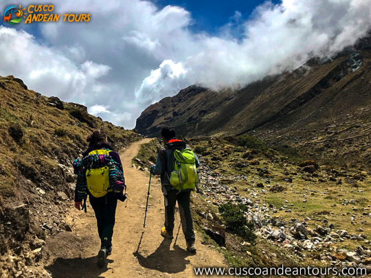
The Vilcabamba chain - Salkantay Trek:
The sacred and administrative llaqta of Machupicchu is located between important snowfalls of the eastern slope of the Vilcabamba mountain range, «Salkantay, (Humantay Yanantay and Tokorhuay that surround it) and Waqay Willke» 1 whose mountains, object of worship, enable a social cohesion which revolves around its veneration, as these are water providers, a vital element, principle of existence in the Andean world, as well as generating fertility in animals, protection of its inhabitants and success in crops.In the cult of the mountains in the area, religious, political and economic factors are involved; important within the process of social development of their communities, the same that have been present for centuries, and that are and were very familiar to the Andean inhabitants of all times.
The current vision of the inhabitants of the Sacred Mountain (Mollepata, Machupicchu, Santa Teresa, Wayraqmachay, Collpapampa, Totora, Yanama) in force since the time of the Inca society, is shared by Andean peoples, so that the area is known for reverence to the sacred mountains, hardly ignored and that no doubt play a vital function over time.
These sacred mountains are located within the delimitation polygon of the Historic Sanctuary of Machipicchu (SHM), declared as such by supreme decree No. 001-81-AA of January 8, 1981, with an area of 32,592 ha. Likewise, in the buffer zone (ZA) of the SHM specified by the head resolution No. 322-2001-INRENA of September 16, 2004, which proposes the extension of the ZA from including continuous immediate hydrographic basins to the SHM area, increasing the air of the ZA of those in force in 71,589 ha to 193,334 ha. Finally, it is also considered within the National Archaeological Park of Vilcabamba-Choquequirao, declared by means of national directive resolution No. 949 / INC, dated October 9, 2002, which resolves: «To approve the Plan of Delimitation of the National Archaeological Park of Vilcabamba (Choquequirao ), Plan Nº V-01, dated July 2002, with an area of 522,878.30 hectares and a perimeter of 367.09 kilometers, at a scale of 1: 125,000, located in the provinces of La Convencion, Anta and Abancay, in the departments of Cusco and Apurímac ».
Evolution and distribution of glaciers in the Salkantay chain At the time when the glacial areas of the Aobamba basin reached their maximum development, the glaciers probably descended to the height of 2950 m and to the extent that the environmental climatic conditions were changing, a process of deglaciation begins, being observed on the one hand that according to the pre-existing morphology, the main glacier current developed along the channel of the Aobamba valley, which during its retreat was subdivided into the areas of the ravines tributaries, generating in turn in the latter, the secondary glacial basins, such as in the cases of the Mesada, Tokorhuay, Paccha Grande, Sisaypampa and Orcospampa streams, which are the most traveled in the upper area of the main basin. On the other hand, on the slopes of the flanks of the valley where the slopes are steep, the glacial retreat of the fronts occurred almost parallel to the longitudinal axis of the main glacier current. Currently, the glaciers that belong to Aobamba are concentrated around the Palkay (5422 m), Salkantay (6264 m) and Tokorhuay (5473 m) hills, obviously year after year they continue to lose size and volume. In the last thirty years the rate of glacial melting has increased rapidly, the causes of such melting being attributed to the greenhouse effects. more cusco tours


1 comentarios:
Your Affiliate Profit Machine is ready -
Plus, earning money online using it is as easy as 1...2...3!
Follow the steps below to make money...
STEP 1. Tell the system what affiliate products you want to promote
STEP 2. Add PUSH BUTTON traffic (this LITERALLY takes 2 minutes)
STEP 3. Watch the affiliate system grow your list and sell your affiliate products all on it's own!
So, do you want to start making money??
Your MONEY MAKING affiliate solution is RIGHT HERE
Publicar un comentario