
AUSANGATE TREK
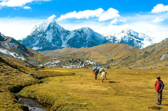
Ausangate is a natural attraction that is located in the district of Ocongate, within the province of Quispicanchi, in the department of Cusco. That snow is part of the Cordillera de Vilcanota and, according to an ancient legend, it was the brother of the Salkantay mountain.
The Nevado Ausangate, has a height of 6,384 meters above sea level; and he is considered an apu, or protective deity of the peoples that surround him; as well as the most representative mountain in the region. Its size is such that it can be appreciated even if one is in the Fortress of Sacsayhuaman, not in vain is considered the fifth highest mountain found in Peru.
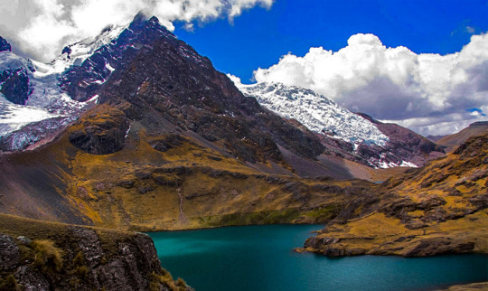
This beautiful Cusco snow cap, impresses the eye, for its incredible natural formations; Not only are beautiful water mirrors like the Sivinicocha, with turquoise waters, but also stone forests, glaciers and high-plains that seem to make this natural attraction a paradise on earth, especially for those tourists who are interested for adventure sports because, the geographical features of Ausangate make it ideal for sports such as rock climbing, ice climbing, trekking, among other activities.
The Nevado Ausangate appears before our eyes as a mountain challenge; it is known that the first attempts to promote it occurred at the beginning of the fifties of the last century, were two the first attempts to conquer the top of the mighty Apu, it was not until 1953, when a German expedition achieved the goal, climbing the mountain on its southern slope, in posterity, new routes were opened for the conquest of the Apu, however, just in 1983, thirty years after the first ascent, Peruvian feet crowned the top of the majestic snow.
LARES INFORMATION
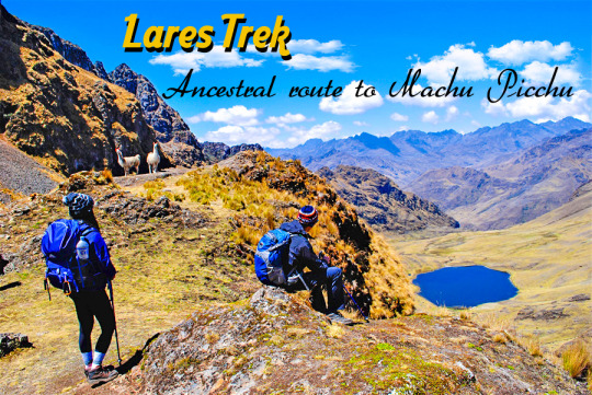
The Laris formed the Lares culture in what is now the Lares district. It seems that the capital or center of the Lares culture has not been the current capital of the district because there is no vestige of ancient cultures, nor in the conformation urbanistic that is completely Spanish, nor in the walls and foundations of the buildings, it is thought that the center of Lares culture was the population of Choquecancha, already displaced from the citadel of Antawala "
In the Colonial period (1535-1824), the entire area of Lares, by de Choquekancha, was not exploited by the Spaniards for being in a completely hilly terrain, they only maintained relations for the trade of some products.
In the Republican period (1824 to this day), the region acquires its greatest splendor forming part of the Province of Calca, Department of Cusco, Lares acquires the category of District by virtue of the Law of October 22, 1892, with its capital the current town of Lares.
Etymologically, the word "Lares comes from that one of Aymara origin Laris that means maternal uncle and sometimes, all relative on the part of the mother. With the passage of time it is undoubted that for reasons of diction and the law of least effort, staying in Lares. "^ Currently the capital of the district, the town of Lares has no cultural vestige, nor in the urban conformation that in its totality is Spanish, according to the French Paúl Marcoy that in the Valley of Lares due to the intense rains of the station took place in the dawn of the 14 of January of 1958, a landslide of a hill forming a dike or dam of the waters of the Yanatile river, which overflowed originated the devastating alluvium of the Phaqcha region of the Lares Valley, causing dozens of deaths, thousands of victims and numerous material losses. As a result of that tragedy the newspaper "El Comercio" of Lima published an article with the title of "LARES, A FORGOTTEN VALLEY", mentioning in passing the illustrious travelers who arrived to that extensive region, among them Paul Marcoy ".
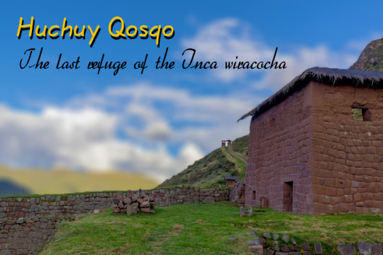
HUCHUY QOSQO
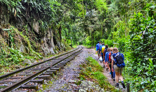
Another alternative is the Inca trail that is going to be the longest, and therefore somewhat strenuous, is less frequented and allows us to enjoy a greater variety of jungle landscapes as it takes you from 3,750 meters above sea level to the 4,400 meters to finish at 3,040 meters, which means crossing the mountains between the town of Chincheros and the "Sacred Valley of the Incas".
For that you have to take from Cusco the private or private buses that go to Urubamba (but take them by the Chincheros road and ask the "collector" of the transport bus to let you get off at the detour to the community of TAUCA (a a few minutes from Chincheros) where you arrive after an hour of travel.
Usually there is a private taxi-group that will take you to TAUCA, but on the way we stop to see the immense PIURAY lagoon up close (it is the water source of the city of Cusco). On the opposite bank shines the tower of the church of UMASBAMBA, one of the oldest in the area. You travel about 15 minutes to Tauca on the outskirts of the town, where the car no longer moved on the steep climb.
From here we start walking at the beginning of the trail, it has no slope and it makes its way into a narrow ravine. There are no curves or crossings of roads so it is impossible to get lost until the road announced its end on the slopes of some very large hills. It was like getting into a dead end. In the hills to my right I could see some muleteers who were going up to the first "abra", they carried the backpacks of the tourists on the back of a beast. Finally I reached the "abra" and found a couple of apachetas. I started the descent by the path that opened to my left while I was looking down a lagoon called ESOCOCHA, 15 minutes later you reach the second "abra" and there I found a sign that indicated the way to the ruins. From there the view was pure honey: an endless puna, behind several peaks perpetually dressed in white and above these a dense tangle of clouds that never ended
Now everything was a descent without truce where you can see some arrows painted in blue that guide you to the ruins. We rested with the muleteers who prepared the lunch for the group of tourists to continue towards HUCHUY QOSQO, began the walk passing through a copse of puyas appeared from nowhere terraces in good condition that were scattered by a ravine. It was magical to feel myself there observing nature.
Finally I came to a small plain where I found a sign with an arrow shape that read: HUCHUY QOSQO. At my feet a magnificent view opened up: in the background lay, scattered on a blanket of greenery, the ruins that I was looking for, and much lower down the houses of the town of Lamay in the middle of the always beautiful Urubamba valley.
Low and on arrival I found the gatekeeper to pay an entrance to HUCHUY QOSQO (3,550 meters) is the most important archaeological center in the Urubamba Valley, after Ollantaytambo and Pisaq (the virtue of being a little outside the classic tourist circuit what makes it more special) at the same time you have that space to go to Pisaq and Ollantaytambo.
INCA JUNGLE
Abra Málaga is a route that begins in the town of Ollantaytambo, Cusco and travels along highway 28B Ollantaytambo - Quillabamba, crossing unique Andean ecosystems. This route contains two types of well-defined areas: El Abra (4,297 masl) and the low zone (Carrizales 3,245 masl). The birds you can observe are rare and very sought after.
The predominant ecosystem is the Montano Tropical rainforest or the cloud forest in the Carrizales area, with forests of low trees covered by epiphytic plants and also some areas of bamboo. At Abra Málaga, at an altitude of 4,200 meters, we are in a rainy-Montano Tropical moor, with small Polylepis forests in the basins' births.
History
The avifauna of this area of Peru was studied since 1869 by Sclater and Salvin, Berlepsch and Stolzmann (1906).In 1915 an expedition of the Machu Picchu Geographical Society was conducted, directed by Frank M. Chapman and George K. Cherrie (1-24 July 1916), and by Harry L. Watkins (April 3-25, 1917).
From September 1974, June 1976, 1977 and 1978, October 1978 and August 1979, staff from the Museum of Zoology of the Louisiana State University (LSU) visited the valley in order to carry out an inventory and increase knowledge of birds and small mammals. Three main camps were made along the Ollantaytambo-Quillabamba road through Abra Málaga (3900 m), and a fourth was in Kiteni (450 m), after Quillabamba.


0 comentarios:
Publicar un comentario